

 SNOWDON
 Côte-Sainte-Catherine
|
⦸ Terminus |

Architect
Jean-Louis Beaulieu (BTM)

Artists

Start of service
 Orange line: September 7, 1981
 Blue line: January 4, 1988

Art & Architecture

In order to reduce the amount of demolition necessary in a densely built neighbourhood,1 this station was mined at quite a deep level and planned essentially as three parallel vaulted tunnels: the blue line platforms stacked on one side, the orange line on the other, with a central tunnel for transfers and connection to the exit. The three main vaults are connected by four smaller transverse tunnels.
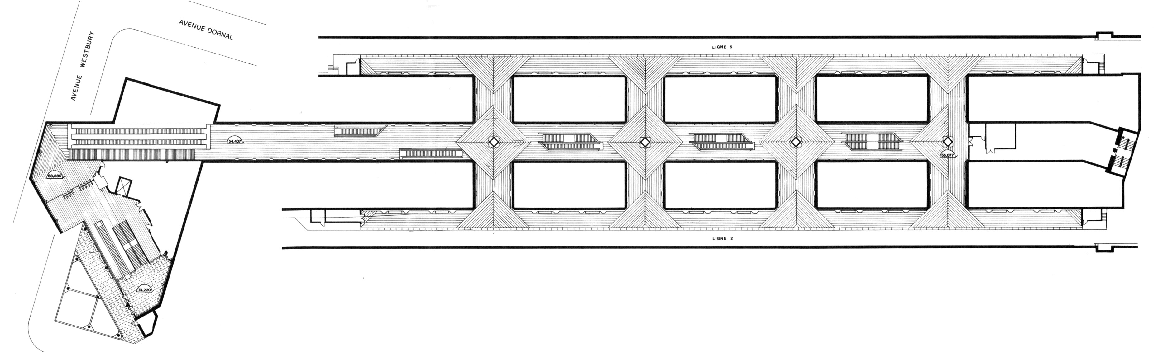
(Source2)

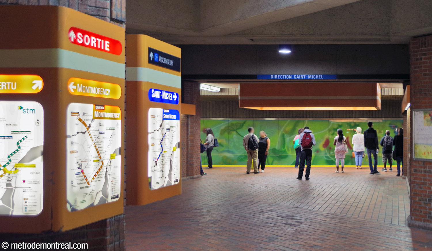
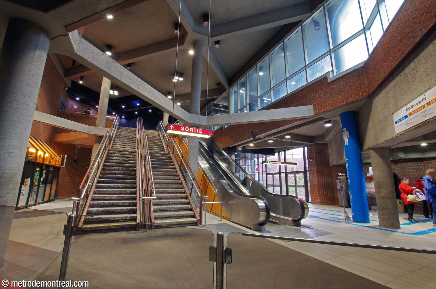
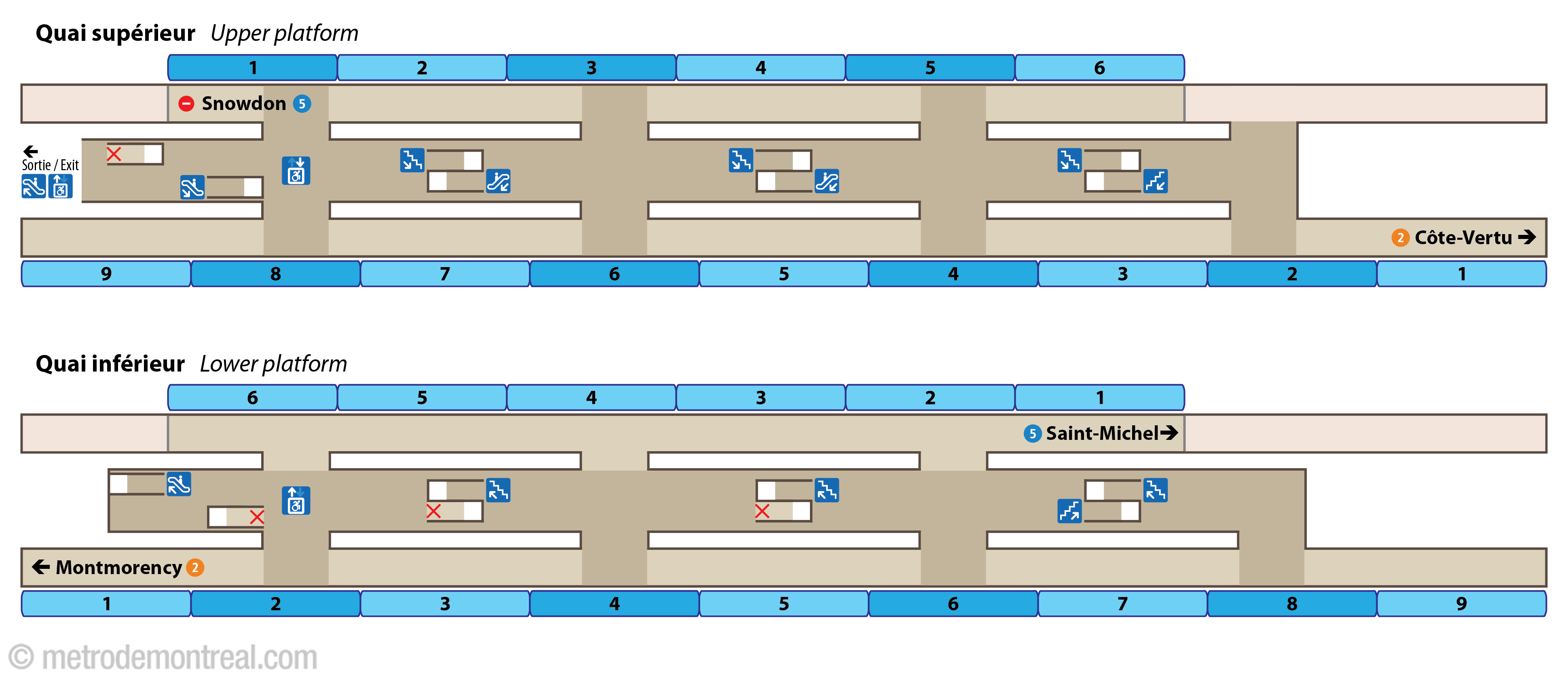
Due to these space constraints, the stairs between platform levels have had to be positioned quite creatively in the central tunnel. Three stairwells in the middle of the tunnel each house two flights facing opposite directions: in two of them, an escalator is paired with a staircase, with the last housing two fixed staircases. Additionally, two more escalators are located at the entrance end, one along each side of the tunnel, to more efficiently direct passengers entering or exiting the metro here.
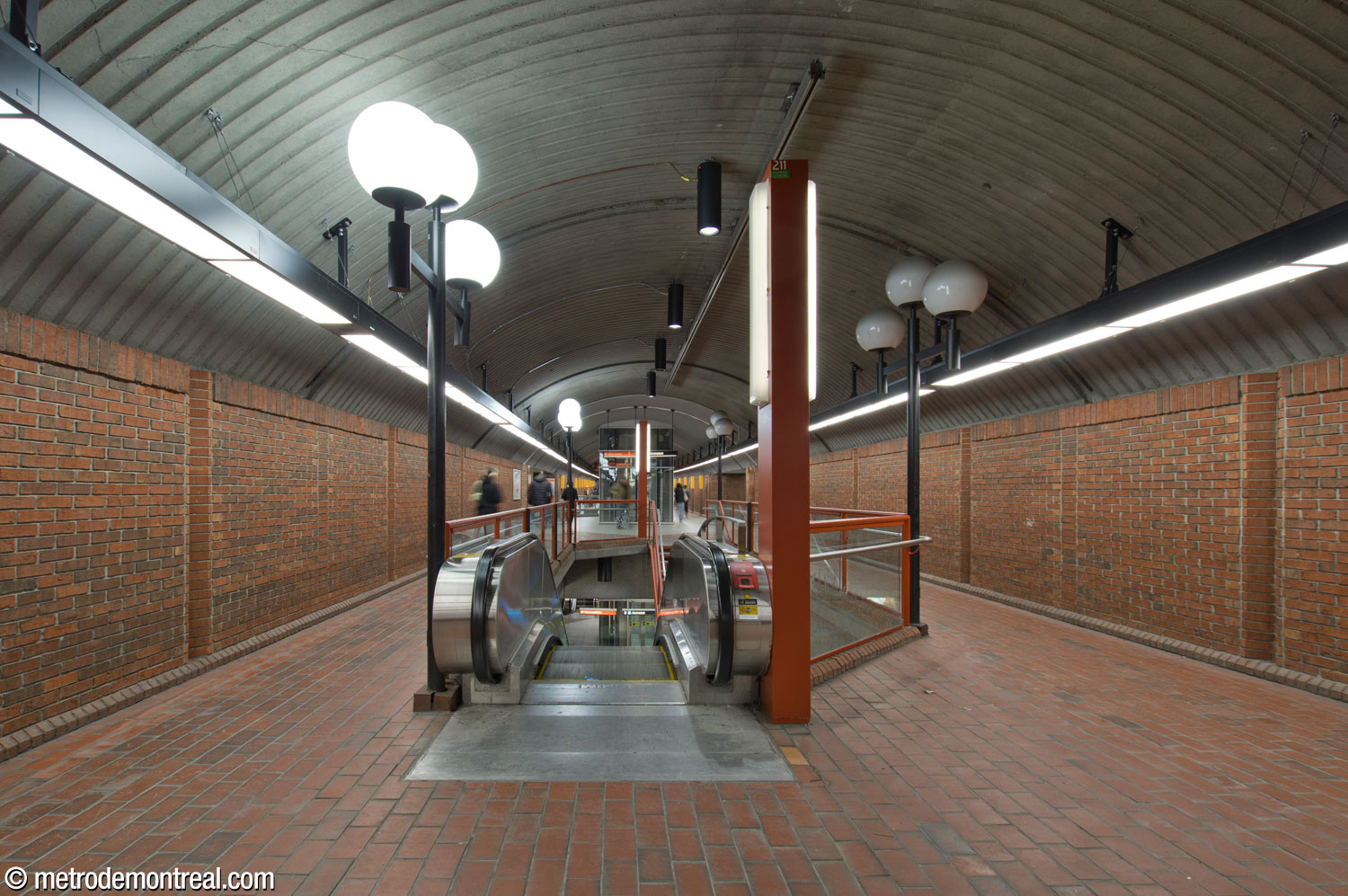
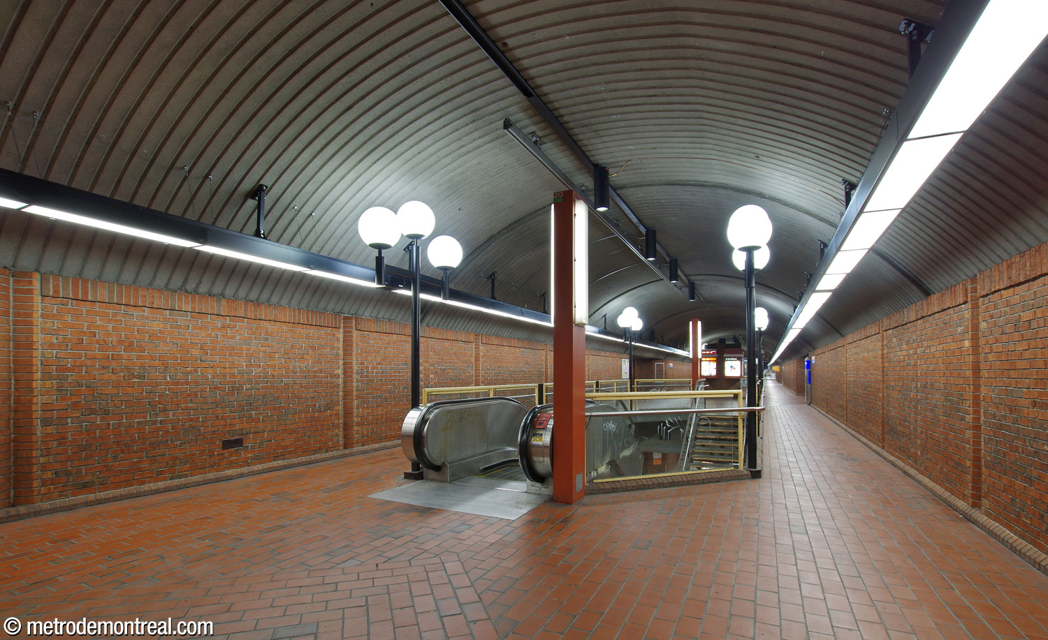
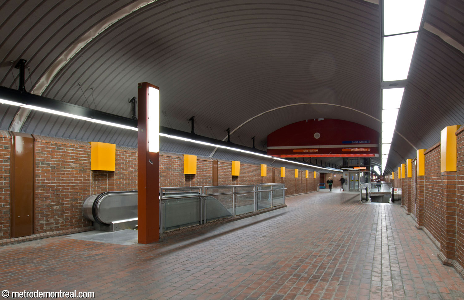
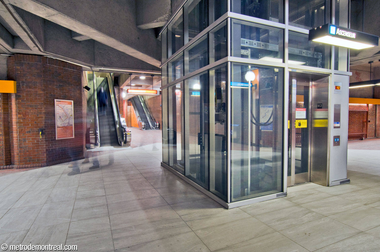
The escalators at platform level (and in the headhouse) are a space-saving extra-narrow model not found elsewhere in the metro. The stairs lack risers and are supported on space frames to provide a sense of openness and lessen visual obstruction.

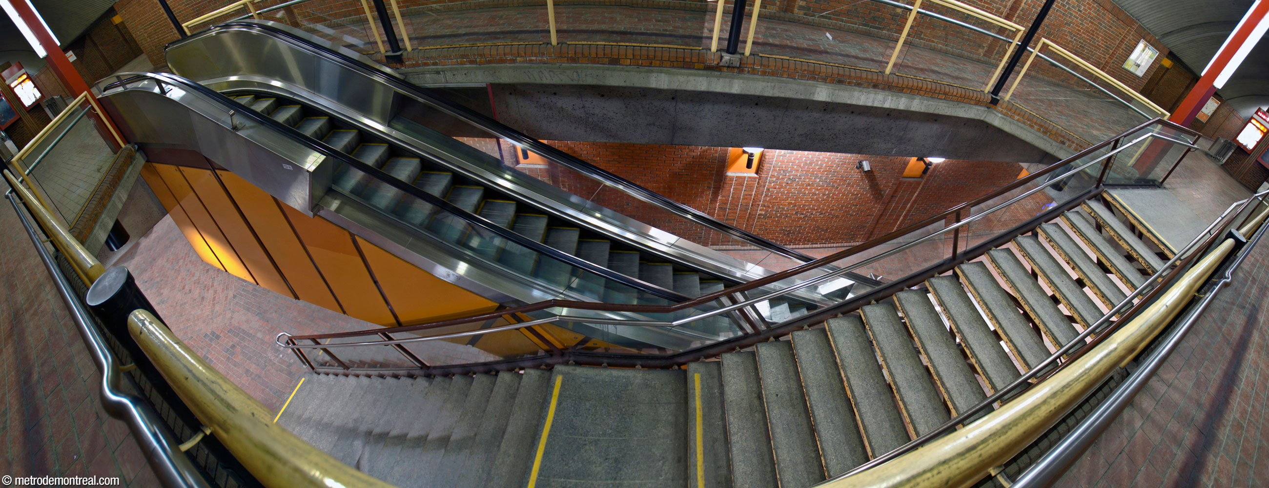
Although the station is arranged for cross-platform transfer like Lionel-Groulx, an odd discrepancy soon becomes apparent. Lionel-Groulx station has both inbound platforms on one level and both outbound platforms on another. Since most transferring passengers are continuing their trip into or out of downtown, this allows the majority of transfers to be made by simply walking straight across the platform.
At Snowdon, conversely, the upper level has the outbound Côte-Vertu and inbound Snowdon terminus platforms, while the lower level has the inbound Montmorency and outbound Saint-Michel platforms. Passengers coming from the blue line and continuing toward downtown, or the reverse, thus have to go down stairs to transfer.
The reason for this is that the station was designed based on plans to extend the blue line from Snowdon westward into Notre-Dame-de-Grâce. If that had happened, passengers from NDG would have enjoyed the same cross-platform advantage as at Lionel-Groulx. As things are, the current layout at least allows cross-platform transfers between the blue line and the north end of the orange line, facilitating trips within the Côte-des-Neiges neighbourhood (Snowdon to Plamondon and Côte-des-Neiges), as well as for Université de Montréal students coming from northern neighbourhoods. Also, since the blue line terminus platform is on the upper level, all other possible transfers involve going downstairs, not up.
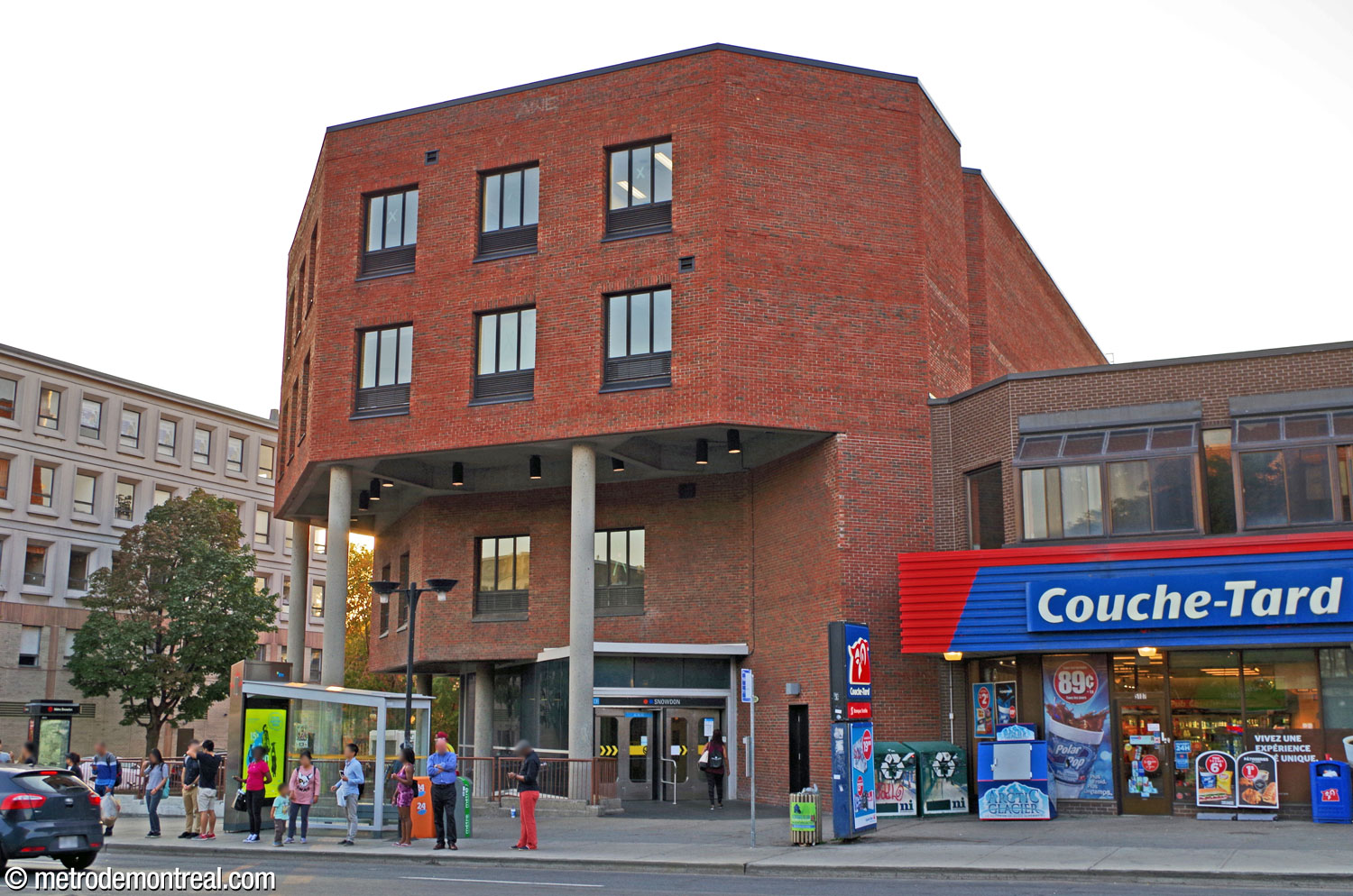
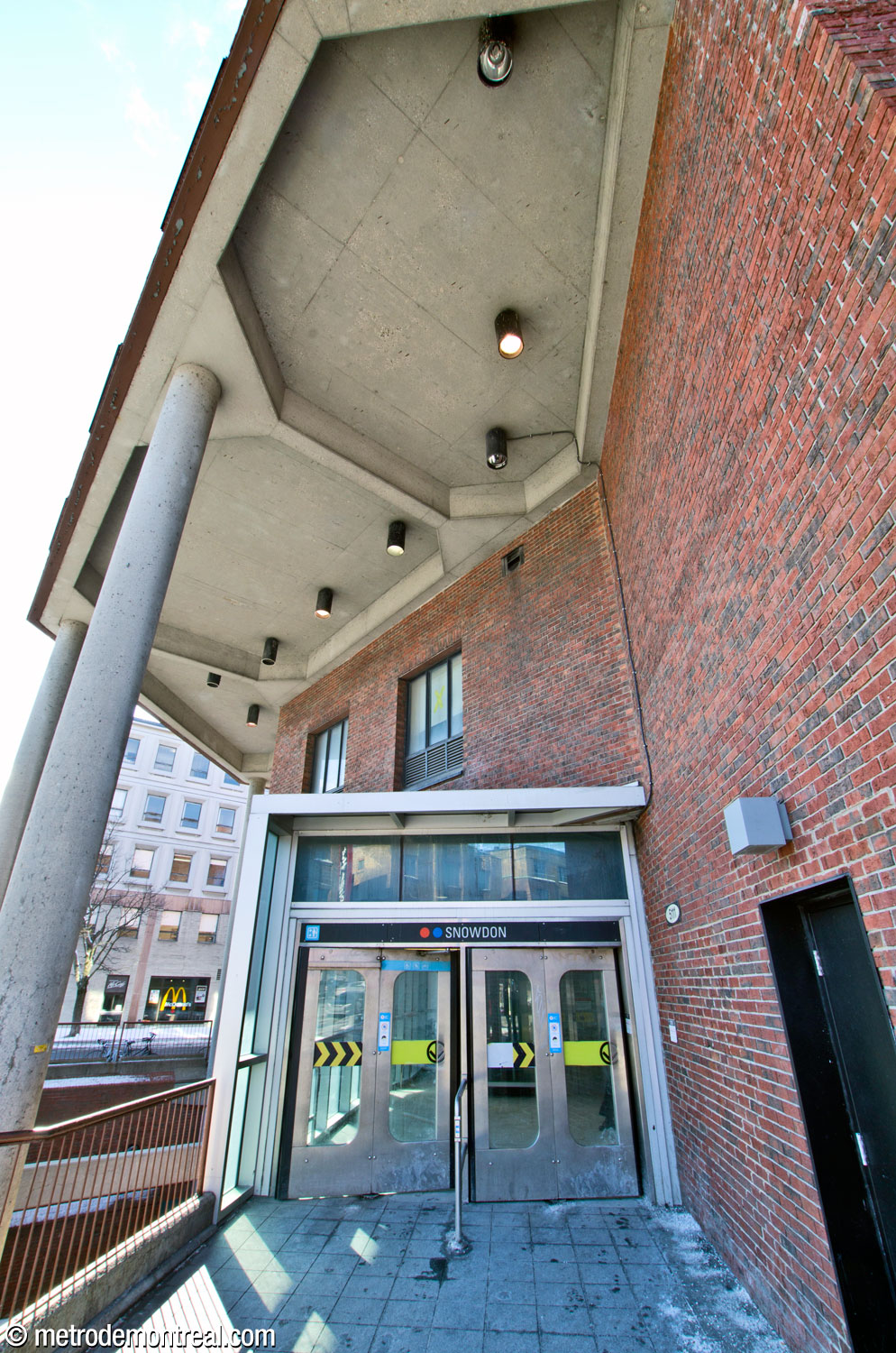
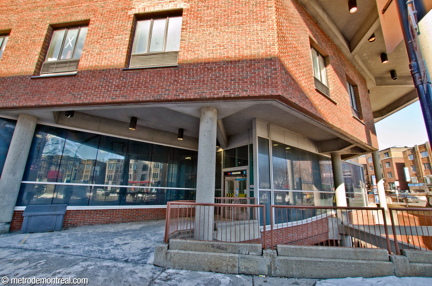
The station’s single access is integrated into a four-story brick building housing STM facilities. There are two sets of entrance doors, at either end of a diagonal walkway below the building’s overhang. The walkway runs along a sunken area that previously featured a unique, attractive garden, with public access from the ticket hall. However, the space was requisitioned for a temporary access during extensive renovations in 2013-2016, and there are sadly no current plans to restore the garden.3
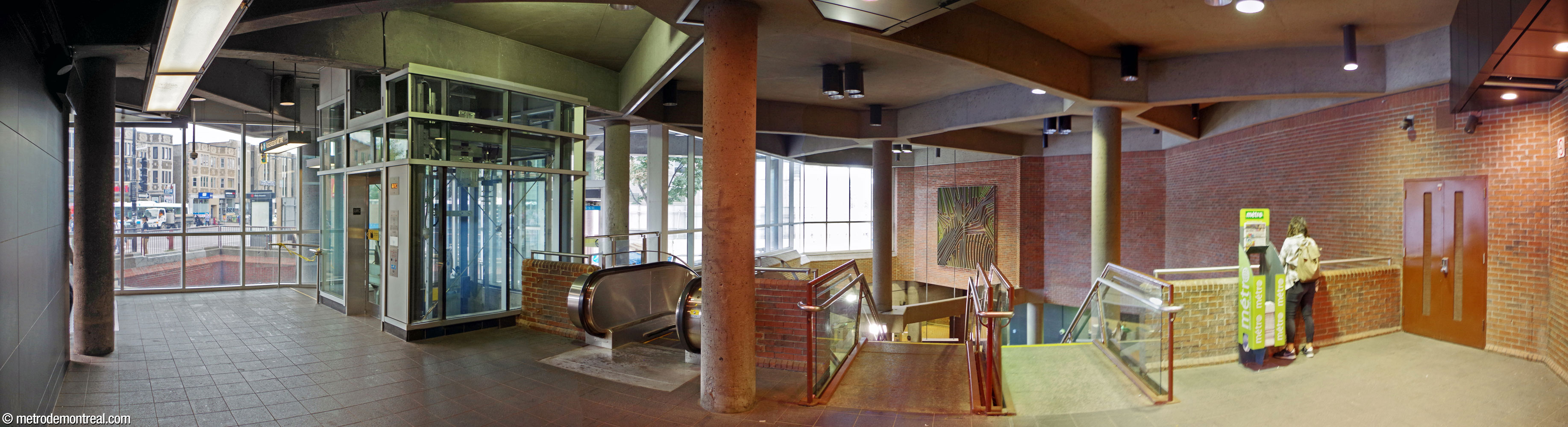
From the entrances, a fairly small landing gives access to the elevator, escalator, and stairs down to the ticket hall. This landing overlooks a two-storey volume over the stairs, filled with light from the windows that continue below street level and admit light from the sunken area.
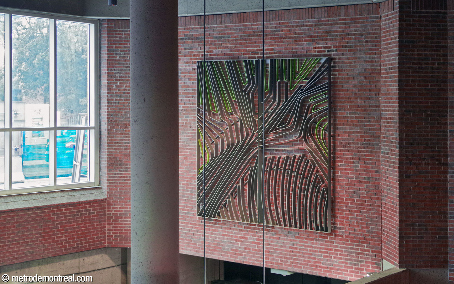

On an overhanging wall facing the entrance, a sculptured metal grille with two rectangular elements filled with curving shapes is suspended. This work, created by the station’s architect Jean-Louis Beaulieu, originally served as a gate closing off a driveway at the rear of the station building. However, the renovations in 2013-2016 eliminated the gate, so the artwork was reinstalled here as part of the redevelopment of the entrance area.
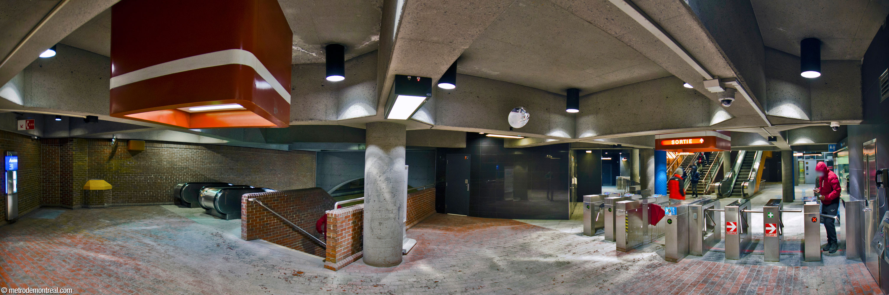
The ticket booth and turnstiles are located just beyond this volume. The elevator down to the platforms is located a short distance away, with its own fare gate; however, the gateline runs along the north edge of the volume to include it within the same fare-paid zone. The main section of the gateline leads to a landing at the top of the stairs and escalators down to the platforms.
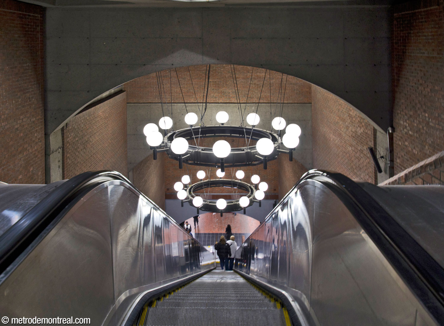
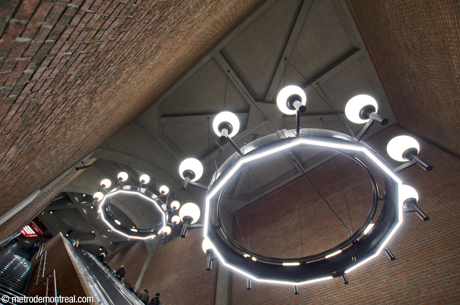
These are housed in a monumental escalator well, a succession of lofty square volumes separated by arches, made more dramatic by two huge, impressive circular chandeliers.
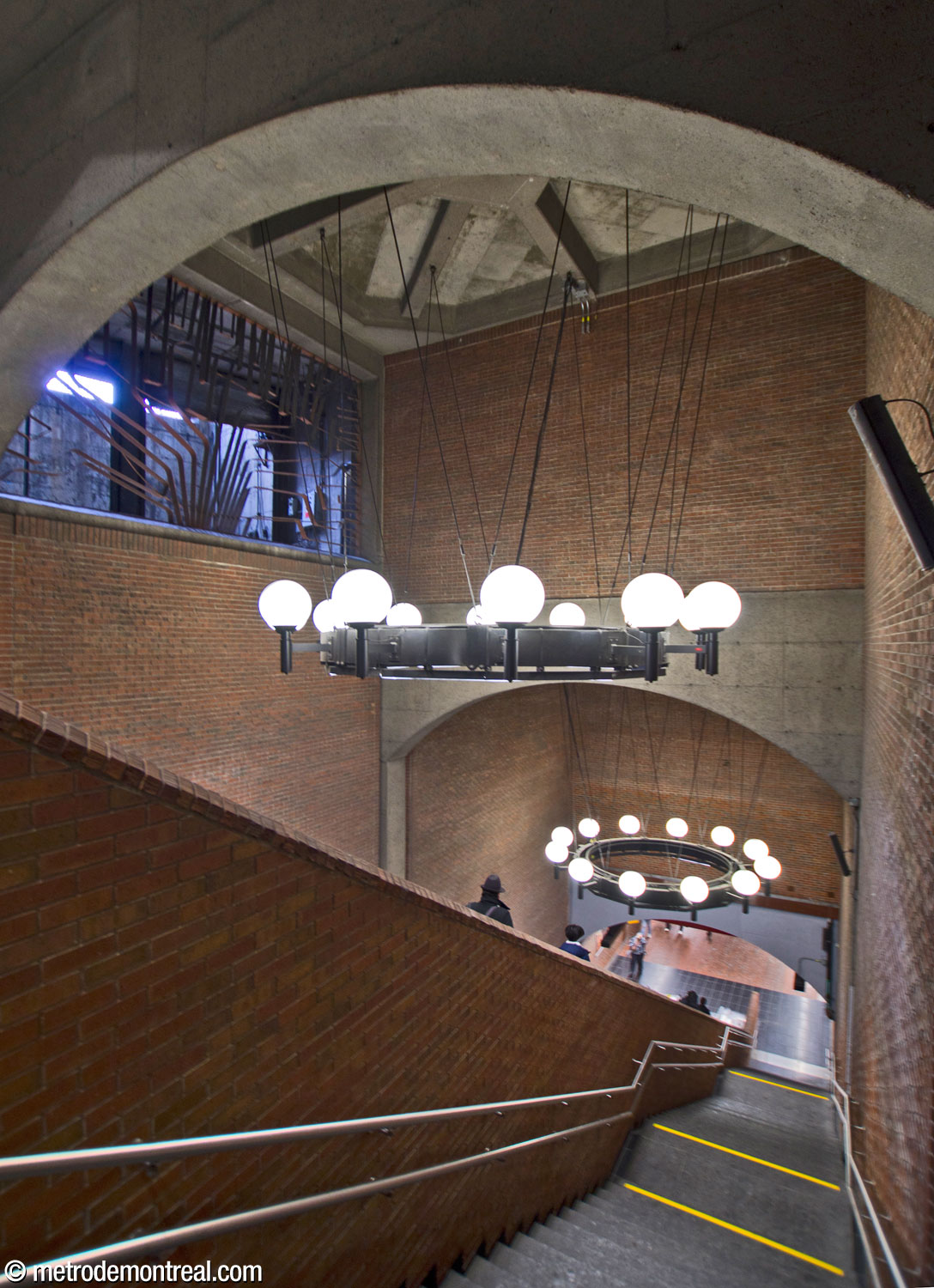
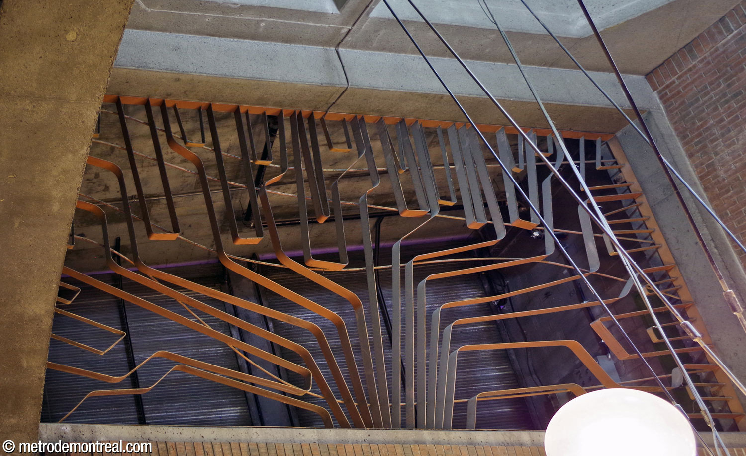
A ventilation shaft over the escalators is concealed by a companion to the sculpture mentioned above, a grille with tree-like forms in terra-cotta-coloured metal, also by Jean-Louis Beaulieu.
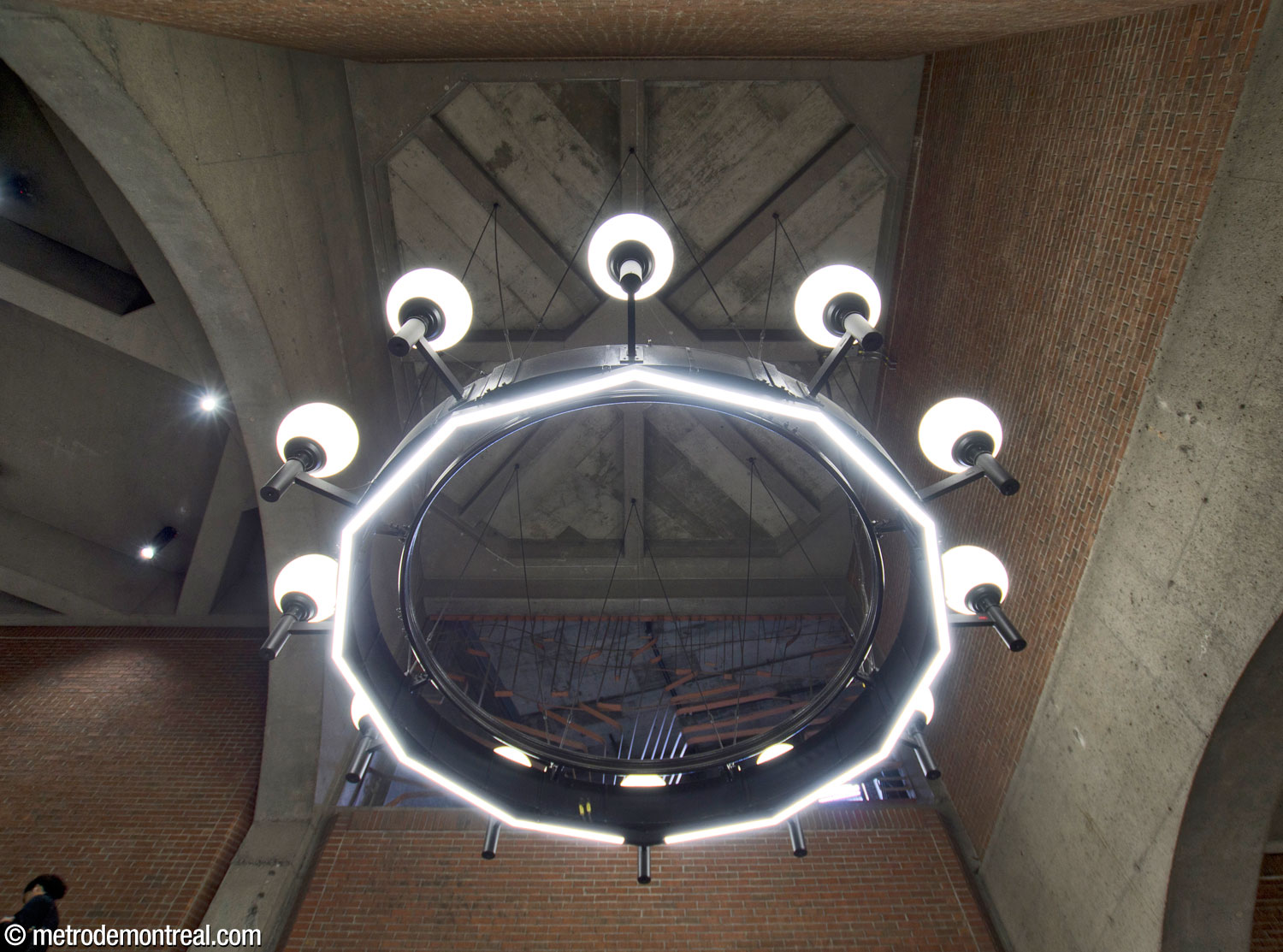
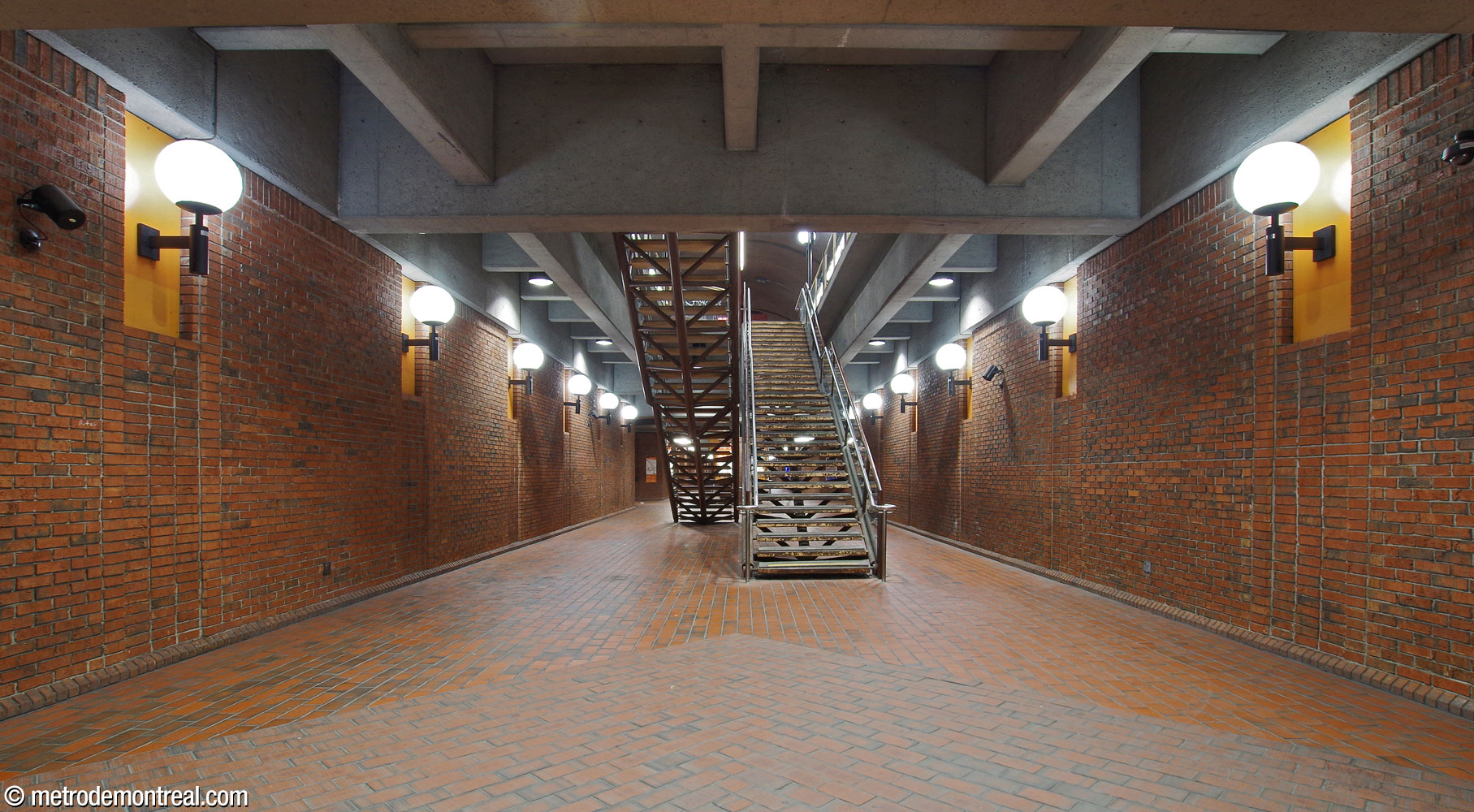
The walls and floors, from the building’s exterior to the platforms, are of Eastern Townships red clay bricks, and are complemented by yellow and burgundy accents. Another unifying feature is the use of globe-shaped lamps in fixtures with classic styles; these, along with the station’s red brick and the sunken garden, were meant to recall the surrounding neighbourhood by suggesting a residential street underground.4 Besides the chandeliers in the main stairwell, the central vault features triple lampposts on the corners of the stairwells on the upper level and wall sconces on the lower level, accompanied by interesting vertical light panels. Light strips along either side of the central vault were added in 2025.

The upper platforms, for their part, use their vaulted ceilings to full effect, emphasizing them with rows of curved lampposts on either side of the platform benches.
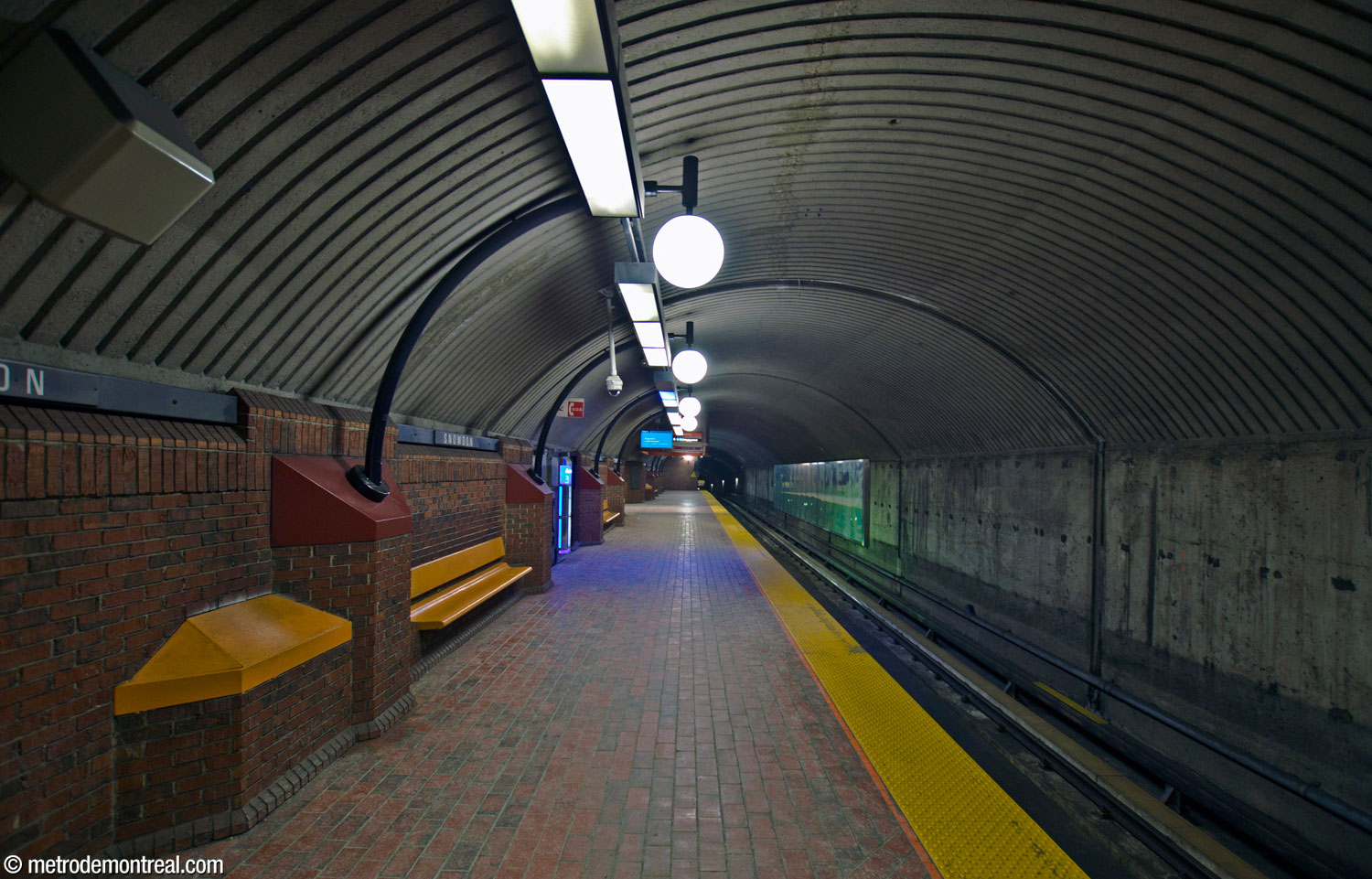
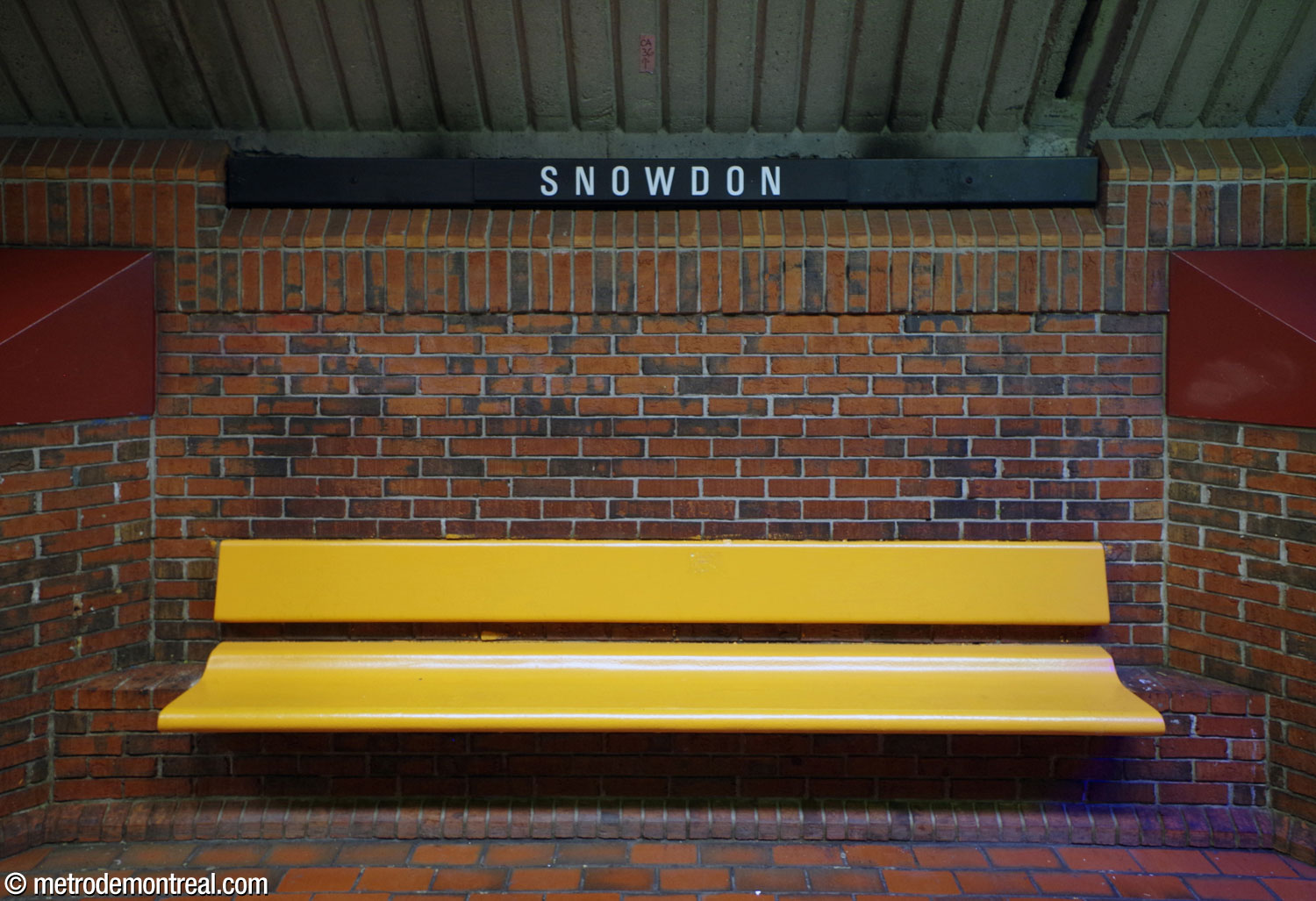
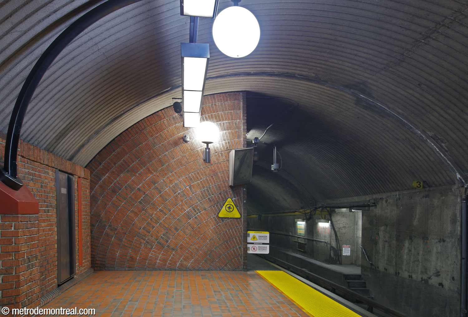
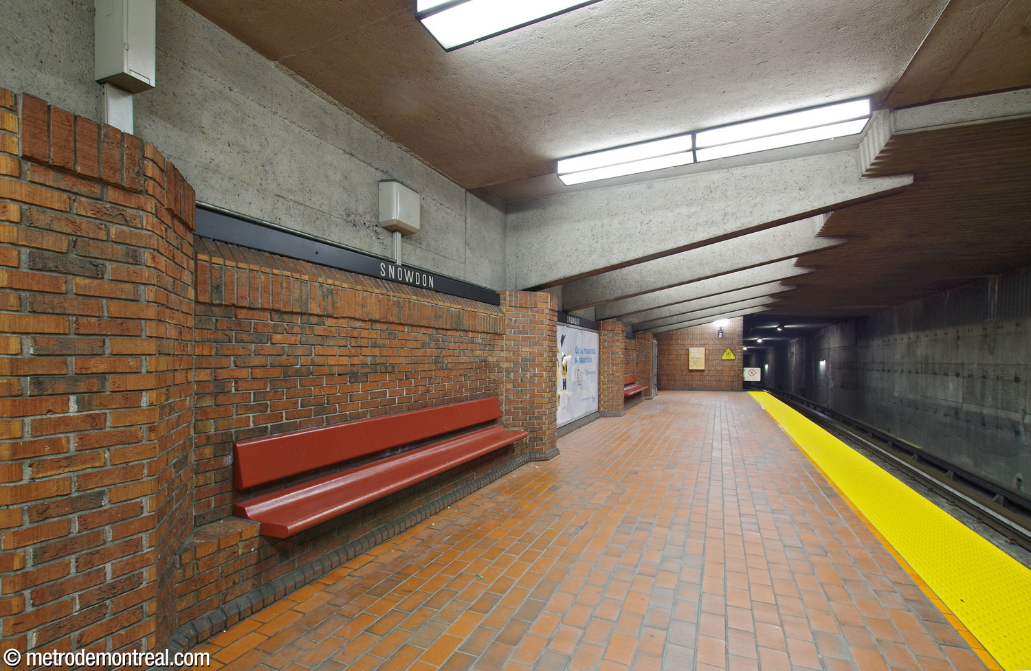
The lower platforms have fairly low ceilings interrupted by corbels holding up the platforms above. The lower level features burgundy benches and yellow accents; these colours are reversed on the upper level.

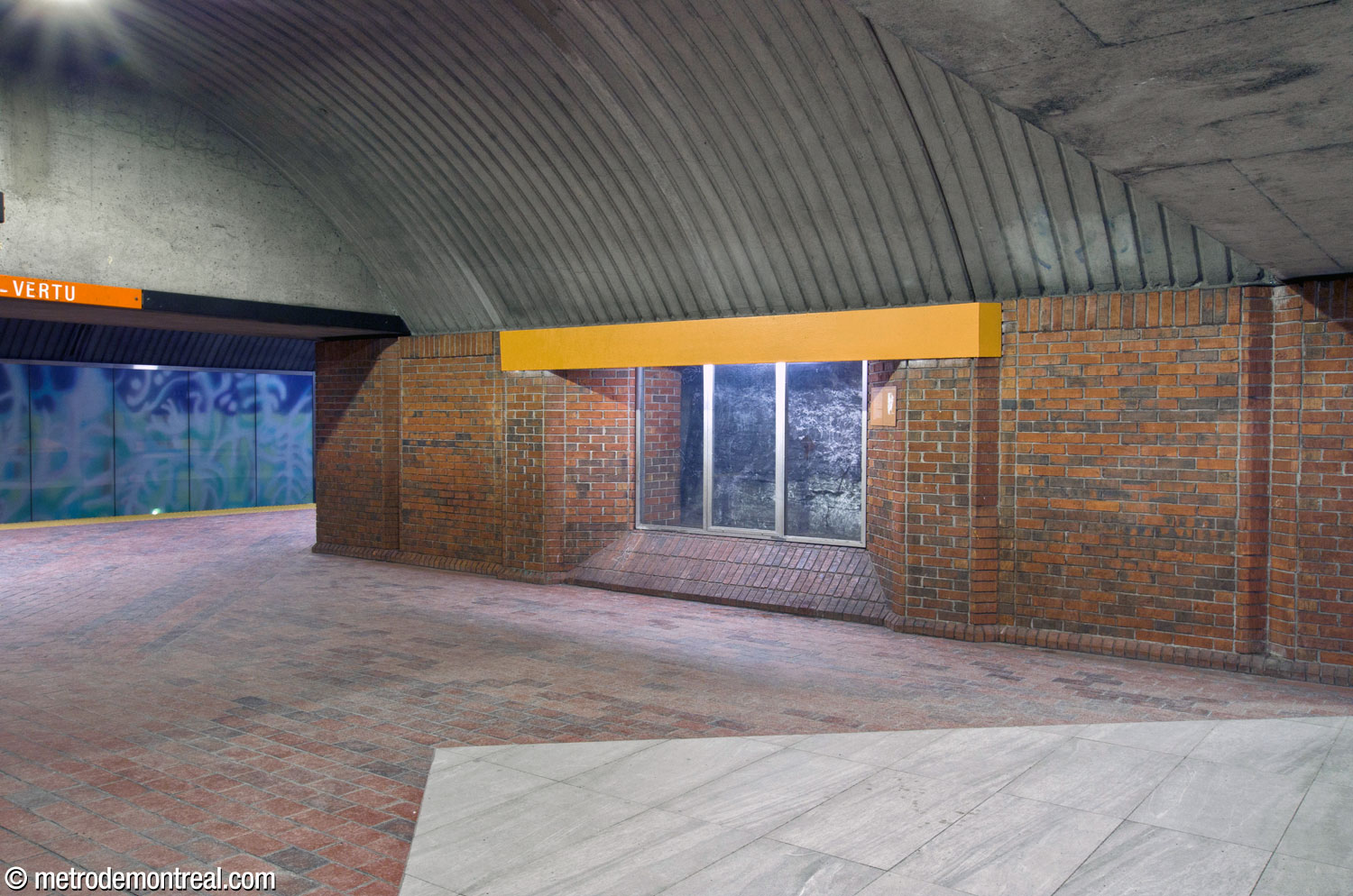
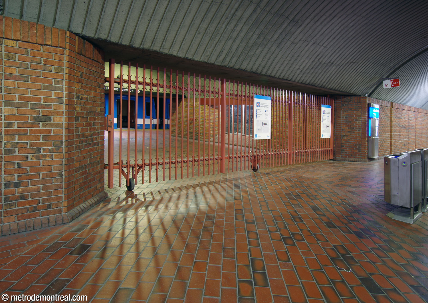
On the upper level in the three transverse tunnels closest to the exit, six windows with interpretive panels have been placed looking in on the natural rock formations from which the station was excavated. Unfortunately, the displays have been allowed to deteriorate somewhat; the glass has been defaced, one of the six interpretive panels is missing, and the three on the blue line side are located behind grilles that are used to close off the blue line platforms after they close. Nevertheless, these views are an interesting look at what was here before the metro.

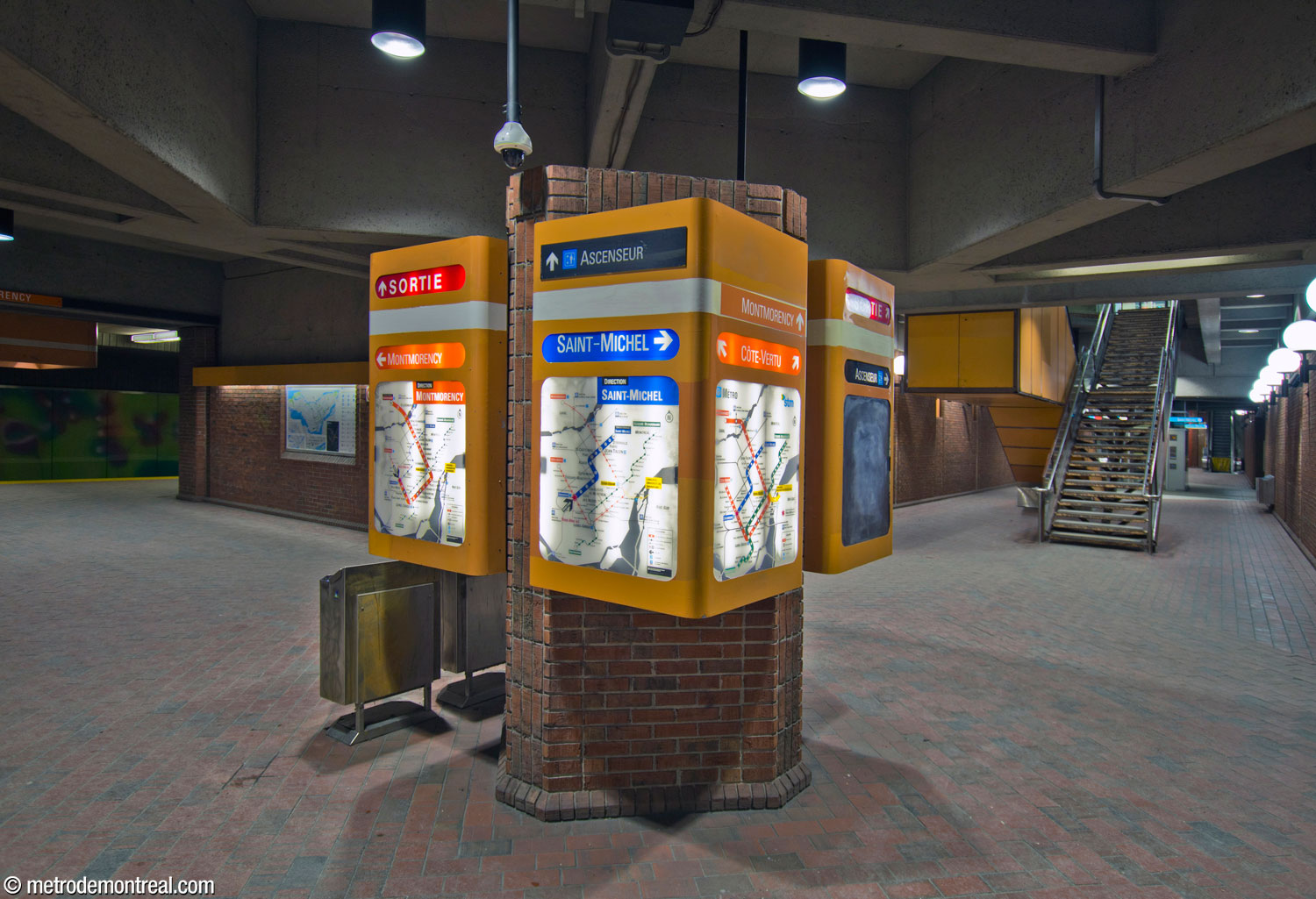
Another unique feature is the imposing information modules in the station’s central core. As these are unable to accommodate the standardized signs used in the rest of the stations, they went without updates for a long time (for example, they displayed the name Berri-De Montigny for some 18 years after the station was renamed Berri-UQAM), until the opening of the Laval metro in 2007 forced the issue. The STM is now able to keep them updated with specially formatted system maps, line maps, and directional signs.

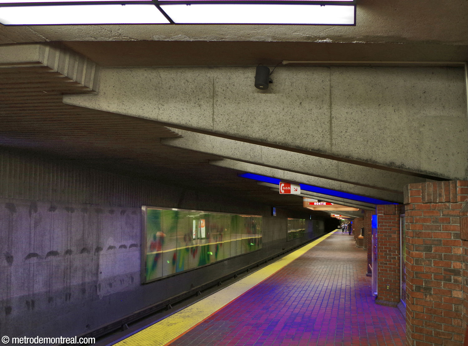
The station’s main artwork has had an eventful history. The work by Claude Guité, entitled Les quatre saisons, originally consisted of four immense murals, one for each platform, each one stretching the entire length (152.4 m) of the platform. The murals were conceived to brighten up the deep, hard-surfaced underground environment with lively colours and a joyful, accessible, natural subject suggested by the presence of four platforms.
Unfortunately, all four were damaged by graffiti soon after the station opened, then further damaged by cleaning attempts.5 “Spring” and “Winter,” on the Montmorency and Côte-Vertu platforms respectively, were left in an especially pitiable state of disrepair; about fifty percent of the Montmorency mural’s panels and nearly all of those of the Côte-Vertu mural were partially obliterated.
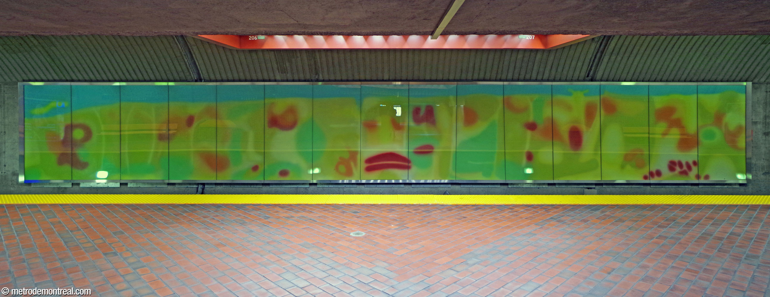
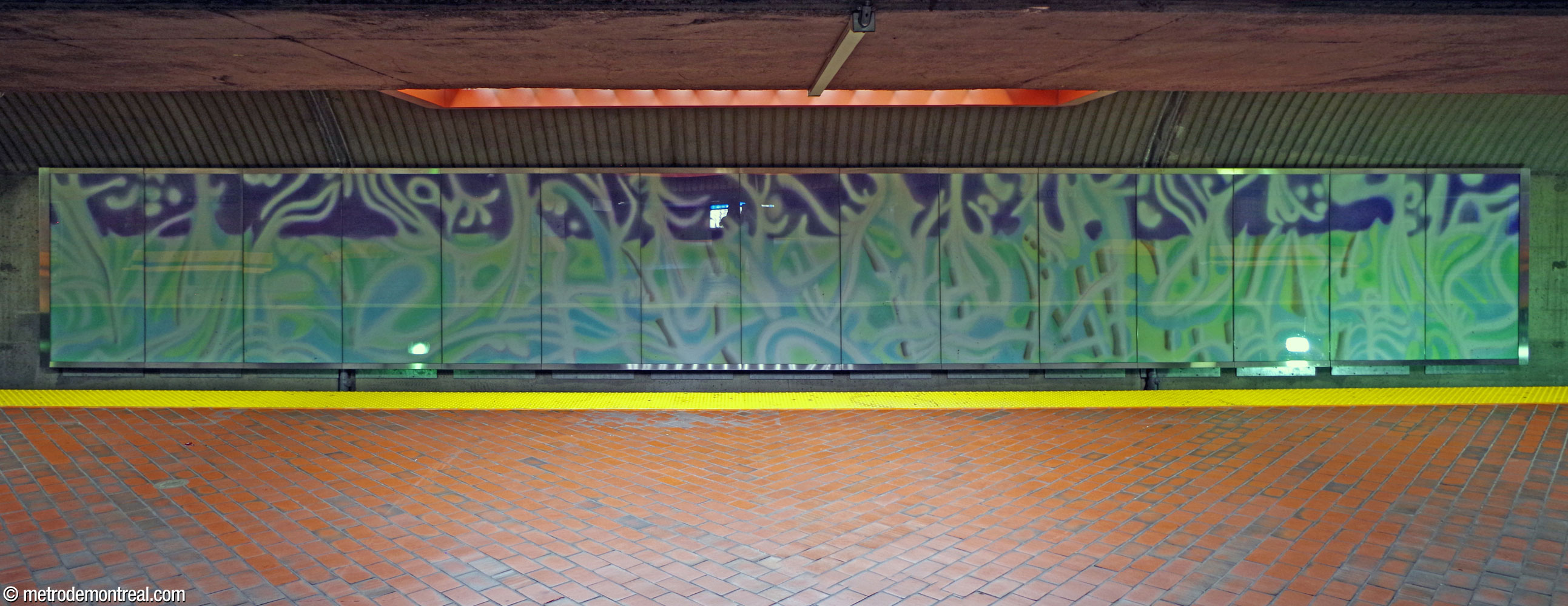
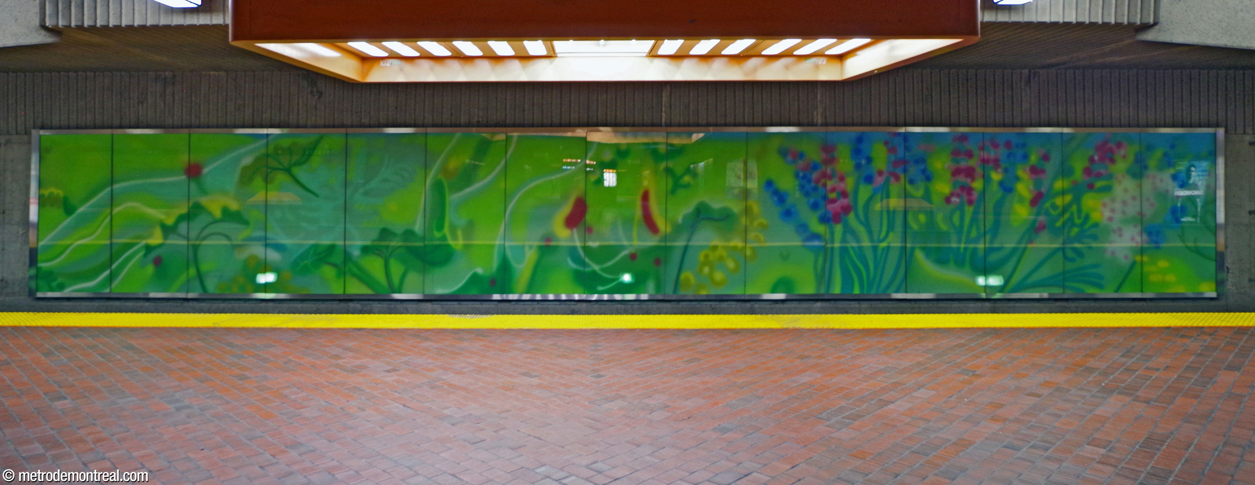
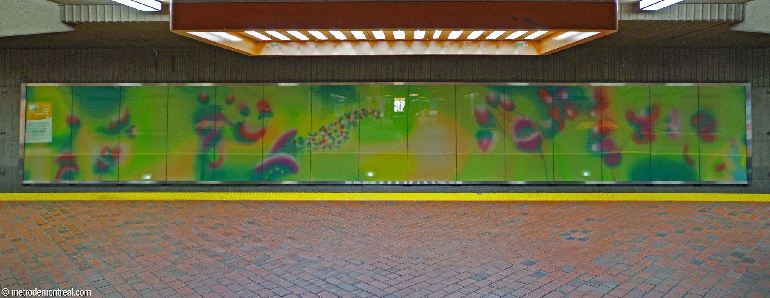
This deplorable situation endured for some twenty years. Finally, in 2004, the murals were removed in 2004 and repainted or restored with the collaboration of the artist. Sections of the work (four each on the Côte-Vertu, Montmorency, and Snowdon terminus platforms and three on the Saint-Michel platform) were reinstalled, protected by transparent panels, in front of the entrances to each platform. The remaining sections have been stored and may be reinstalled in the future.

Accessibility
This station is equipped with elevators for wheelchair accessibility. There are three elevator shafts. One, located near the entrance doors, links the station entrance to the ticket hall. The second, between the ticket hall and the upper platform, is located on the eastern side of the ticket hall, a short distance away from the turnstiles; it is accessible from the main gateline by a walkway inside the fare-paid zone, but a turnstile and ticket gate are also provided just in front of it. It exits onto the central tunnel near the foot of the escalators to the ticket hall. The third, linking the two platform levels, is located in the middle of the central tunnel.
The three elevators were opened on June 3, 2016.6
History & Trivia

Ridership
3,619,998 entrances in 2025
23rd busiest stationNote: Includes only entrances, not transfers

Platform Depth
Upper platform: 19.5 m deep
Lower platform: 24.6 m deep
6th deepest station

Interstation Distances
To Côte-Sainte-Catherine: 693.00 metres
To Villa-Maria: 884.41 metres
To Côte-des-Neiges: 959.60 metres
Origin of the Name
Snowdon district. The neighbourhood and city council district of Snowdon is named for a farm belonging to James Snowdon (1791-1864), on which it was built.7, 8 A street named Rue Snowdon is located a few blocks south of the station and of the centre of the area’s commercial zone, the intersection of Boulevard Décarie and Chemin Queen-Mary, near this station.
The choice of this name for the station no doubt owes something to the former presence of Snowdon Junction, a major streetcar terminus that existed at the corner of Boulevard Décarie and Chemin Queen-Mary until the end of streetcar service in 1959.
Name proposed during planning phase: Queen Mary.9
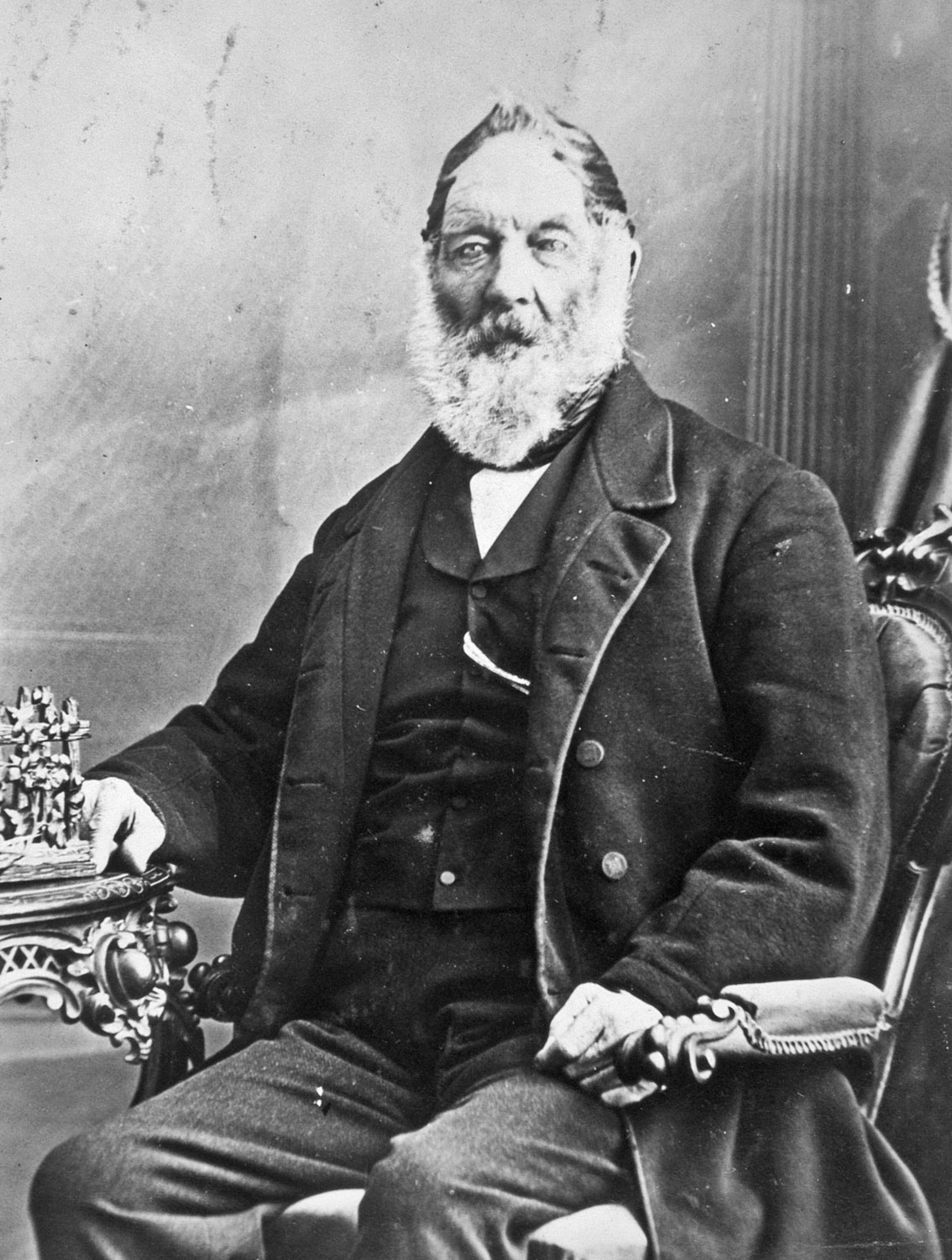
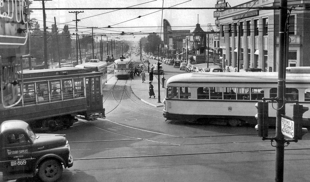
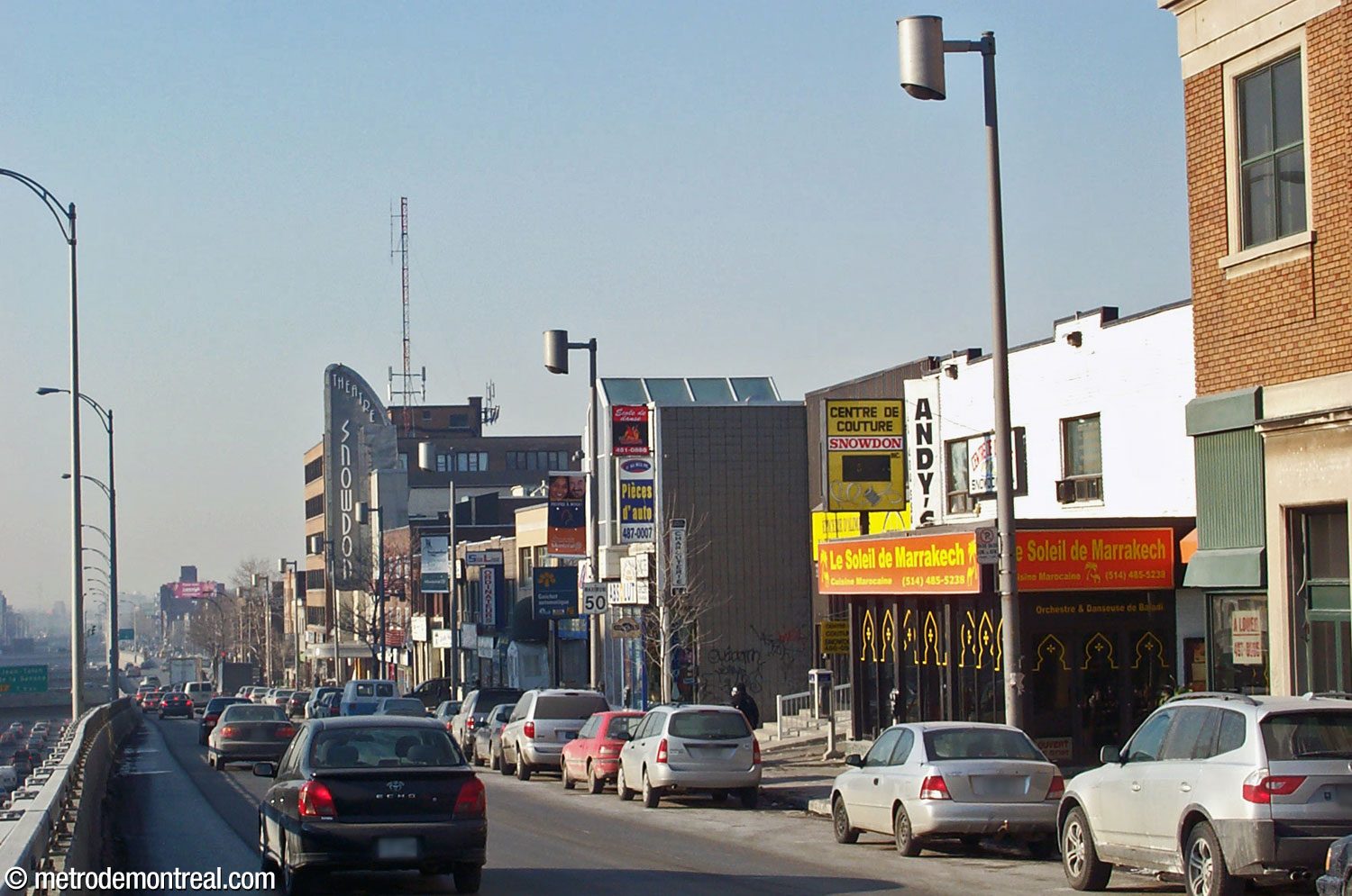
Commercial buildings in Snowdon district, including the former Snowdon Theatre with its iconic sign, along Boulevard Décarie
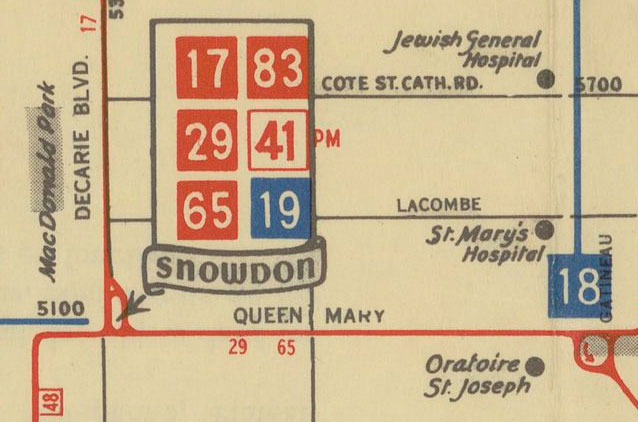
Snowdon Junction on a 1941 transit map
(Source12)
Trivia
- This is the only station to have served as the terminus for two different lines. Before the inauguration of the blue line, Snowdon was the western terminus of the orange line for some nine months between its inauguration and that of Côte-Sainte-Catherine station.
- The station’s ticket hall was designed so as to allow three additional exits to be added, to the east, west (across Avenue de Westbury) and south (across Chemin Queen-Mary) of the station.1 In particular, the BTM recommended in 1985 that a second entrance be added on the south side of Chemin Queen-Mary to improve safety for pedestrians crossing the busy street. However, the project was opposed by the local city councillor Marvin Rotrand and the local merchants’ association,13 and never came to fruition.
- An early plan to have one of the platforms left as a cavern of naked rock, like some metro stations in Stockholm, had to be abandoned due to the poor quality of the surrounding rock.1 The windows presenting the local geology recall this plan.
- The station’s 2016 renovation made it the only station in the network to offer public washrooms. (Certain stations have washrooms in the metropolitan bus terminals connected to them.) Two single-stall, gender-neutral facilities were installed in the ticket hall between the escalator shaft and elevator to the platforms, as a pilot project for the possible installation of washrooms in all the transfer stations. Unfortunately, after they were closed due to the COVID-19 pandemic, it was announced in 2025 that they would be permanently closed to the public.14
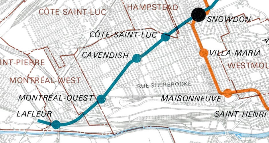
A 1976 BTM map shows the planned extension of the blue line into Notre-Dame-de-Grâce, Montréal-Ouest and Saint-Pierre. The platforms at Snowdon were laid out so as to provide this extension with direct cross-platform transfer to the inbound orange line, as at Lionel-Groulx.
(Source15)

Architectural sketch showing the planned use of bare rock on one of the platforms
(Source1)
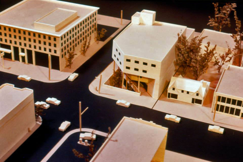
Maquette of the station’s headhouse
(Source16)
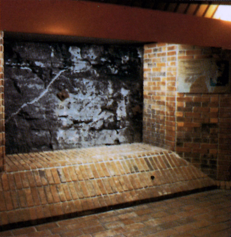
One of the displays showing the surrounding rock, prior to the installation of glass windows
(Source2)
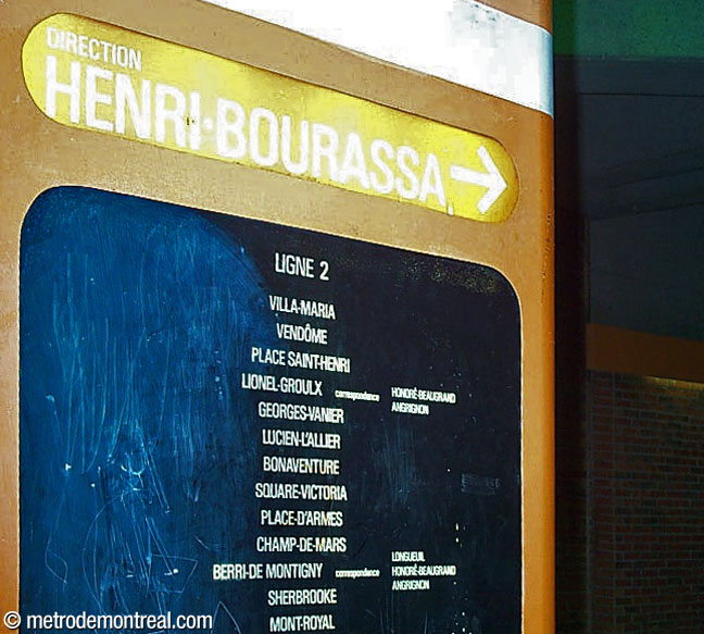
A panel in one of the information modules in the central tunnel is seen in 2001, still listing the name Berri-de Montigny despite the name having been changed to Berri-UQAM some twelve years previously. As custom-sized signage is needed to fit the module, the signage was not changed for many years, until the Laval extension opened in 2007.
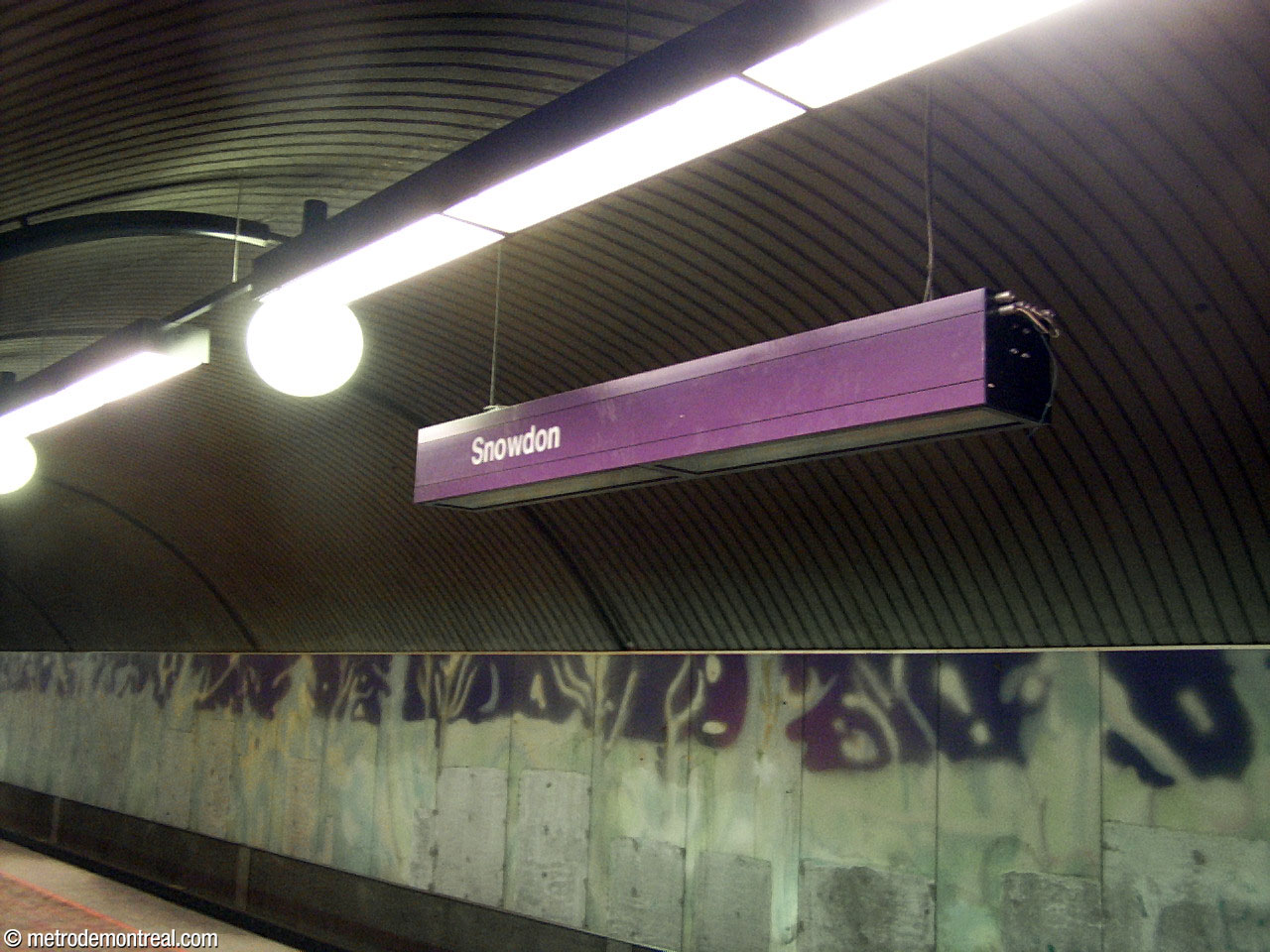
A unique purple nameplate fixture that was installed on the Côte-Vertu platform in 2003 for unclear reasons and later removed
Views of Claude Guité’s Les quatre saisons prior to damage and restoration:
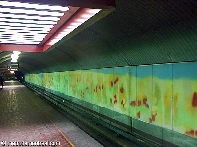
‘Autumn’, on the Snowdon terminus platform

‘Winter’, on today’s Côte-Vertu platform
(Source16)
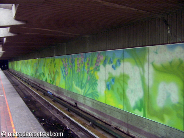
‘Summer’, on the Saint-Michel platform
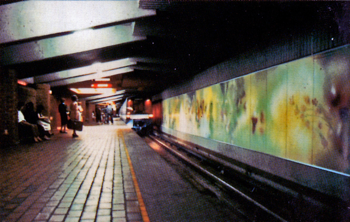
‘Spring’, on today’s Montmorency platform
(Source2)
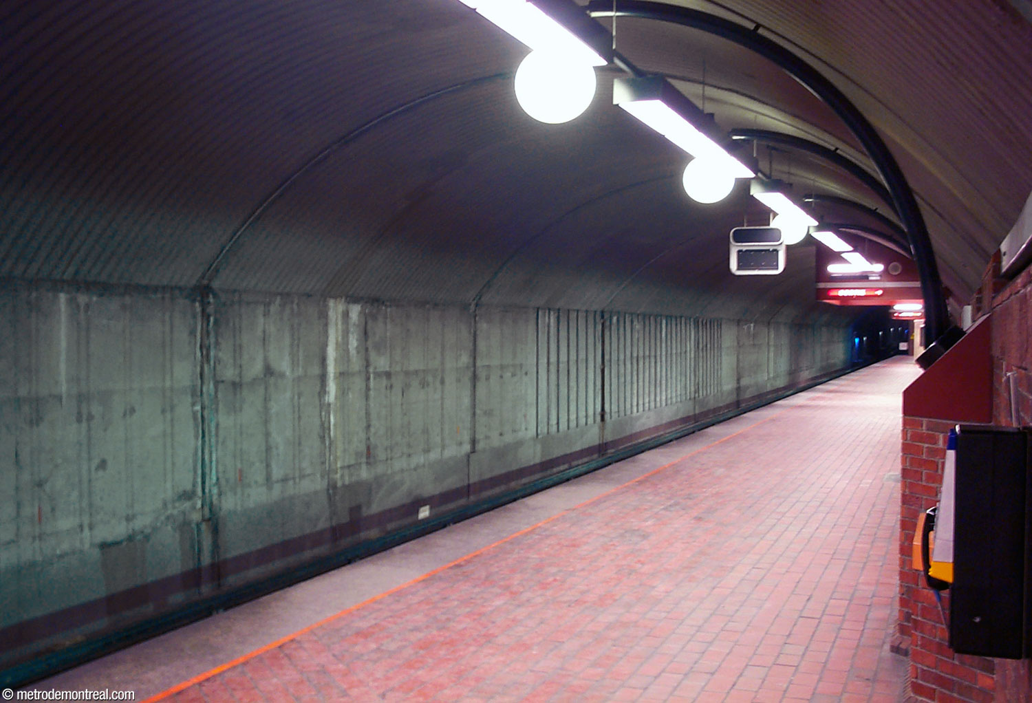
One of the platforms in 2005 following the removal of Les quatre saisons for restoration
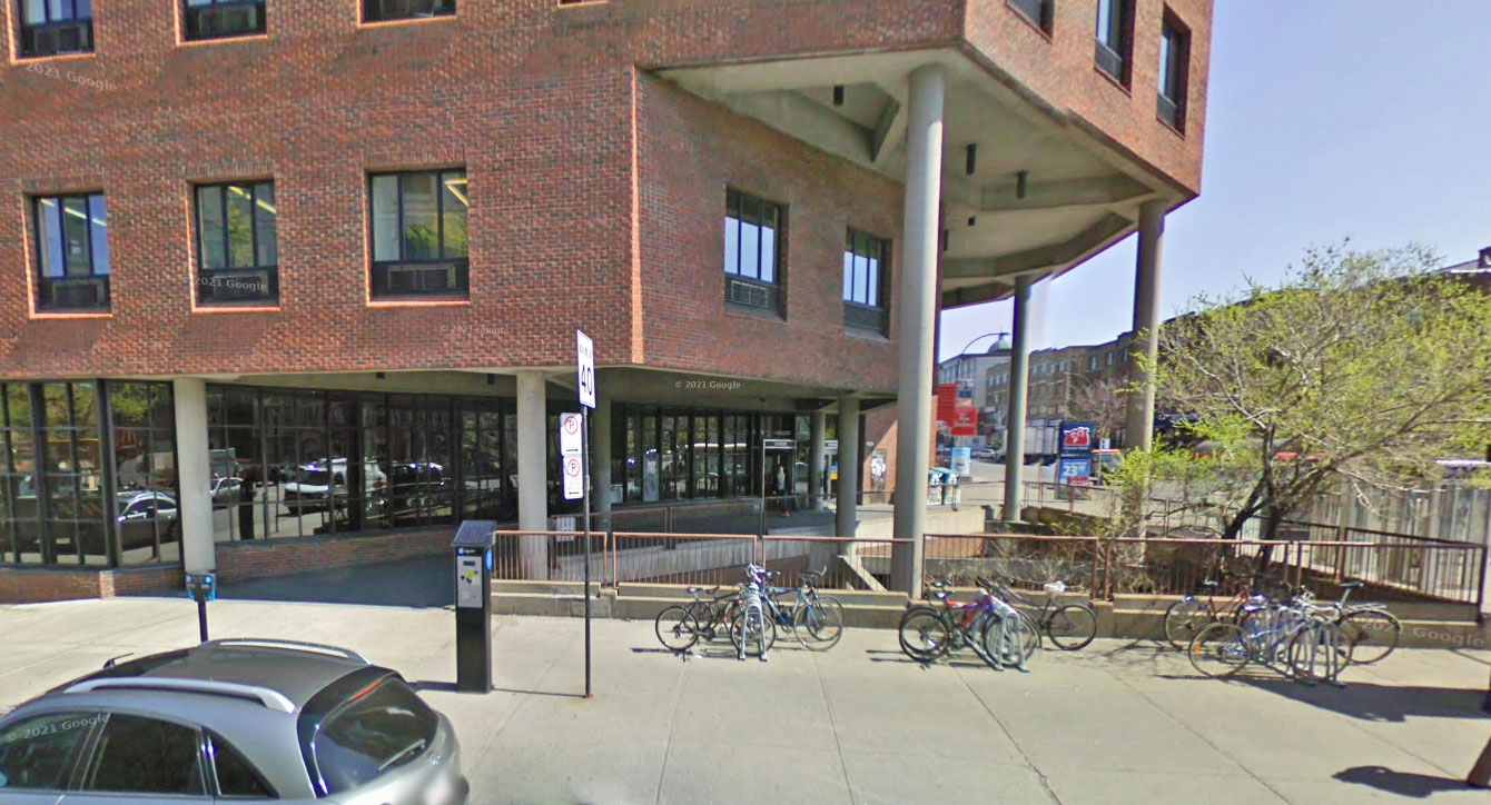
The station entrance seen in 2009, prior to the 2013-2016 renovations. The entrance opened onto an exterior walkway above the sunken garden. The renovations enclosed part of the walkway, with doors on either end.
(Source17)
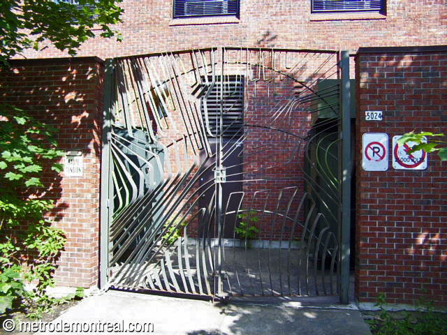
The sculptural gates by Jean-Louis Beaulieu on the rear of the station, prior to their removal and reinstallation inside
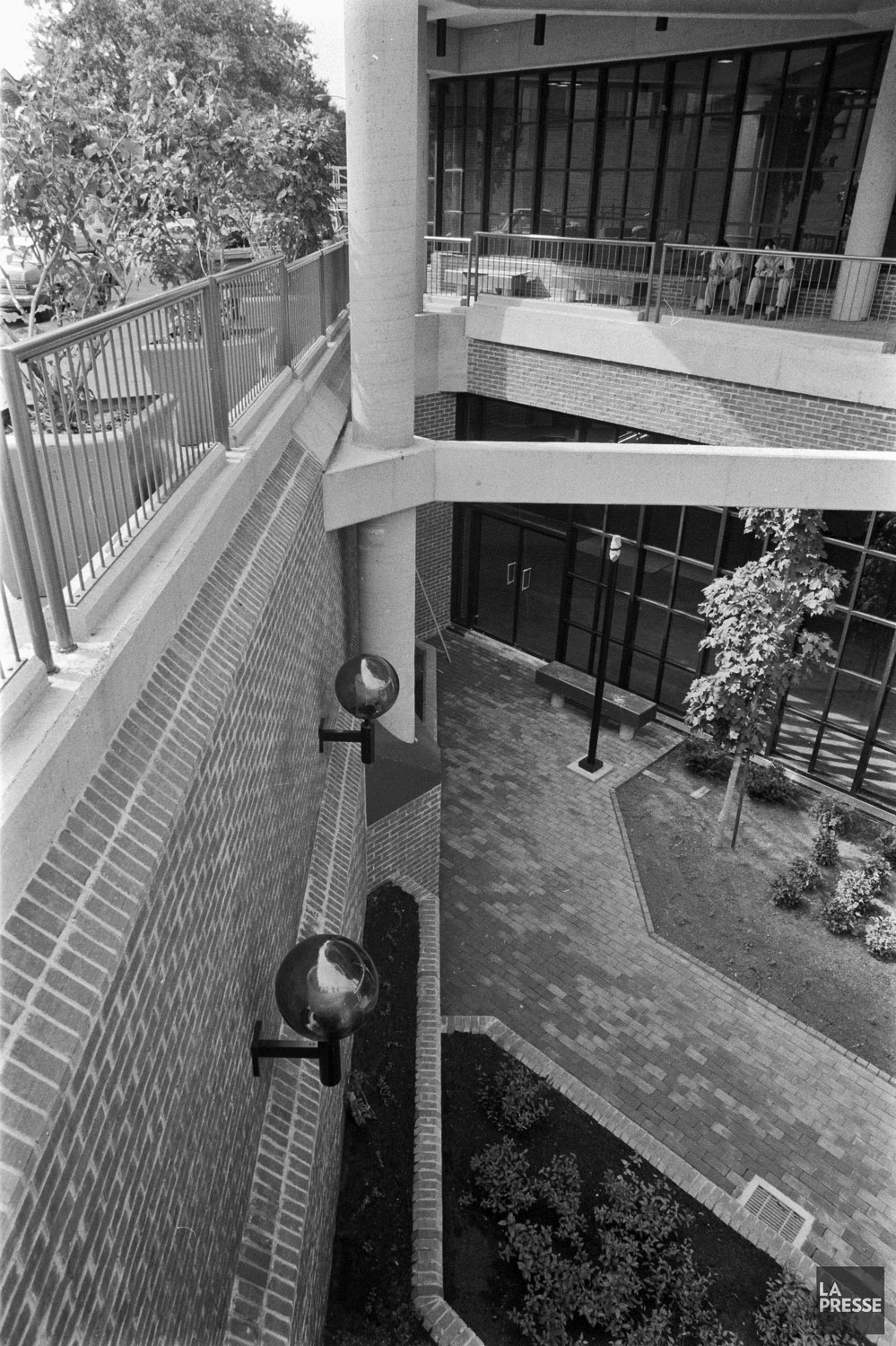
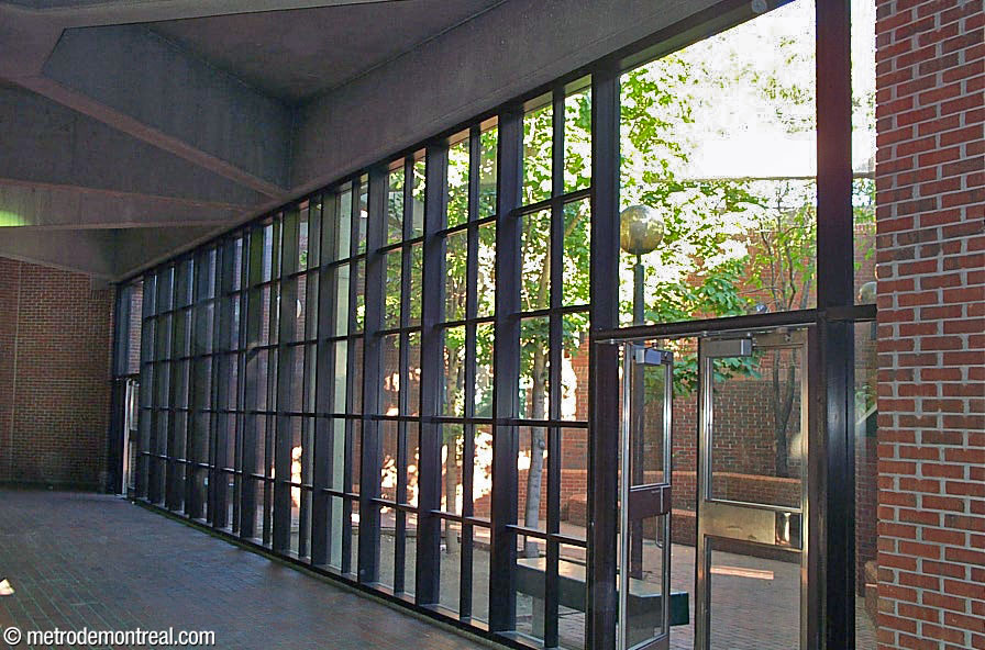

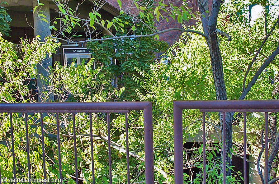
The station’s sunken garden prior to 2013
(Far left image: Source18)
Text of the interpretive plaques on geology:
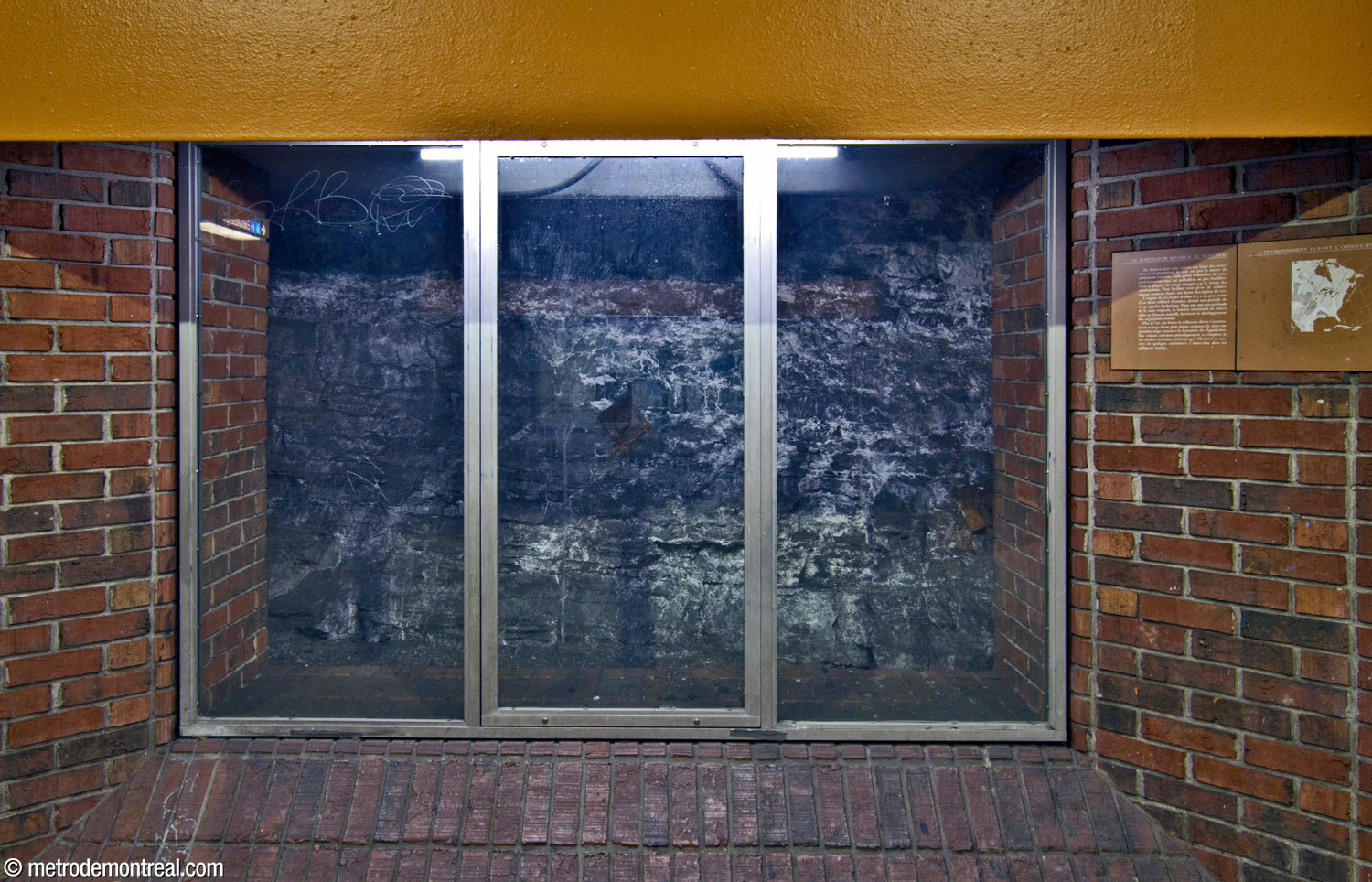
The rocky substrate of Montreal
Six windows in this station have provided openings allowing you to see a little of the nature of the rocky substrate. This underground part of our environment is probably not very familiar to you, being usually covered by the concrete of buildings. To facilitate this contact, each panel gives a brief description of the rock.
These rocks date back a little less than half a billion years, to a period of time called the Ordovician. In a shallow tropical sea, sunlight fostered an environment rich in nutrients, promoting the development of marine organisms.
Further to the east, various muds and sediments accumulated offshore from a continental shelf, in a first stage leading to the formation of the Appalachian Mountains. Volcanoes erupted periodically and the ash sometimes reached as far as Montreal in layers a few centimetres thick, alternating with the marine sediments.
The environment during the Ordovician
- The equator during the Middle Ordovician
- Winds
- Shallow sea
- Islands and volcanoes

Homage to the human “moles”
The steel pieces you see here bear witness to the roughness of the hostile environment that the workers had to confront in order to dig the tunnels through Montreal’s bedrock. In this case, they served to stabilize the rock of the vault in order to allow the workers to keep digging forward in safety, to meet another team of workers doing the same in the other direction.
This window illustrates some of the difficulties overcome by these workers; you will have no difficulty believing that the completed work conceals the traces of numerous other obstacles of the same kind connected with the arduous work of building underground.
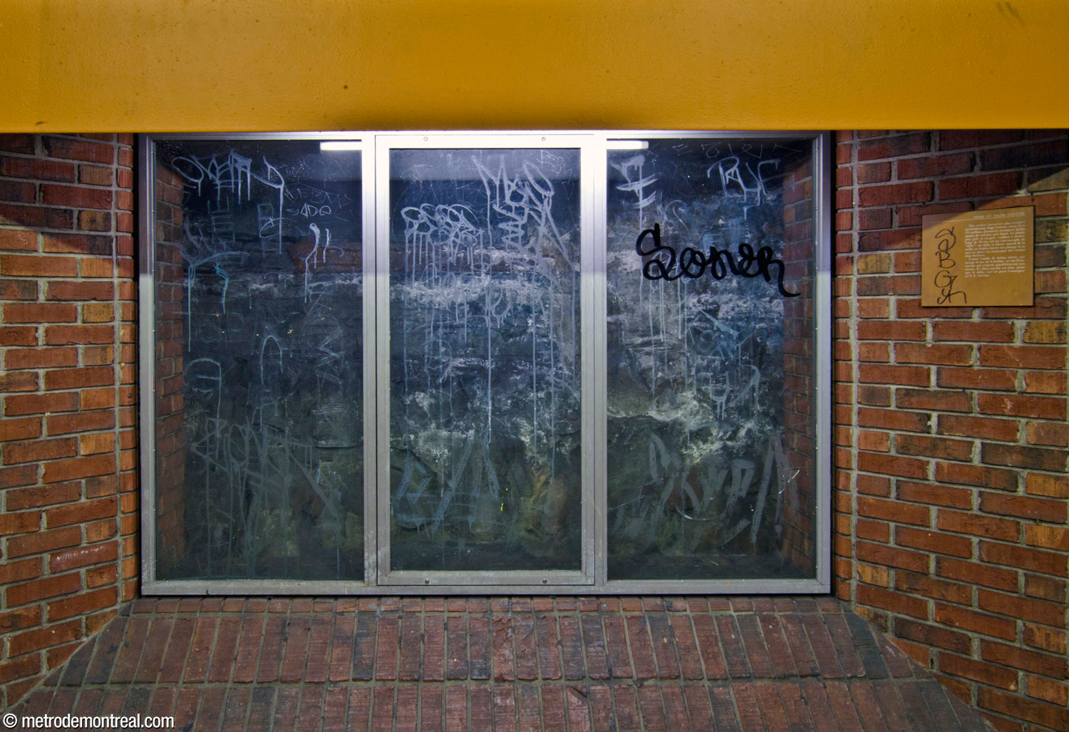
Dyke and sill
More recent intrusive rocks (probably from the Cretaceous period, between 65 and 135 million years ago) cross through the strata of dark grey limestone. The paler and slightly greener band to the right, 50 cm wide, is a good example of a “dyke.” A dyke is formed when molten rock pierces through strata that have already formed.
The other band of the same colour, in the bottom of the window, is a sill, which is injected parallel to the strata. Since we can see that the sill overlaps the dyke, the sill is younger.

Montreal in the tropics
The study of rocks gives us information on the very ancient past of our region. Each segment of rock gives us a chapter of that history. These limestone strata have been found to contain accumulations of the fossilized shells of animals that lived more than 450 million years ago, on the floor of a tropical sea.
Just as history books are subdivided into chapters and sections, geologists divide the long sequence of strata into groups, formations, and members. The limestone strata in this window, like all the rock from which Snowdon station was excavated, belong to the Trenton group, Montreal formation, Rosemont member.
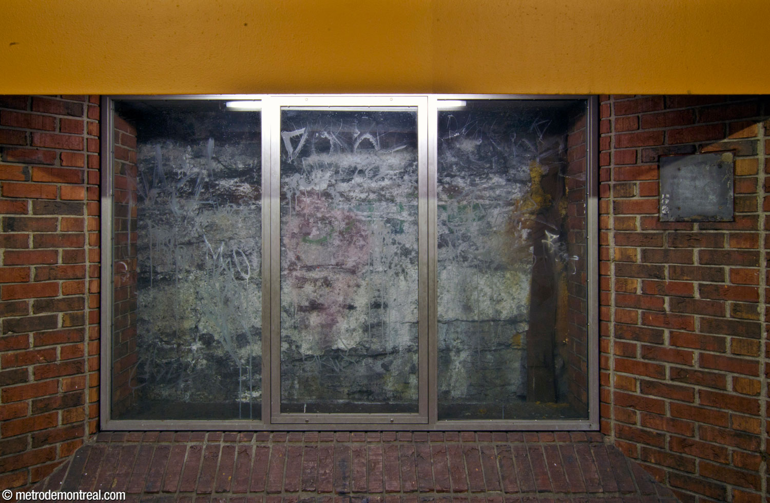
(Geology window with missing plaque)
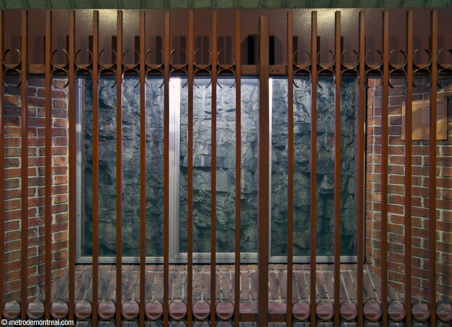
Strata formed by sediments
The horizontal bands are layers of limestone sediment formed in a warm sea 450 million years ago. The thin, darker layers are accumulations of clay, less rich in fossils.
The layers or “strata” of sediment were transformed into hard rock by the pressure produced by several thousand metres of accumulated sediment, which later slowly eroded away.
General Information
Platform diagram
Most convenient metro cars to use when travelling to this station
Station surroundings

Station address
Borough of Côte-des-Neiges–Notre-Dame-de-Grâce
5111 Chemin Queen-Mary, at Avenue de Westbury
Official website
Service information, opening hours, frequency, bus routes

Most recent update: October 10, 2026
References
- Jean-Louis Beaulieu. Snowdon (presentation document for the Bureau de transport métropolitain). March 1977. Archives de la Ville de Montréal, dossier CA M001 XCD001-D19, item 1D-06-01-04F. ↩ ↩ ↩ ↩
- Image source: Bureau de transport métropolitain. (1989). ‘Snowdon’ [pamphlet]. ↩ ↩ ↩
- STM, board of directors’ meeting, November 6, 2019. ↩
- Info-STM. (2006, January 18). “Les artistes du métro de Montréal: Jean-Louis Beaulieu.” Métro, p. 13. Reproduced on the STM website. ↩
- Wood, Nancy. (1985, May 28.) “Métro graffiti erased—so are murals.” The Gazette, p. A1. ↩
- STM. (2016, June 3). “Station de métro Snowdon: une nouvelle station accessible pour le bénéfice des clients.” [Press release.] ↩
- Stock, Sandra. (2021, winter). “Snowdon: Remembering the streetcar.” Quebec Heritage News, vol. 15, no. 1, pp. 28-29. ↩
- James (Snadon) Snowdon Sr. (1791 – 1870). WikiTree. ↩
- Lazarus, Charles. (1973, March 10). “Work on Albert Metro complex due to begin in August.” The Montreal Star. Source: Archives de la Ville de Montréal, CA M001 VM166-1-1-D5277, p. 12. ↩
- William Notman. Mr. James Snowdon. 1865. Photograph. Collection: McCord Stewart Museum, no. I-62324.0.1. ↩
- Image source: Montreal Gazette Collection, Library and Archives Canada. Found in: Grumley, J.R. Thomas. (2001). Montreal Streetcars. Vol. I. Ottawa: Bytown Railway Society. P. 24. ↩
- Image source: Montreal Tramways Co. (1941). Route Map. Bibliothèque et Archives nationales du Québec, G/3452/M65P22/1941/C64 CAR. ↩
- “Councillor opposes Métro exit.” (1985, August 12). The Gazette, p. A3. ↩
- Teisceira-Lessard, Philippe. (2025, June 18.) “Échec d’un projet-pilote: La STM met une croix sur les toilettes dans le métro”. La Presse. ↩
- Image source: Gaston, J. (1976.) Le métro de Montréal. Montreal: Bureau de transport métropolitain. ↩
- © STM archives. ↩ ↩
- Image source: Google Street View, May 2009. ↩
- Photograph by Michel Gravel, La Presse, September 3, 1981. Fonds La Presse. Bibliothèque et Archives nationales du Québec, P833,S5,D1981-0325, no. 13. ↩