
Station page features
This page explains the information you can find on the pages that showcase each station.
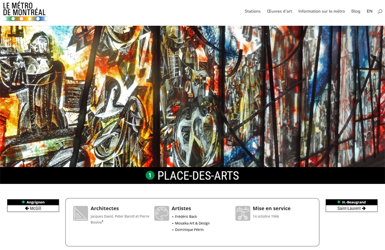
Menu bar: Links to major site sections, to the French version of the current page, and to the search function.
Cover image and title: A cover image representing the station, and the station’s name and line roundel.
Navigation boxes: On either side of the info box, a navigation box takes you to the previous and following stations on the line.
Info box: Lists the station’s architects (including those of major station features added after construction), the artists of the station’s artworks, and the date the station (and any major additions) came into service. Note that this last is, as far as the author can determine, the date on which the station first admitted members of the public for passenger service, rather than the date of any official inauguration ceremonies, when different.
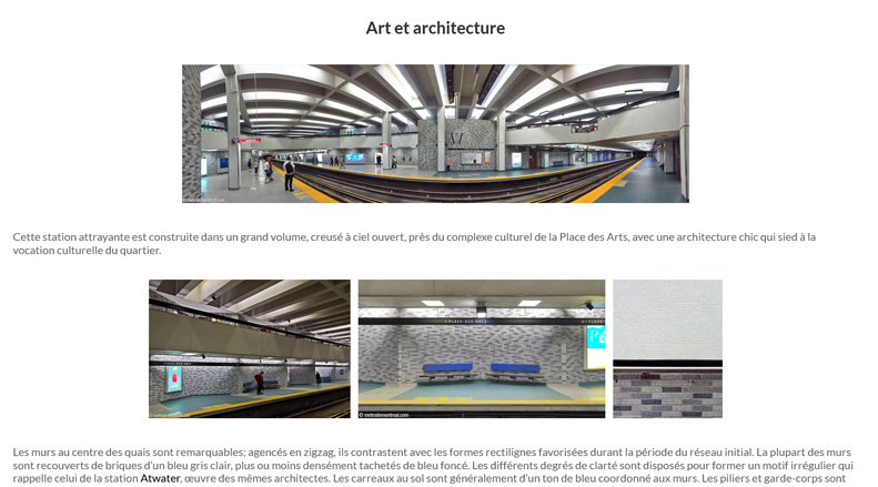
Photo essay: The main part of the station page, presenting an essay describing the station’s architecture and artworks, illustrated with numerous photos.
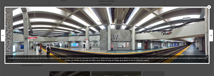
Lightbox: Clicking on any of the photos in the photo essay brings up a lightbox, displaying a larger view of the photo as well as a caption. You can click the left and right arrows or use the left and right arrow keys to navigate through all the photos in the photo essay section.
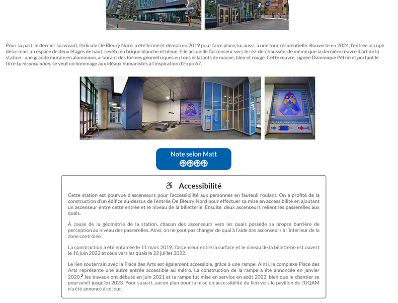
Matt’s Rating: At the end of the photo essay, a box provides the author’s subjective rating for the aesthetics of this station, between one and five arrows.
Accessibility information: This separate box explains whether elevators are available in the station for wheelchair accessibility, and if so, describes their layout.
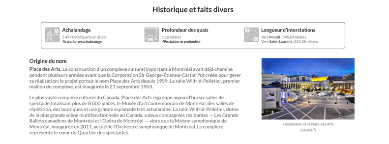
History and Trivia section: This section presents a variety of historical and other information about the station, beginning with several sections that are presented for each station.
Statistics infobox: This infobox lists the station’s annual ridership (number of people entering the station’s ticket barriers per year), the depth of its platforms below street level, and the interstation distances, i.e. the length of the tunnel between the end of this station’s platforms and the beginning of the next station’s in each direction.
Origin of the name: This section explains what feature (street, park, etc.) the station is named for and the person or thing at the origin of that name, including a short biography or history, images of the namesake, and other archival material. The station’s former names and planned names are also listed.
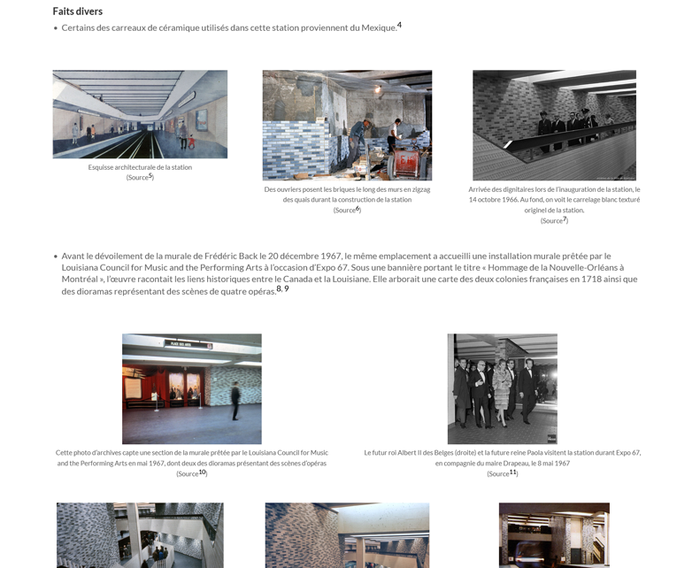
Trivia section: Historical and other interesting facts are presented here, along with archival photos and images. These images can be clicked on to expand them into their own lightbox where they can be cycled through, like the station photos above.
General Information section: Includes various practical information about the station and its location.
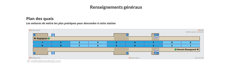
Platform diagram: This diagram shows the station’s platforms with their exits, shown along the length of a stopped train. This allows you to identify which car is the best to use if you are going to this station. The station’s different exits are labeled where relevant, elevators are shown, and cars stopping next to the stairs and elevators are shown in darker blue. For example, suppose you are using an Angrignon-bound train to get to Place-des-Arts station and you want to go to the underground city access to UQAM. Looking at the Angrignon platform on the diagram, you will see that the closest staircase to that exit is alongside the seventh car from the front. So at your departure station, you would want to get on the seventh car.
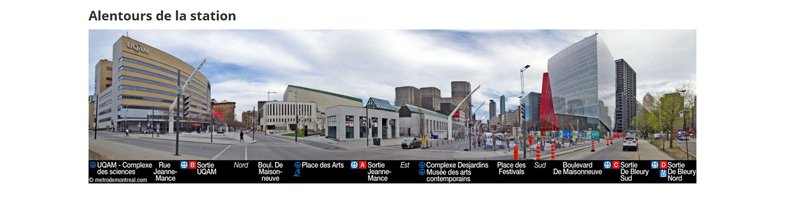
Station surroundings: A panorama (or in some cases more than one) showing the station’s accesses and the cityscape around them, with the accesses, underground city links, other major buildings, streets, and cardinal directions labelled.
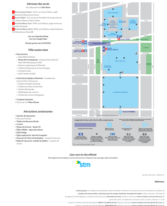
Station address: The station’s address and cross street are listed, with the borough or municipality in which it is located. Multiple accesses are listed by name, as well as by their identifying letters if applicable. These are followed by links to OpenStreetMap, Google Maps, and the STM’s neighbourhood map for the station (in PDF format).
Underground city: All buildings connected to the station by underground city and accessible to the public are listed. For the major downtown underground city stations, a diagram is provided showing the connections. When the underground city leads to other metro stations, links to these are provided.
Nearby attractions: Points of interest near the station are identified. Points of interest connected to the station by underground city are listed in that section and not repeated here.
Link to official website: A link to the official STM page for the station (and in the case of intermodal stations or metropolitan terminals, the other transit companies’ pages where available). This provides up-to-date information on service frequency, opening and closing times, bus schedules, etc.
References: Footnotes linked to in the text above providing citations for information, sources for historical images, and occasional additional notes.
Page footer: Features drop-down menus linking to all station pages, along with links to various information about the site.
Most recent update: 2026-09-22