


 BERRI-UQAM
 Saint-Laurent
Architects
Claude Longpré and Gilles Marchand1
Sainte-Catherine headhouse (1999): Gaétan Pelletier


Start of service

 Green and orange lines: October 14, 1966
 Yellow line: April 1, 1967

Art & Architecture
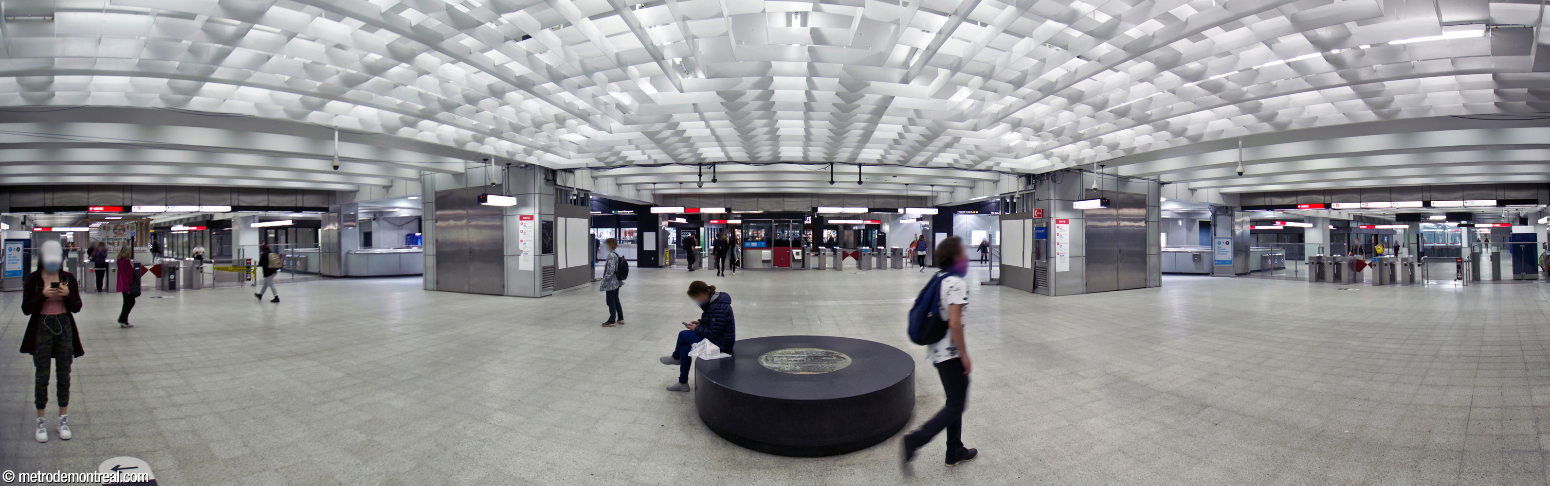
This is the largest, busiest, and most complex station in the network, spanning three lines, and has been the hub of the metro network since the metro was inaugurated in 1966. To accommodate these functions, the main part of the station was built in a massive cross-shaped cut-and-cover volume underneath Boulevard De Maisonneuve and Rue Berri. The station’s roof actually consists of crossing reinforced-concrete bridges that support the roadways above, held up by the station’s columns.
The station occupies five underground levels: the concourse, the orange line, the green line, the access to the yellow line, and the yellow line. The first three of these are located in the main open-cut excavation, with the orange line in the north-south part of the excavation, and the green line in the east-west volume. The yellow line and its accesses are built in separate mined tunnels to the west, under Rue Saint-Denis.
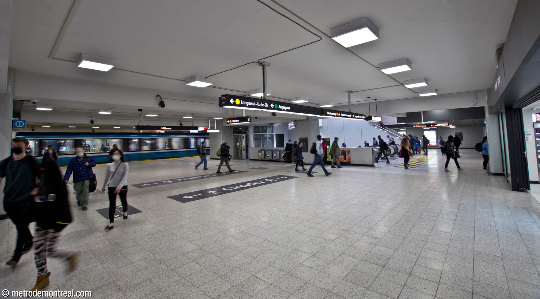
The station’s ticket hall level occupies the space above the two trainrooms, featuring a concourse at the intersection of the cross-shaped volume, with access corridors radiating outward over the station’s platforms. The concourse is a broad rectangular space, consisting of a central fare-paid zone ringed with a fare-free area that connects all the various accesses.
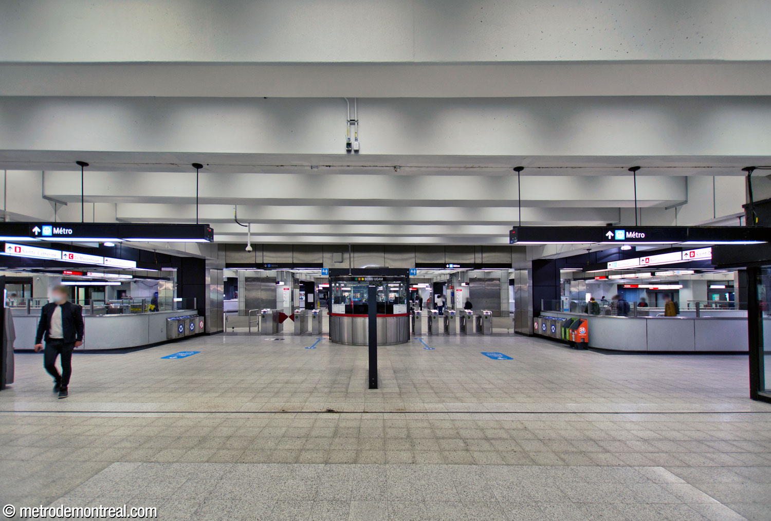
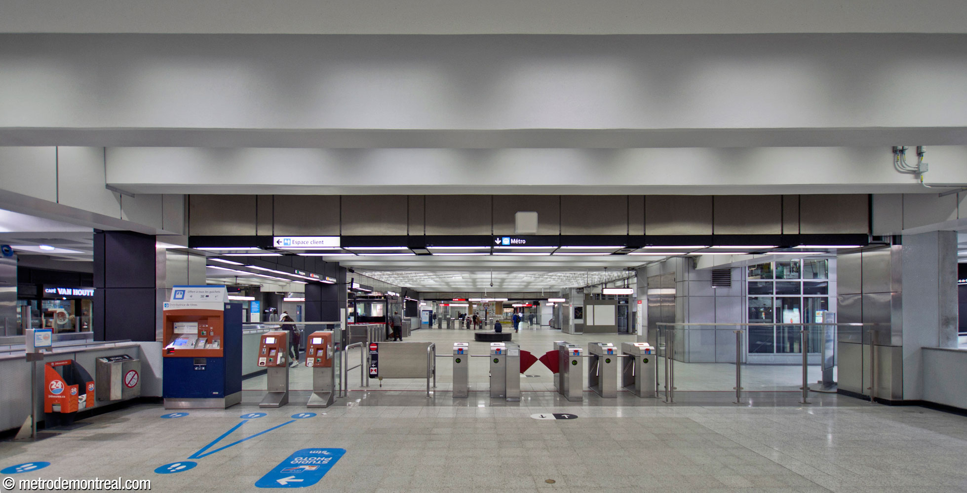
The Rue Berri entrance and the underground city accesses to the Grande Bibliothèque and UQAM’s Judith-Jasmin building open directly onto the central concourse. The completion of the Grande Bibliothèque du Québec brought natural light to the concourse for the first time via a sunken garden.
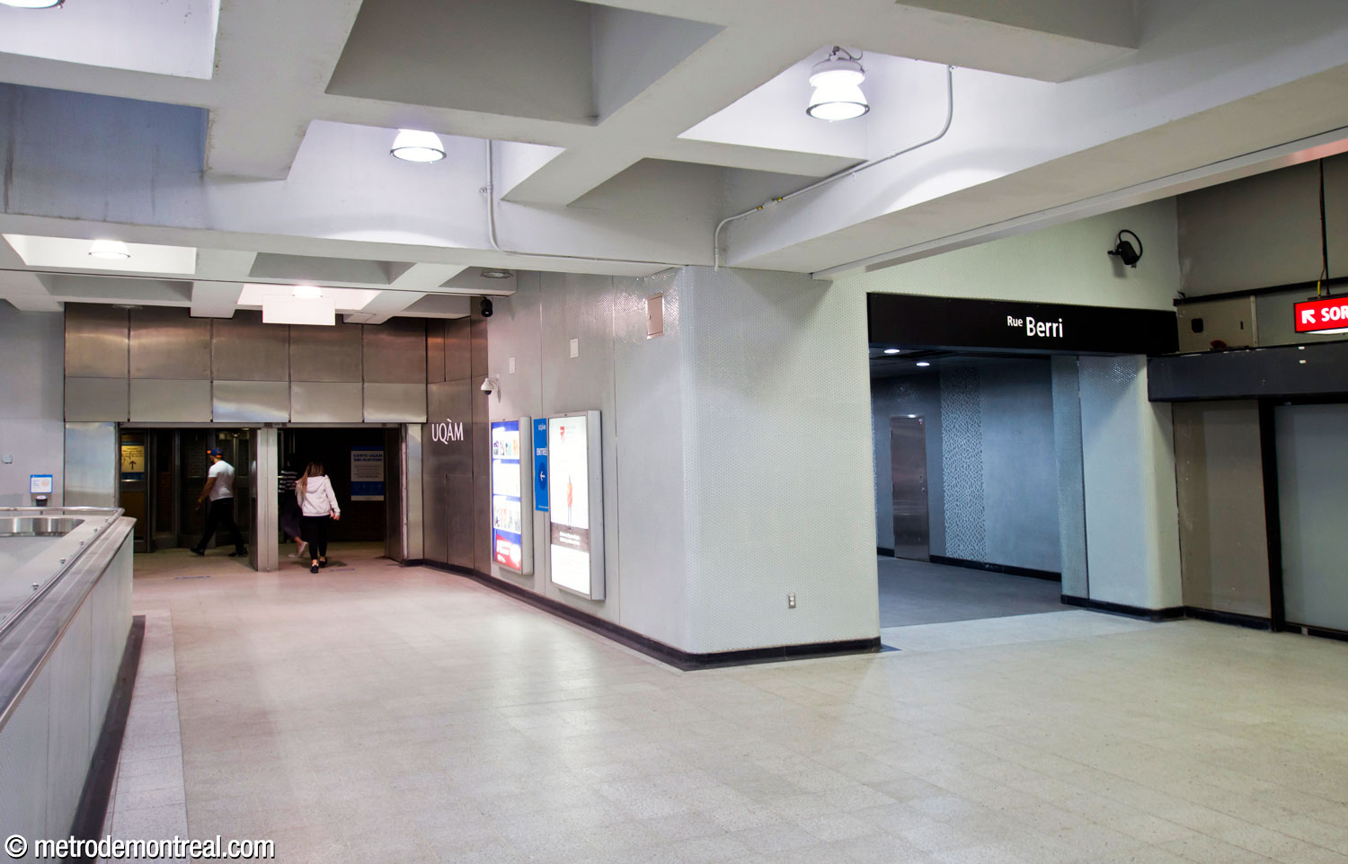
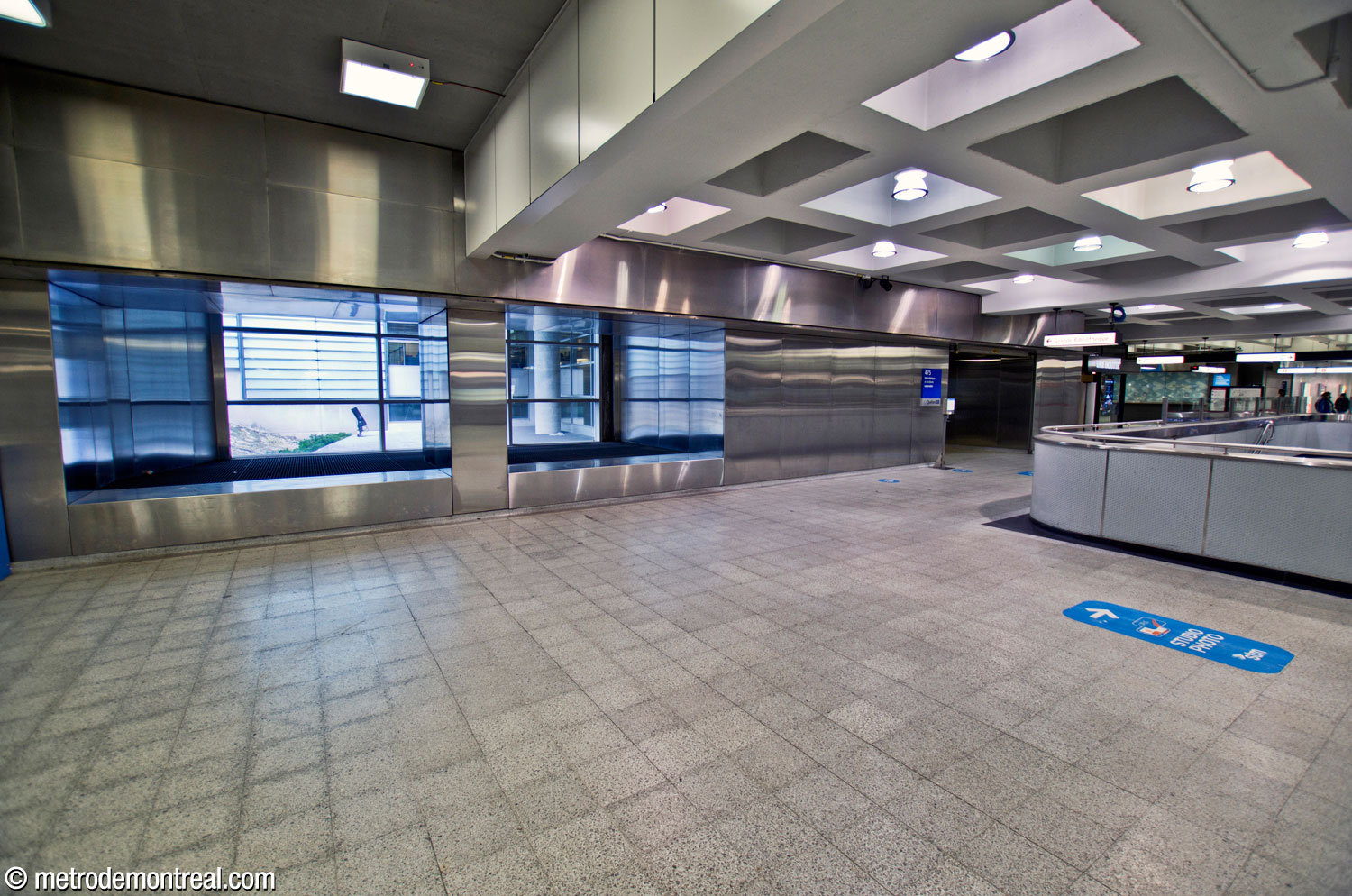
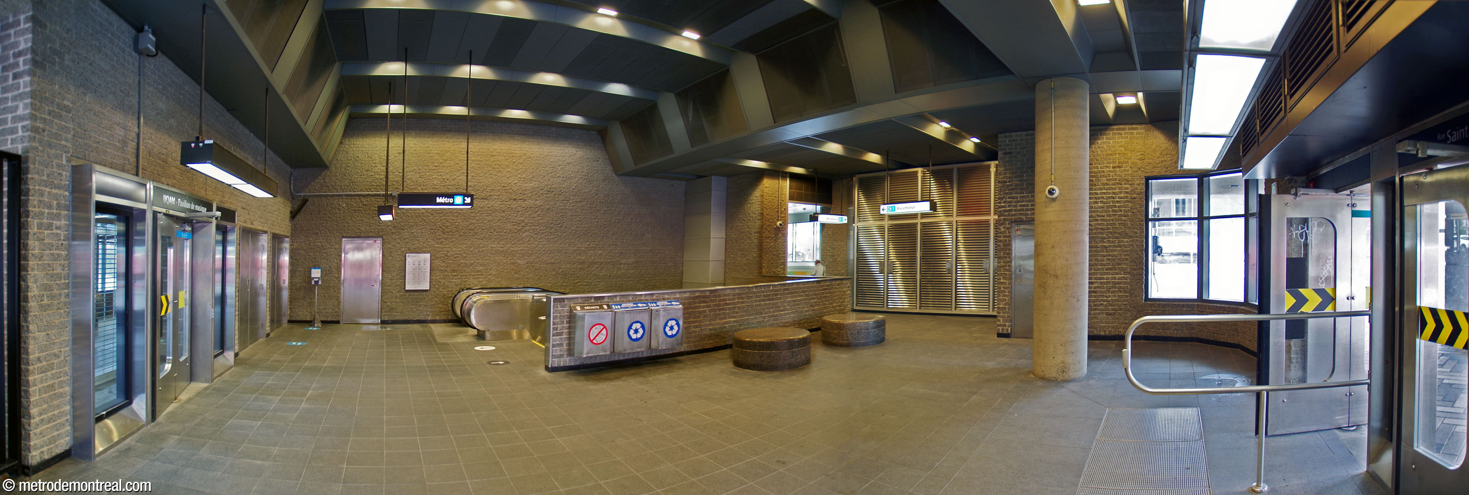
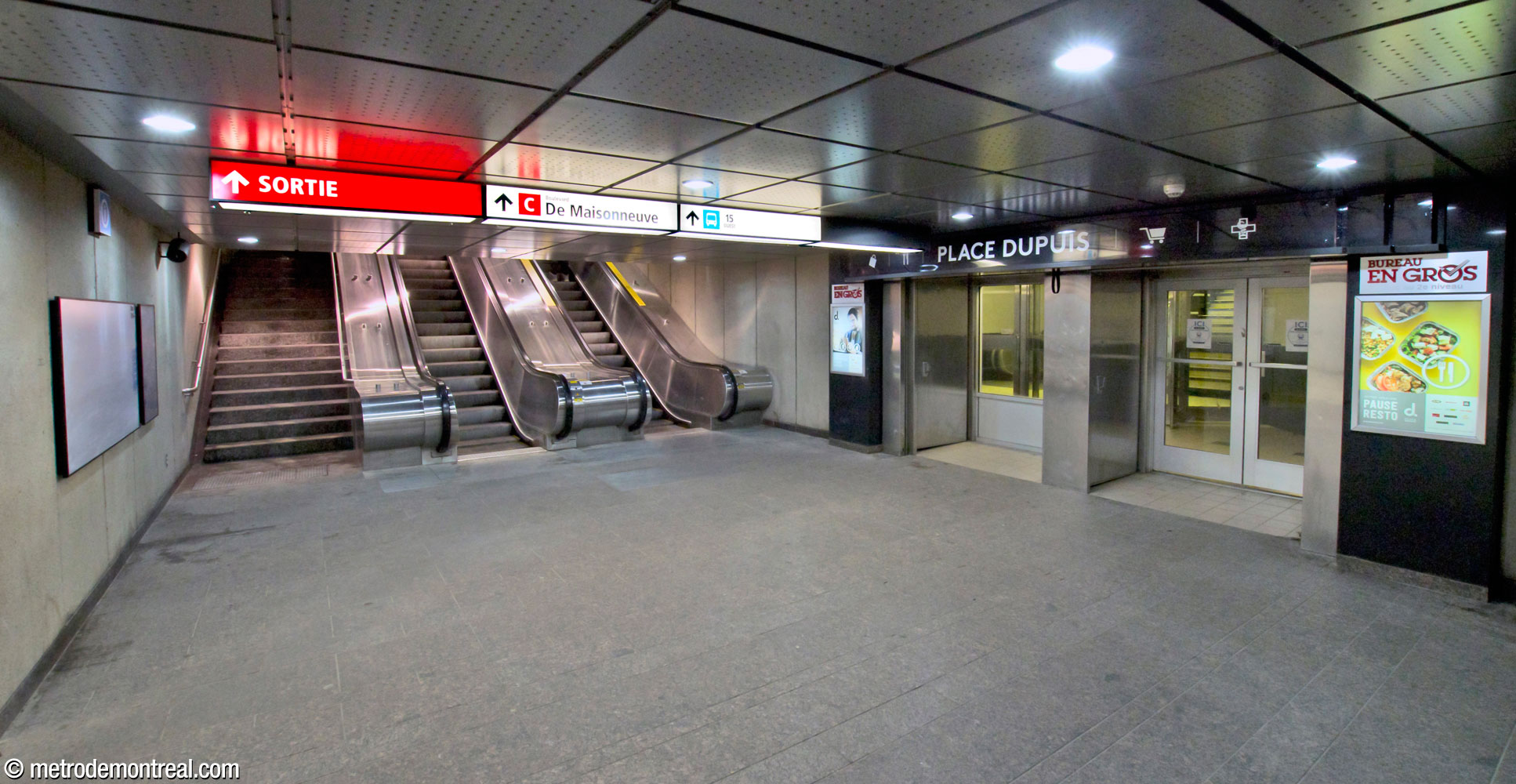
The corridors leading outward from the concourse, clockwise from the east, connect to the De Maisonneuve exit and Place Dupuis; the Sainte-Catherine exit; the Saint-Denis exit and the UQAM’s music building; and the exit in the former bus terminal. Various shops and services line the concourse and the corridors. The corridors to the De Maisonneuve and Saint-Denis exits have had STM historical displays, called Escale STM, added to them.


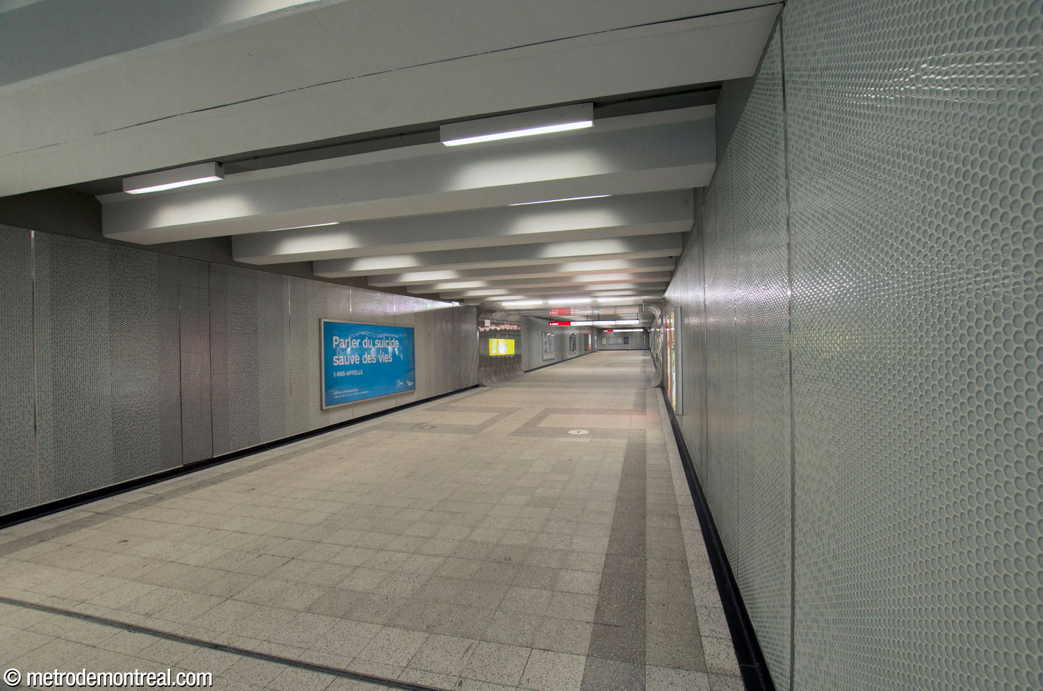
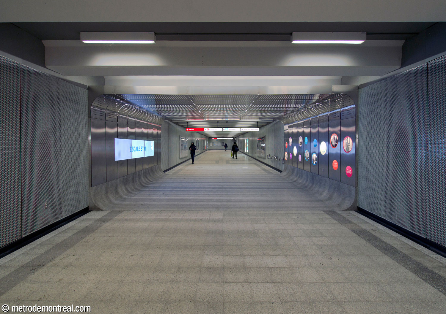
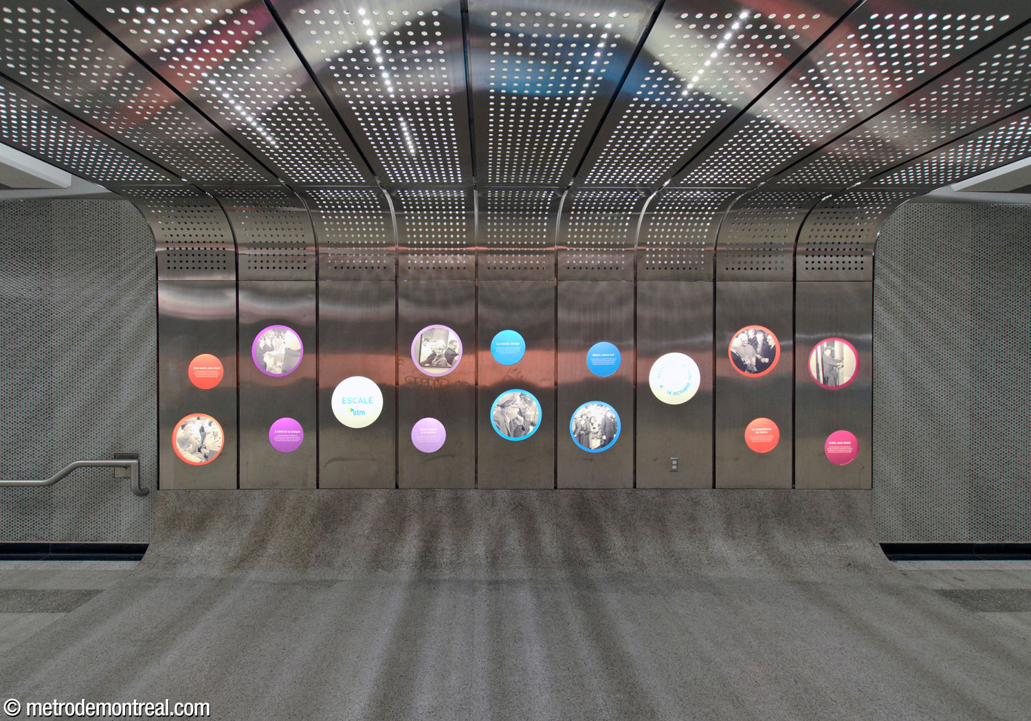
Three of these four corridors used to have openings looking down onto the orange and green line platforms, allowing dramatic vistas into the station’s main volume. Unfortunately, after a tear-gas attack in this station in 2001, these were closed to prevent harmful gases or smoke from spreading throughout the station. One of the openings was mostly closed over and replaced with a restaurant seating area; happily, the other two have been kept open but enclosed with glass, partially preserving the view while respecting safety requirements.
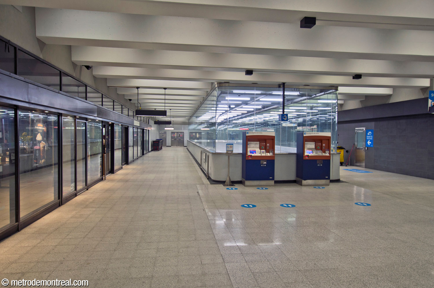
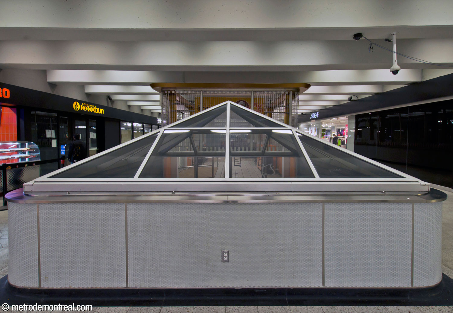

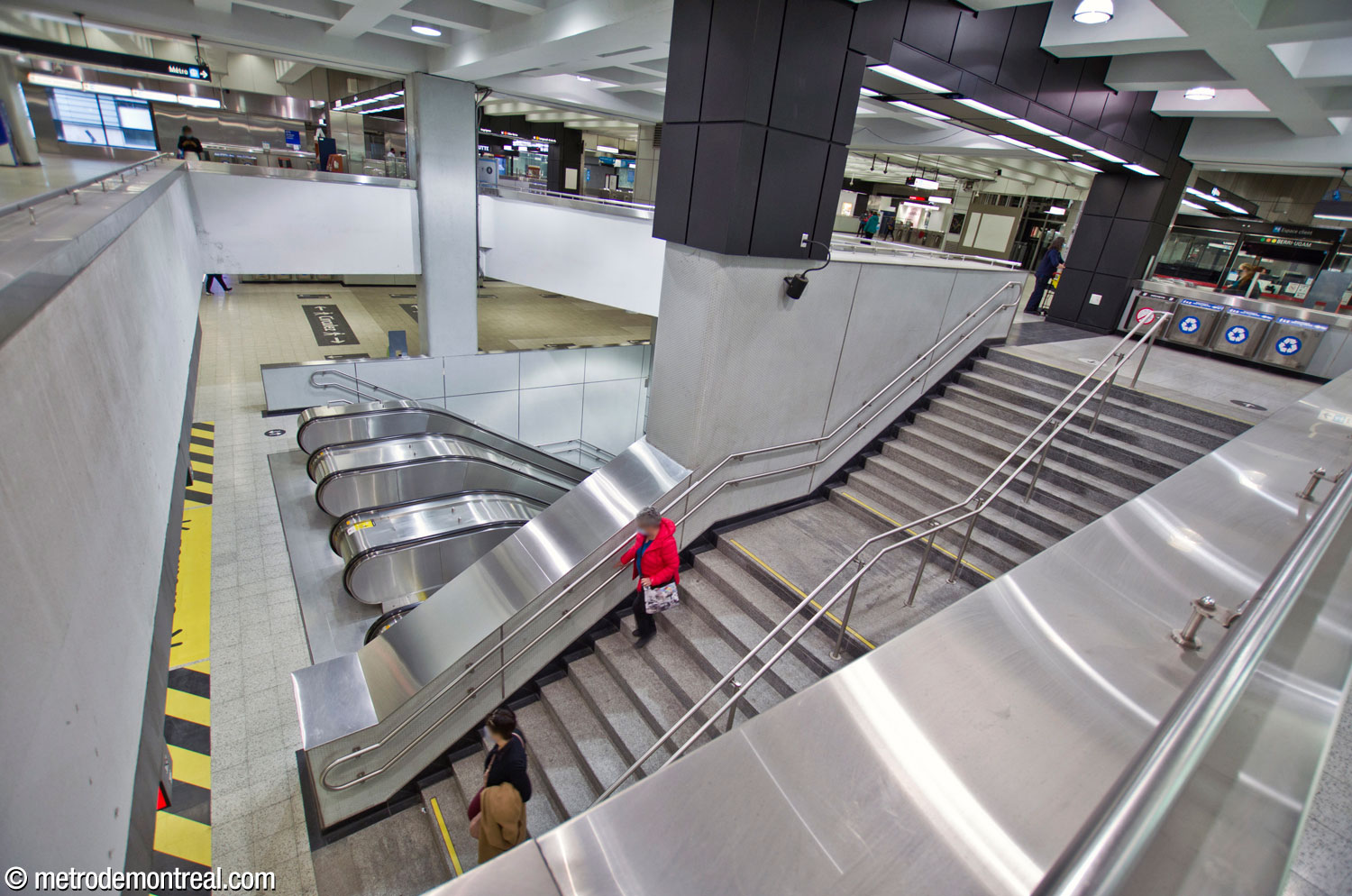
The wide central ticket hall has turnstiles on all four sides, receiving passengers entering from any of the station’s accesses, with ticket booths on the north and south sides. Stairwells at the four corners of the fare-paid zone, along with two elevators, lead to the orange line platforms and thence to the other lines.


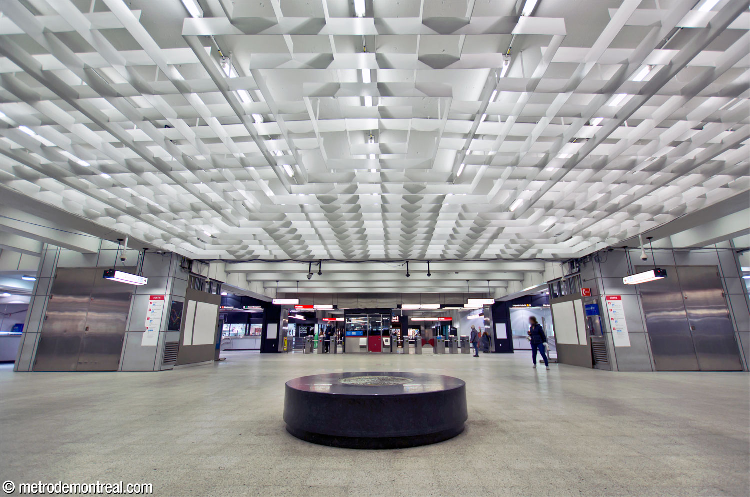
The ticket hall’s distinctive ceiling features concentric squares made up of white plates that diffuse light from enclosed fixtures. At the centre of the ticket hall is a black granite circular bench, popularly called “la puck”; set into it is a circular plaque by Robert LaPalme and Georges Lauda commemorating the inauguration of the metro. The “puck” is a popular meeting point for passengers.

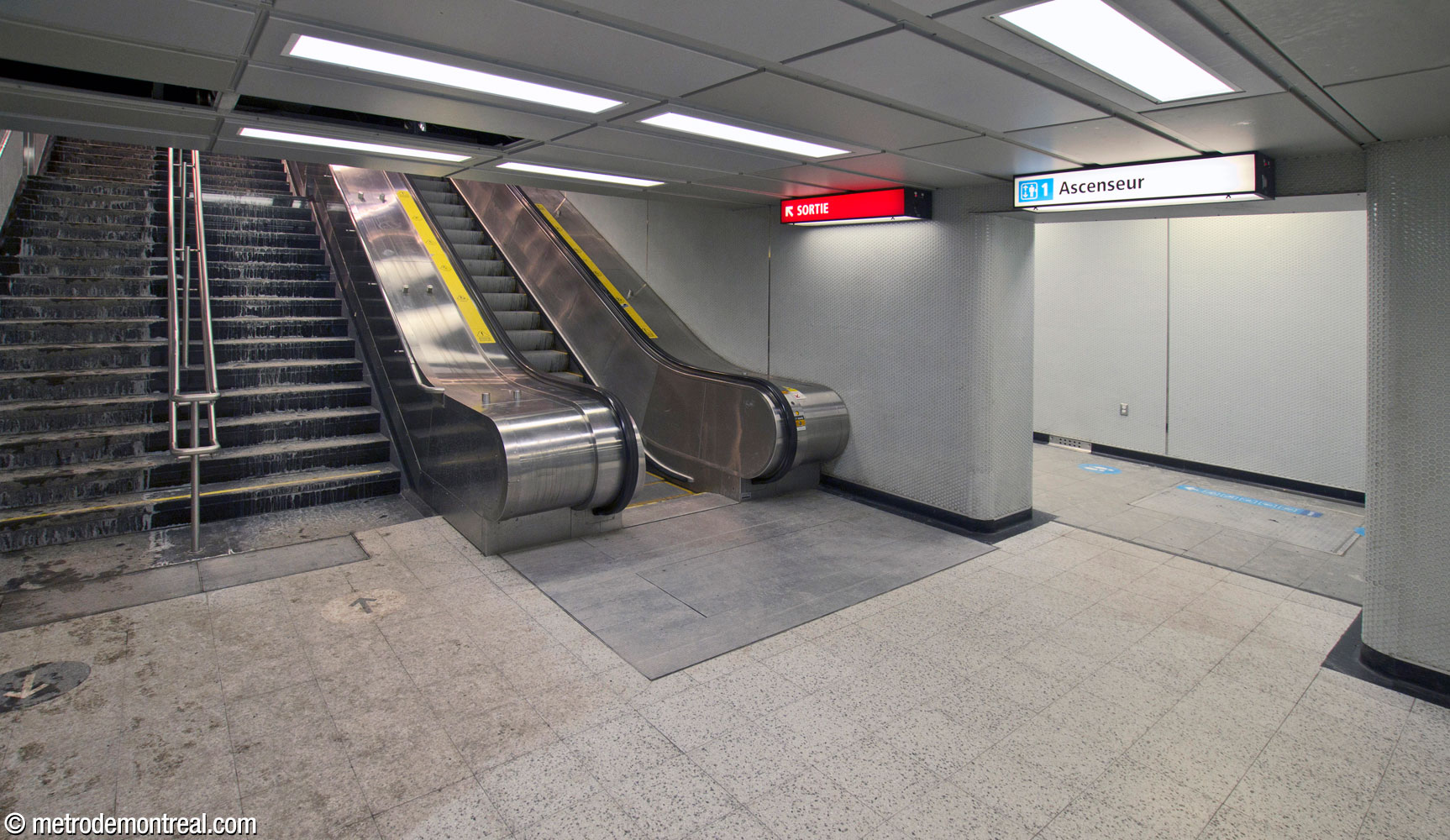
The low ceilings of the orange line trainroom, directly underneath the concourse level, are compensated for by the wide landings on either side of the tracks. These connect the platforms with the staircases, escalators, and elevators that lead up to the ticket hall and down to the other lines.
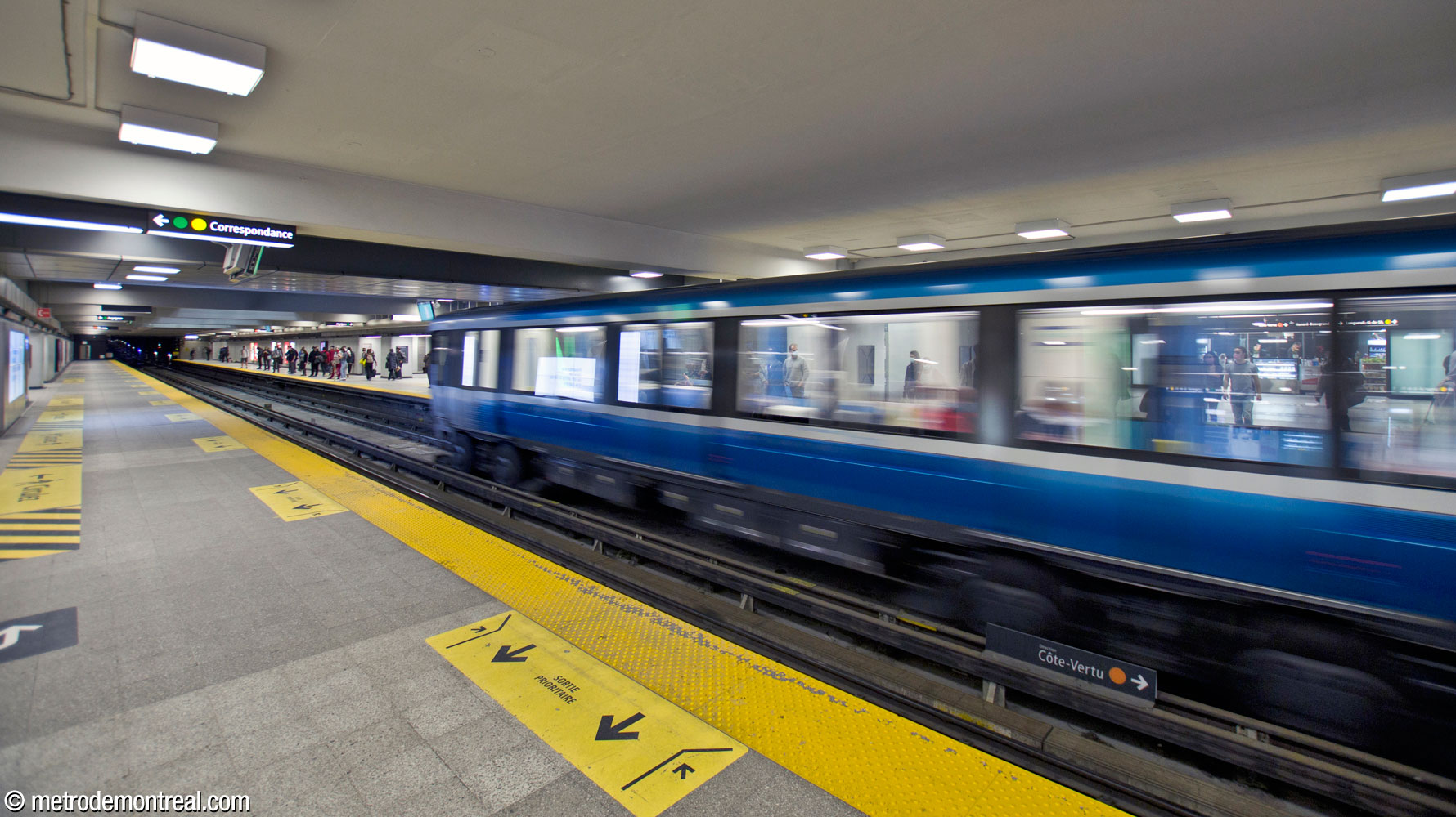
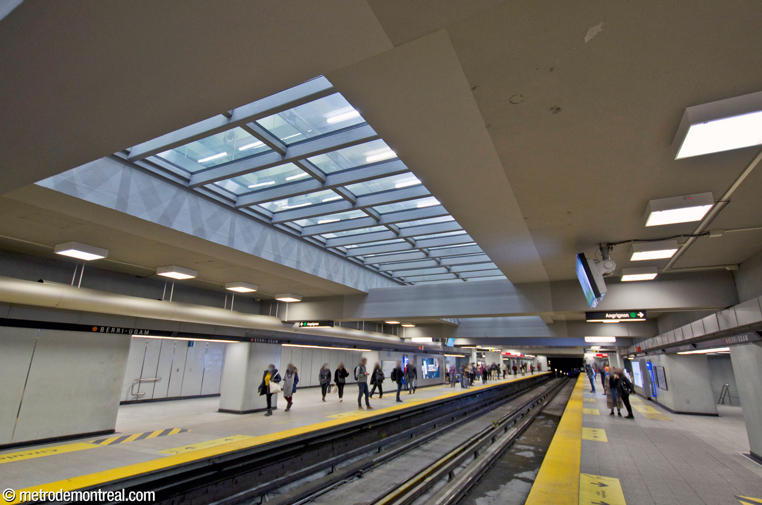
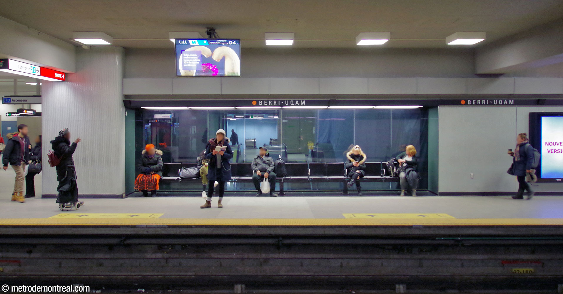

On the south side of each of these landings, impressive escalator wells, descend inward to another wide landing extending south from the Honoré-Beaugrand platform below. On the north side, other large escalator wells descend outward to the Angrignon platform, ending in broad side aisles that give access to the platform.


Smaller, outward-facing escalator wells connect both orange line platforms with the ends of the Honoré-Beaugrand platform, and a further stairwell, added after the station was opened,2 connects the Côte-Vertu and Angrignon platforms.
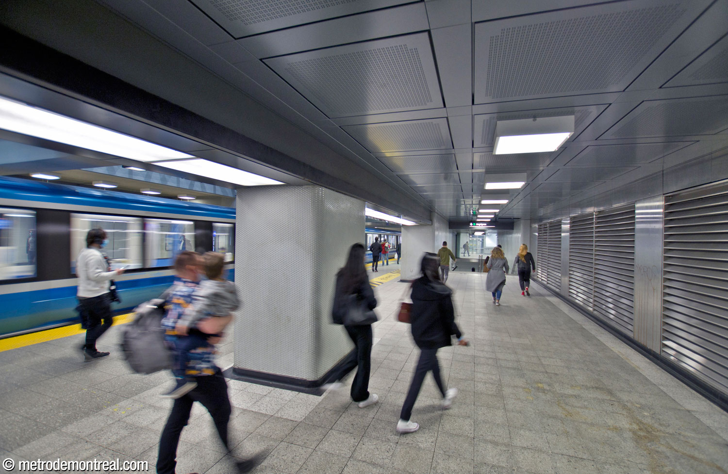


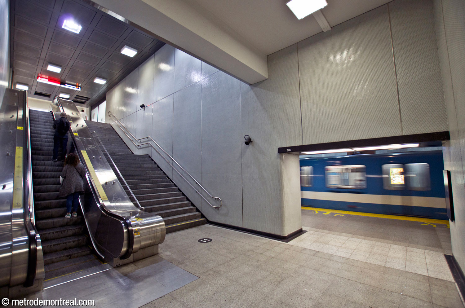

In contrast to the orange line, the full height of the east-west volume towers dramatically over the ends of the green line trainroom. The architects used expansive volumes over the green line and over the stairwells to avoid the confusing and alienating effect of a warren of tunnels often seen in major transfer stations in other cities. Broad, flat expanses of wall loom over the Honoré-Beaugrand platform, emphasizing the volume’s height. On the Angrignon side, by contrast, the side aisles mentioned above form a continuous open volume with the trainroom, separated by thick piers.
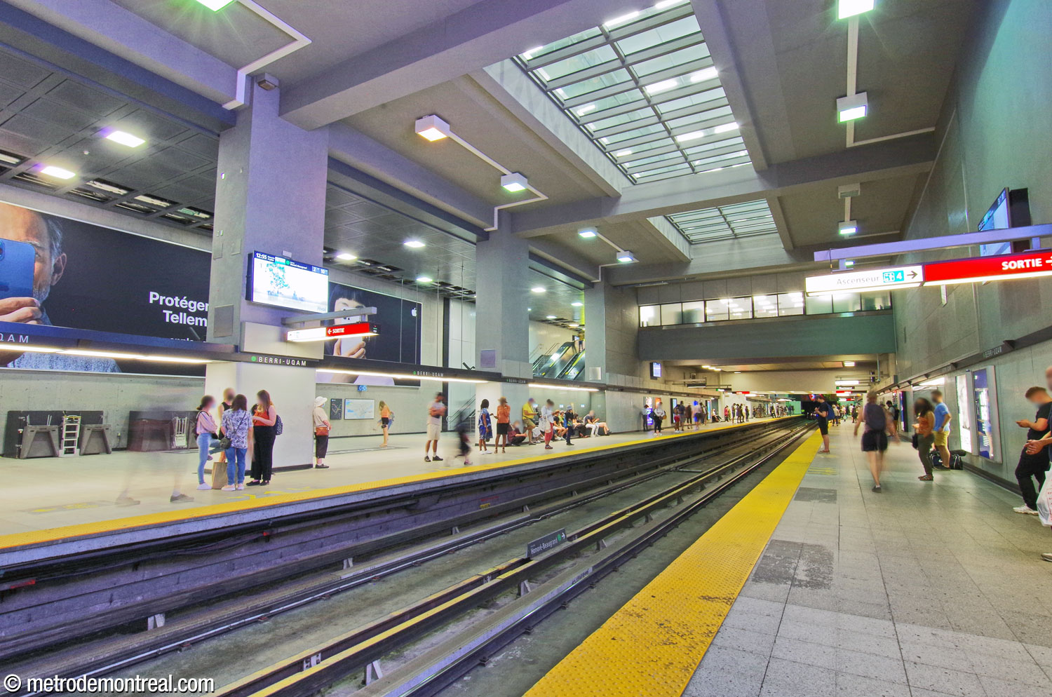


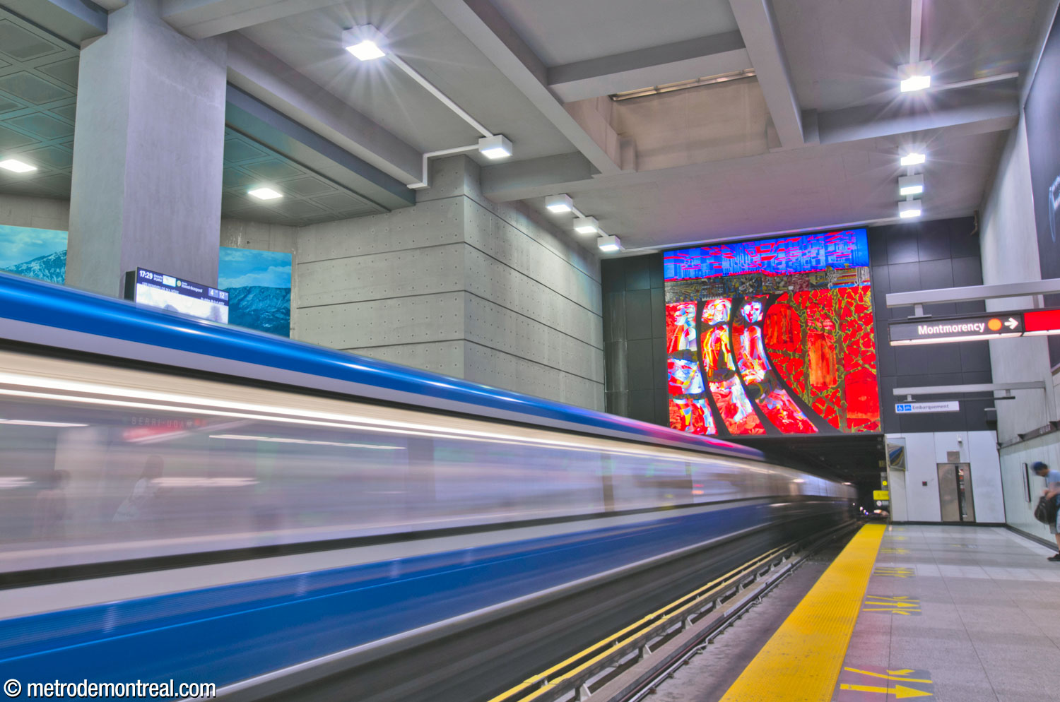
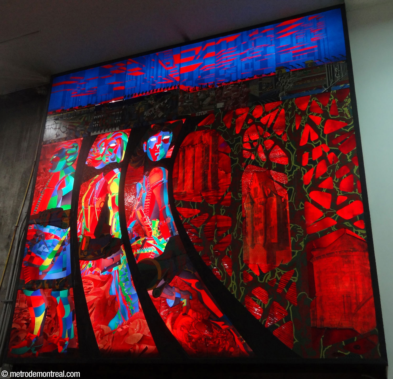
Rising above the eastern end of the green line trainroom, above the tracks, is the station’s main artwork, a huge stained-glass mural by Pierre Gaboriau and Pierre Osterrath. Entitled Hommage aux fondateurs de la ville de Montréal, it represents three people who were instrumental in the foundation of Montreal: Jérôme le Royer de la Dauversière, who bought the island for the colony; Jeanne Mance, the founder of the Hôtel-Dieu; and Paul Chomedey, sieur de Maisonneuve, the colony’s first commander. Representing its subjects in striking shades of blue, red, and green, the work, despite its figurative subject, owes a great deal to the abstraction of the Automatiste movement.
At the western end of the two green line platforms, escalator wells lead down to the yellow line. These are aligned with the escalators coming down from the orange line, making for efficient passenger flow.
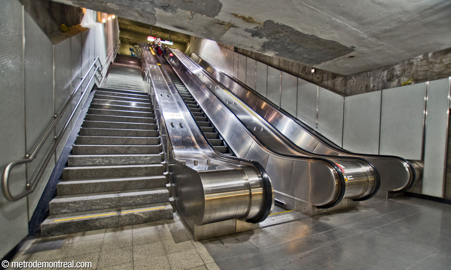
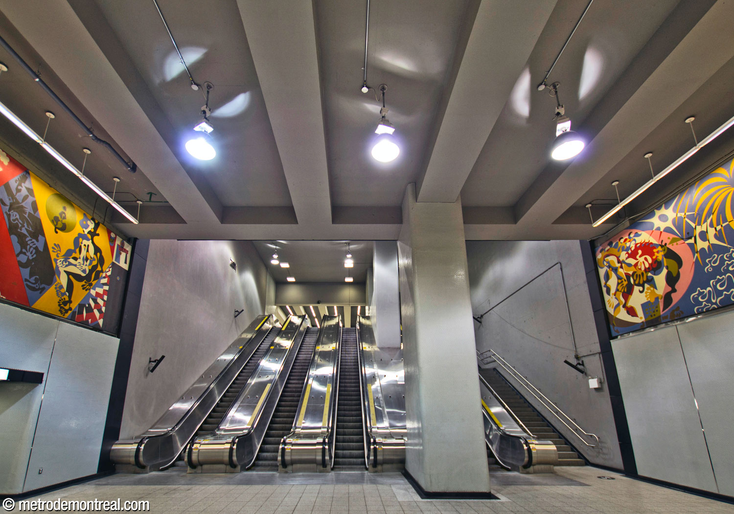
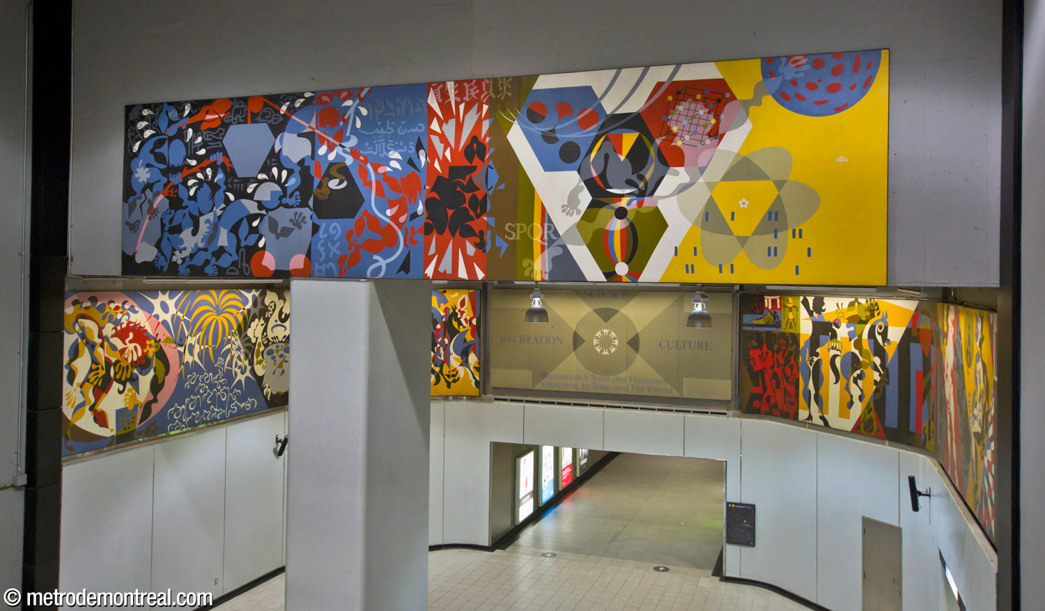
Another connection to the yellow line descends from the central landing on the Honoré-Beaugrand platform, via another large, imposing escalator well. This connection, through which visitors passed to get to the Expo 67 fairgrounds on Île Sainte-Hélène, is decorated with a set of murals created for Expo’s Place d’Accueil by Robert LaPalme. Moved here afterward by special request of Mayor Jean Drapeau, they symbolically depict science, culture, and recreation, the major themes of Expo.

This main escalator well reaches the yellow line via a long, somewhat tedious curved corridor, leading to a landing also joined by the two staircases from the end of the green line platforms. This landing is brightened with a decorative mural called Le mur de la paix, created by the STM’s graphic design department. In colours matching the tiling on the yellow line platforms, it features the word “peace” written in many different languages.
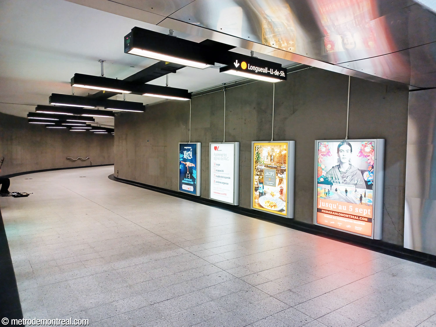
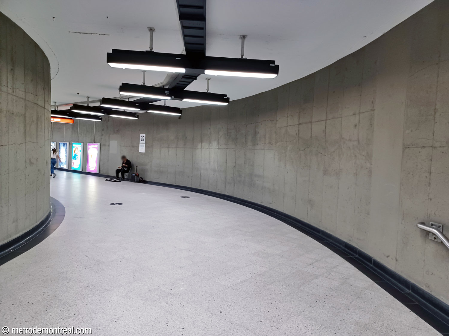
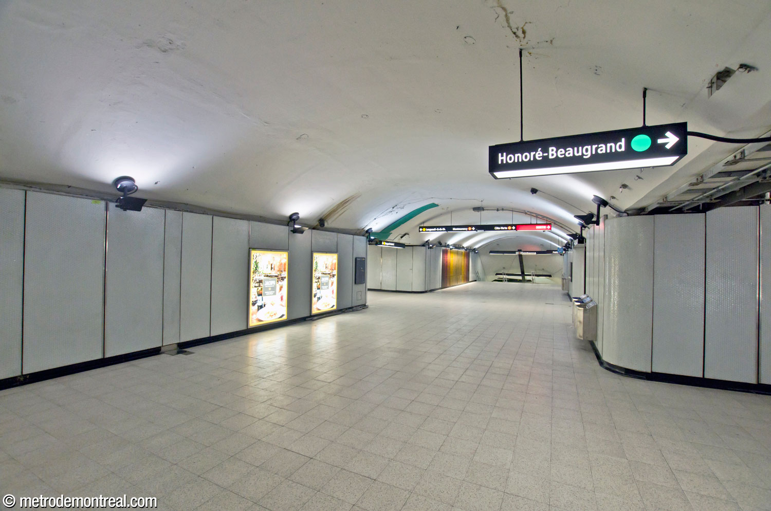


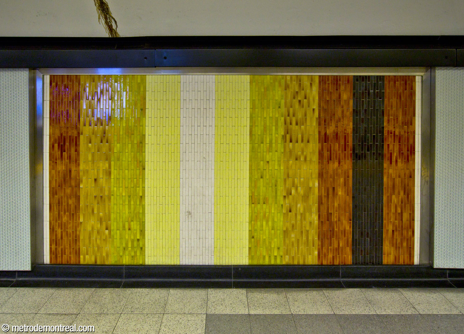
Unusually, the crossover to the departure platform lacks an open transept. The yellow line terminus is brightened with white, yellow, orange, brown, and black tiled motifs by Claude Vermette, recently acknowledged as artworks by the STM.

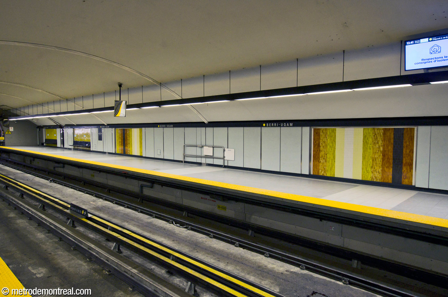
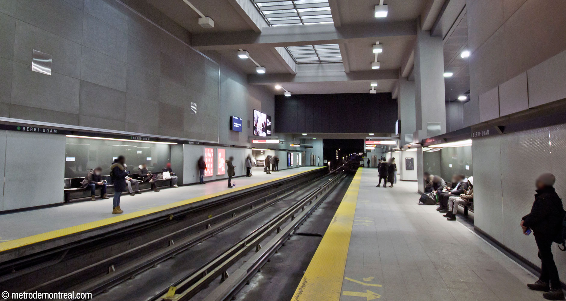
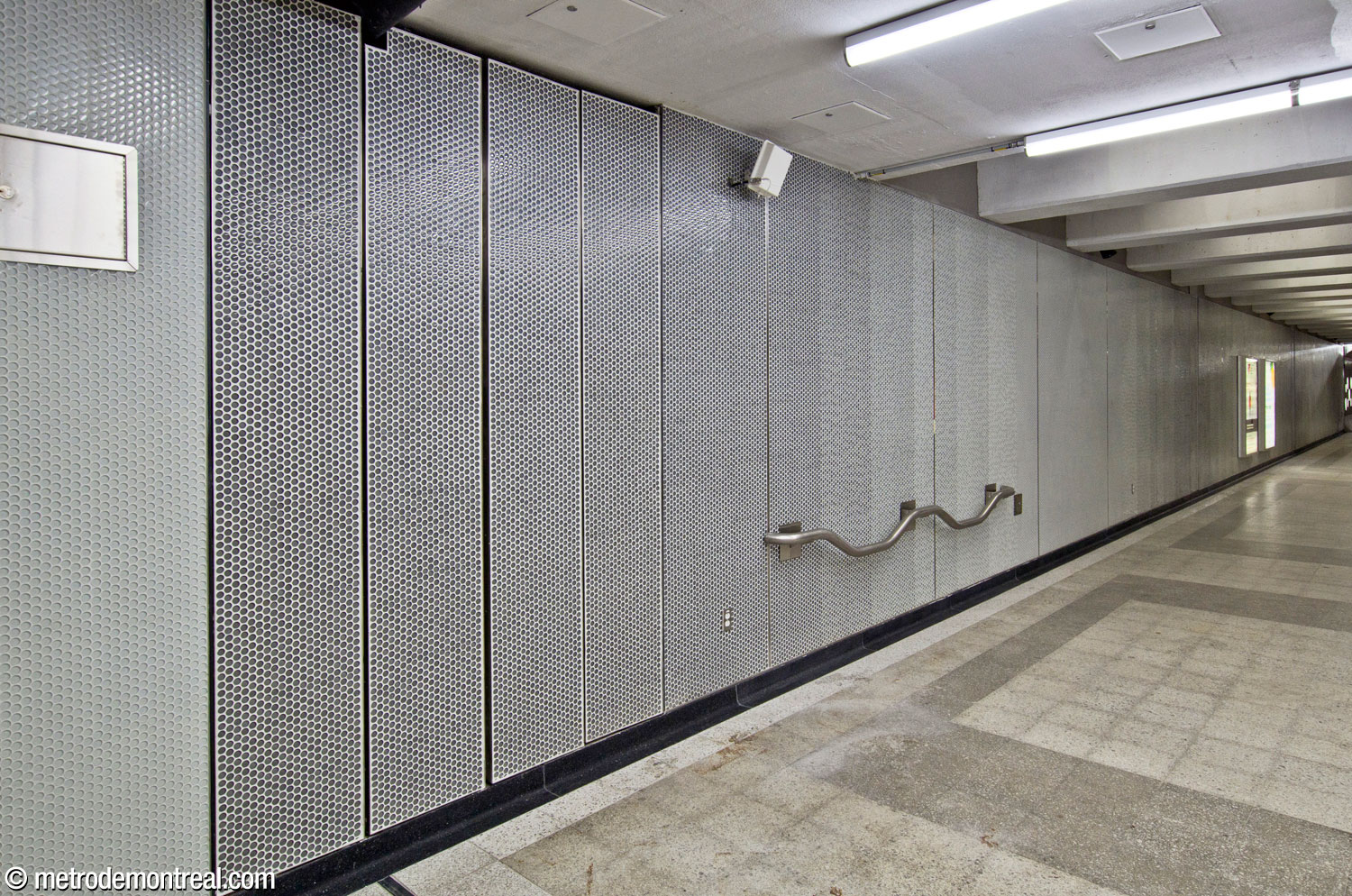
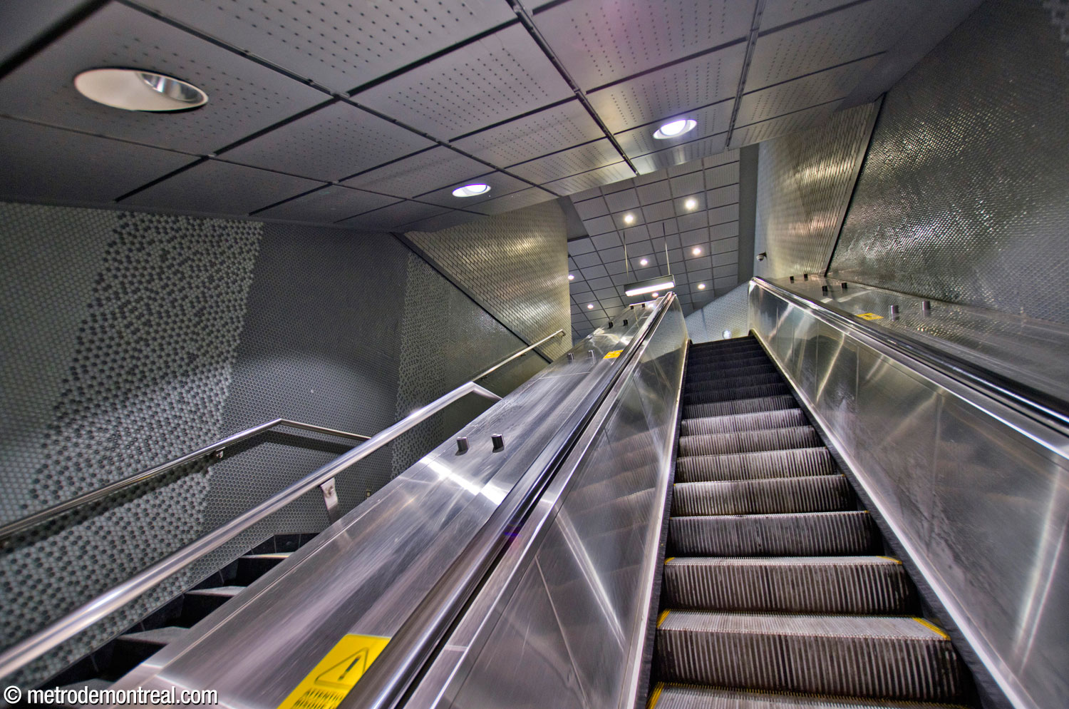
The vast majority of the station is clad in neutral tones that emphasize the spaces and surfaces. Over more than ten years between 2010 and 2021, the station underwent a massive and intricate renovation project, one of whose most visible signs was the replacement of the wall finishings throughout the station. Large expanses of grey circular tiles were replaced with circular glass tiles, with grey gradients added in certain areas. The upper portions of the walls along the main green line volume are in smooth concrete, with a huge concrete mass added to the northeastern corner, somewhat narrowing that end of the Angrignon platform.
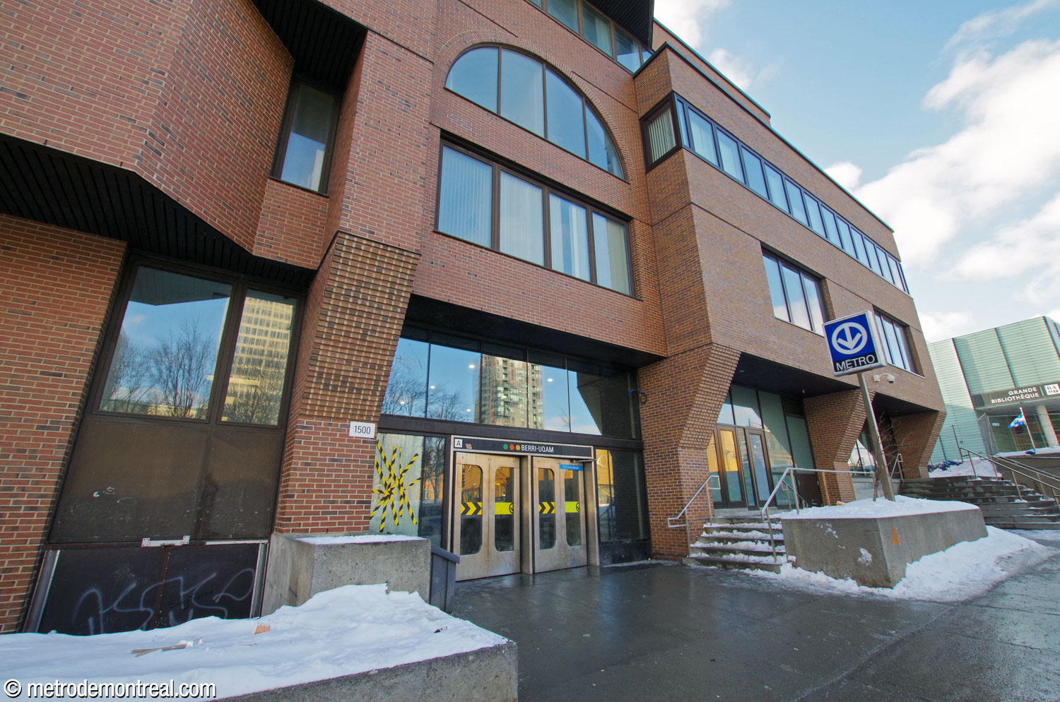
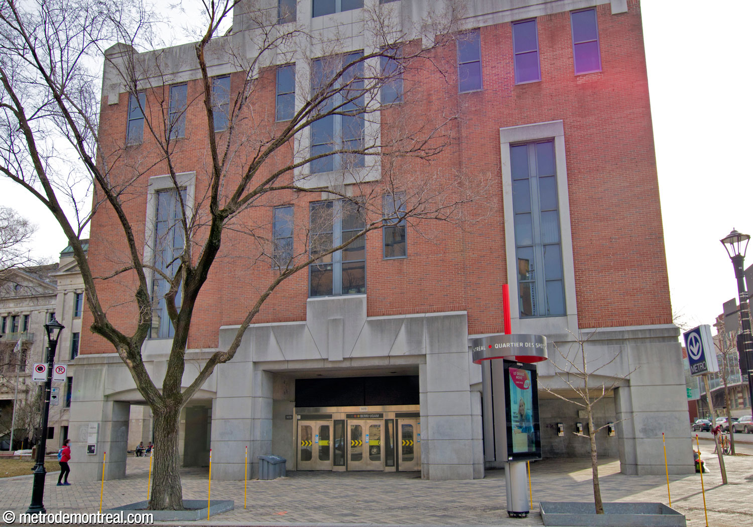
On the street level, all but one of the entrances are integrated into the ground floor of other buildings – two UQAM buildings, the former bus terminal (a shabby prospect), and the Place Dupuis complex.
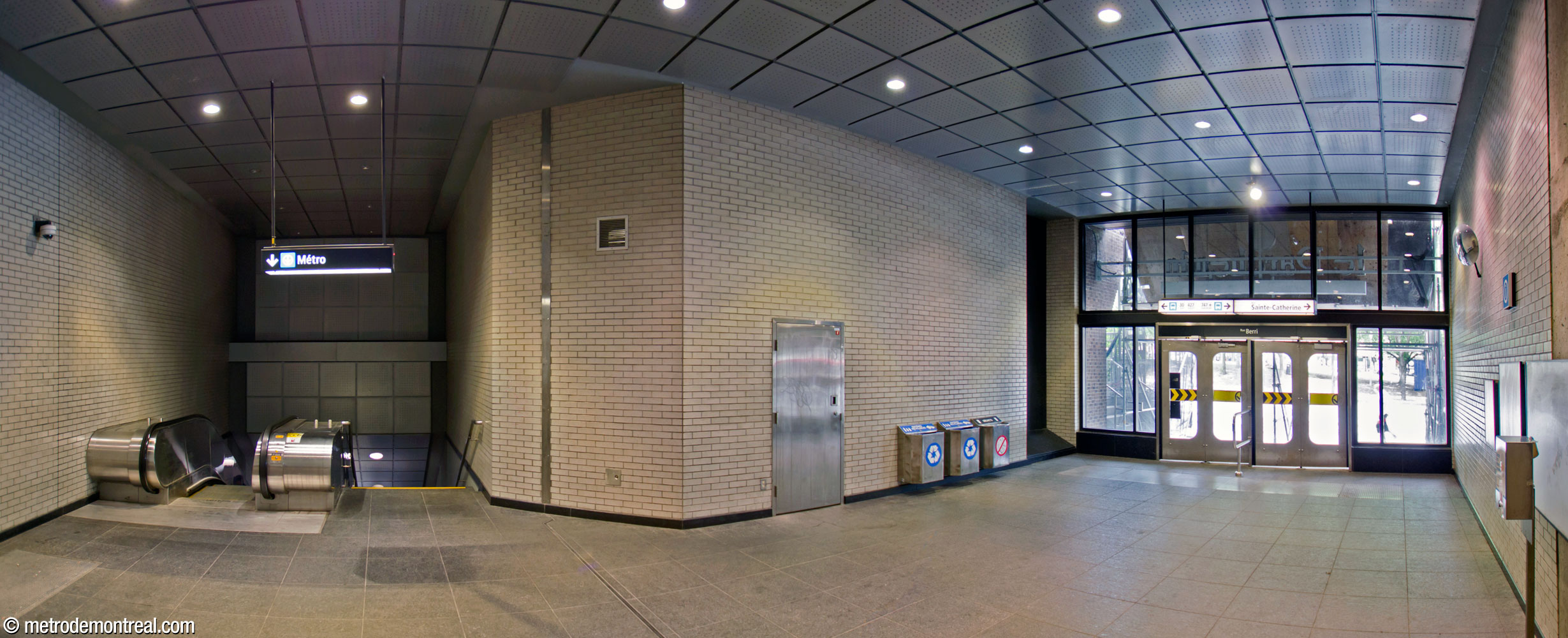



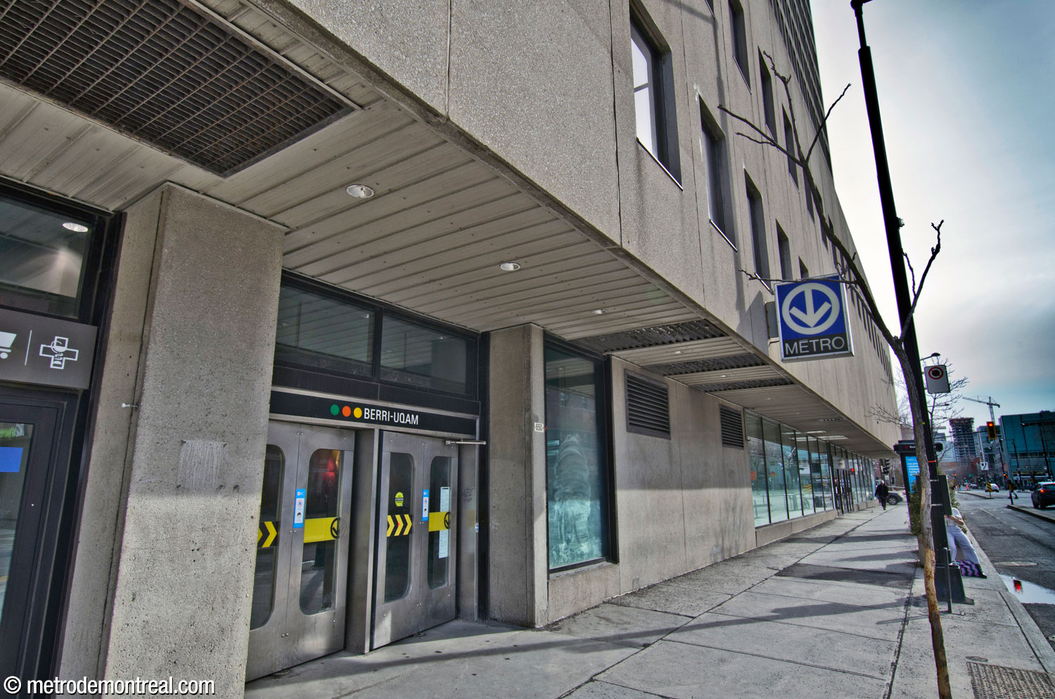
The one freestanding headhouse, located at Berri and Sainte-Catherine in Place Émilie-Gamelin, was rebuilt in 1999 in the same postmodern style as the new entrances built at the same time at Beaudry, Papineau, and Frontenac, the next three stations down the line. It is surprisingly tall for a metro entrance, with a second story containing technical installations, and is done in glass, concrete, and steel.


This entrance houses a statue by Raoul Hunter of Mother Émilie Gamelin, the namesake of the square in which the entrance stands. The square is in fact the former site of the mother house of the Sœurs de la Providence, which she founded; it served among other things as a well-known soup kitchen serving the city’s destitute, and was demolished in 1964 to make way for the station. The statue was commissioned to mark the 200th anniversary of Mother Gamelin’s birth. It is one of only two figurative statues in the metro, the other being the statue of Jacques Cartier at Place-Saint-Henri, and the only one made specifically for the metro. Mother Gamelin is shown in the act of distributing bread; passers-by are so often drawn to shake the statue’s outstretched hand that it has developed a smooth polish.

Accessibility
This station is equipped with elevators for wheelchair accessibility, except for the yellow line.
Two elevators connect the ticket hall to the orange line platforms. From there, each orange line platform has an elevator connecting it to only one of the green line platforms. As a result, users needing to get to the other one need to go up to the ticket hall and back down again. The Angrignon platform is connected to the Montmorency platform; the Honoré-Beaugrand platform is connected to the Côte-Vertu platform.
The last of these elevators also connects to the level of the hallway leading toward the yellow line; however, the yellow line platforms themselves are not yet accessible. Work to install elevators to the yellow line is scheduled to be completed in 2025. (STM project page)
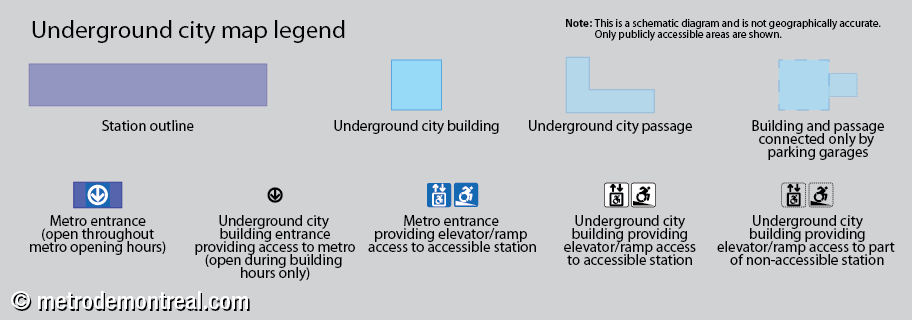
An elevator in the Saint-Denis exit connects the ticket hall level with the street. Outside the station, elevators in the Grande Bibliothèque and UQAM’s Pavillon Judith-Jasmin (as well as other UQAM buildings) also allow access to the station through their underground city links.
Along with Lionel-Groulx, this was among the first two stations after the Laval extension to have elevators added. The elevators between the ticket hall and the orange line platforms were opened on September 14, 2009. Passengers had to use the elevators in the Grande Bibliothèque and the Pavillon Judith-Jasmin to reach the ticket hall from the street until the elevator in the Saint-Denis entrance was opened on April 16, 2010. The elevators to the green line followed on November 6, 2020.
History & Trivia

Ridership
9,085,131 entrances in 2025
Busiest station in the networkNote: Includes only entrances, not transfers

Platform Depth
Orange line platforms: 10.7 m deep Green line platforms: 16.8 m deep Yellow line platforms: 27.4 m deep
2nd deepest station

Interstation Distances
To Saint-Laurent: 336.80 metres
To Beaudry: 378.76 metres
To Champ-de-Mars: 720.50 metres
To Sherbrooke: 579.10 metres
To Jean-Drapeau: 2362.10 metres
Longest interstation distance in the network
Origin of the Name
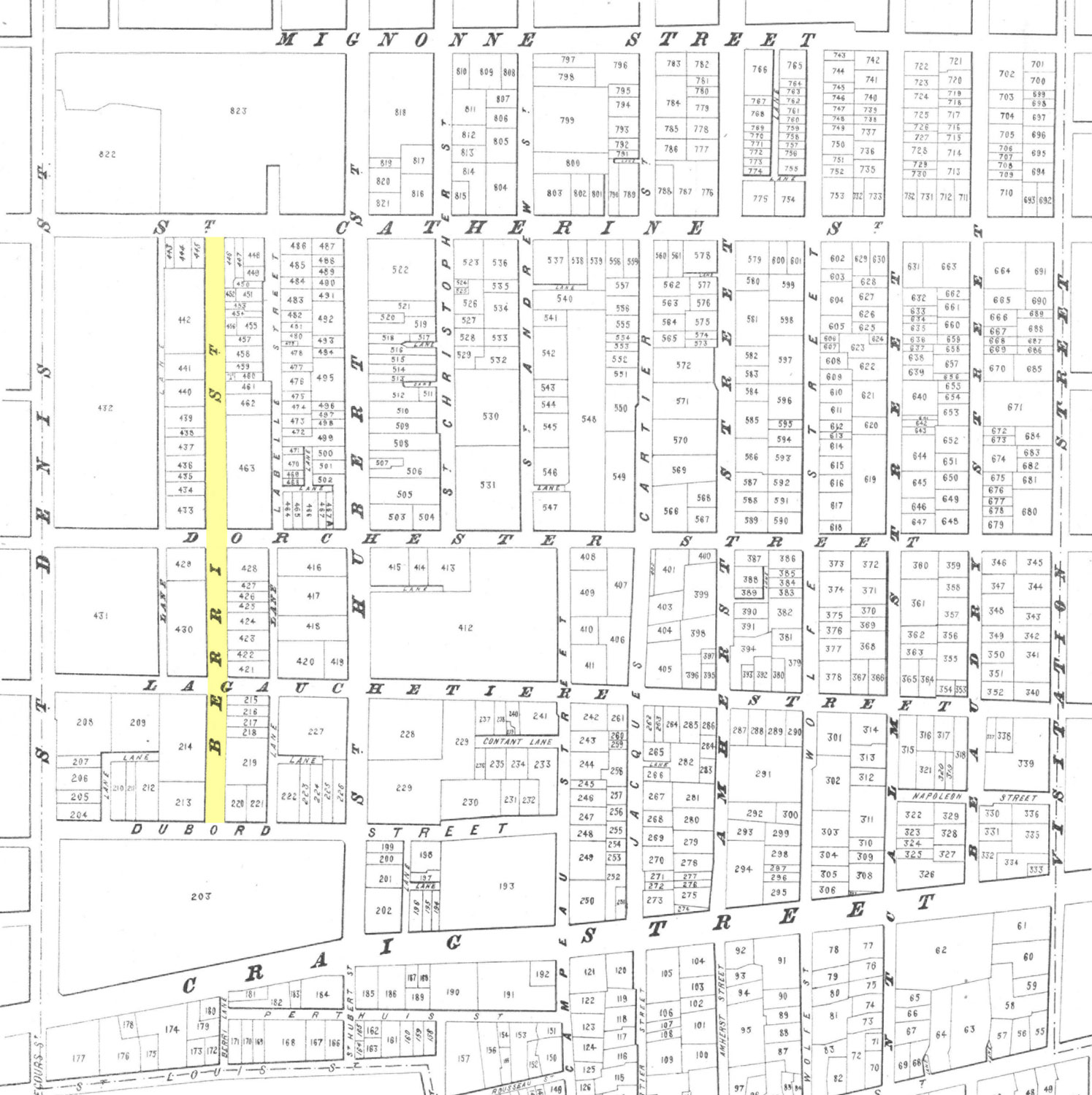
Rue Berri. After a long period of uncertainty, the Commission de toponymie du Québec now believes that the name of this street, long ago spelt Berry, refers to the colonist Simon Després dit Berry de Blois (1621-1663).3 Le Terrier du Saint-Laurent, written in 1663, notes that the section of this road between what are now Rue Saint-Antoine and Rue Sherbrooke was the western boundary of a property acquired on 25 April 1659 by Després. This land was still referred to as “La Berry” in the early 19th century. Rue Berri was officially so named in 1876.4, 5
Université du Québec à Montréal (UQAM). The university was created by the Government of Quebec out of the merger of the École de beaux-arts de Montréal, the Collège Sainte-Marie, and several other schools, and opened in 1969. The campus in this neighbourhood was opened in 1979. It is part of the Université du Québec, a state-run network of universities spread across the province.
Unofficial graphic variant: Berri-UQÀM. (UQAM uses the grave accent over the A in its logo for graphic design reasons, to balance the tail of the Q in its logo. This is not strictly in accordance with the usual rules of French orthography, as abbreviations written in all caps do not usually take accents, so the STM continues to write the name with no accent.)
Names during planning phase: Sainte-Catherine; Palais du Commerce;6 Saint-Denis (yellow line);6 Berri-De Maisonneuve (see below).
Formerly called: Berri-de Montigny (until January 1, 1988). Rue De Montigny was named in honour of the Testard de Montigny family, including Jacques, who came from Rouen to Montreal in 1659; his son Jacques (1663-1737), Sieur de Montigny; his son, Jean-Baptiste (1724-1786), who like his father was a troop captain; and Benjamin-Antoine (1838-1899) and his son Louvigny (1876-1955), both authors.
The construction of the green line of the metro under several separate streets north of Rue Sainte-Catherine, including Western, Saint-Luc, Burnside, and De Montigny streets, led to these being combined into a single roadway, which received the name Boulevard De Maisonneuve. In fact, by the time Berri-de Montigny station opened, Rue De Montigny was already gone! (A small portion remains near Place des Arts.) The executive committee of the City of Montreal announced that the name would be changed to Berri-De Maisonneuve once Expo 67 was over (to avoid confusing visitors), but for unknown reasons this never took place.7
After the name Université-de-Montréal was announced for a station on the blue line, and with McGill already on the green line, UQAM and Concordia University pressed to also have their names reflected in the stations serving their campuses.8 As a result, Berri-de Montigny and Guy stations were renamed Berri-UQAM and Guy-Concordia at the same time, just four days before Université-de-Montréal station was opened.9
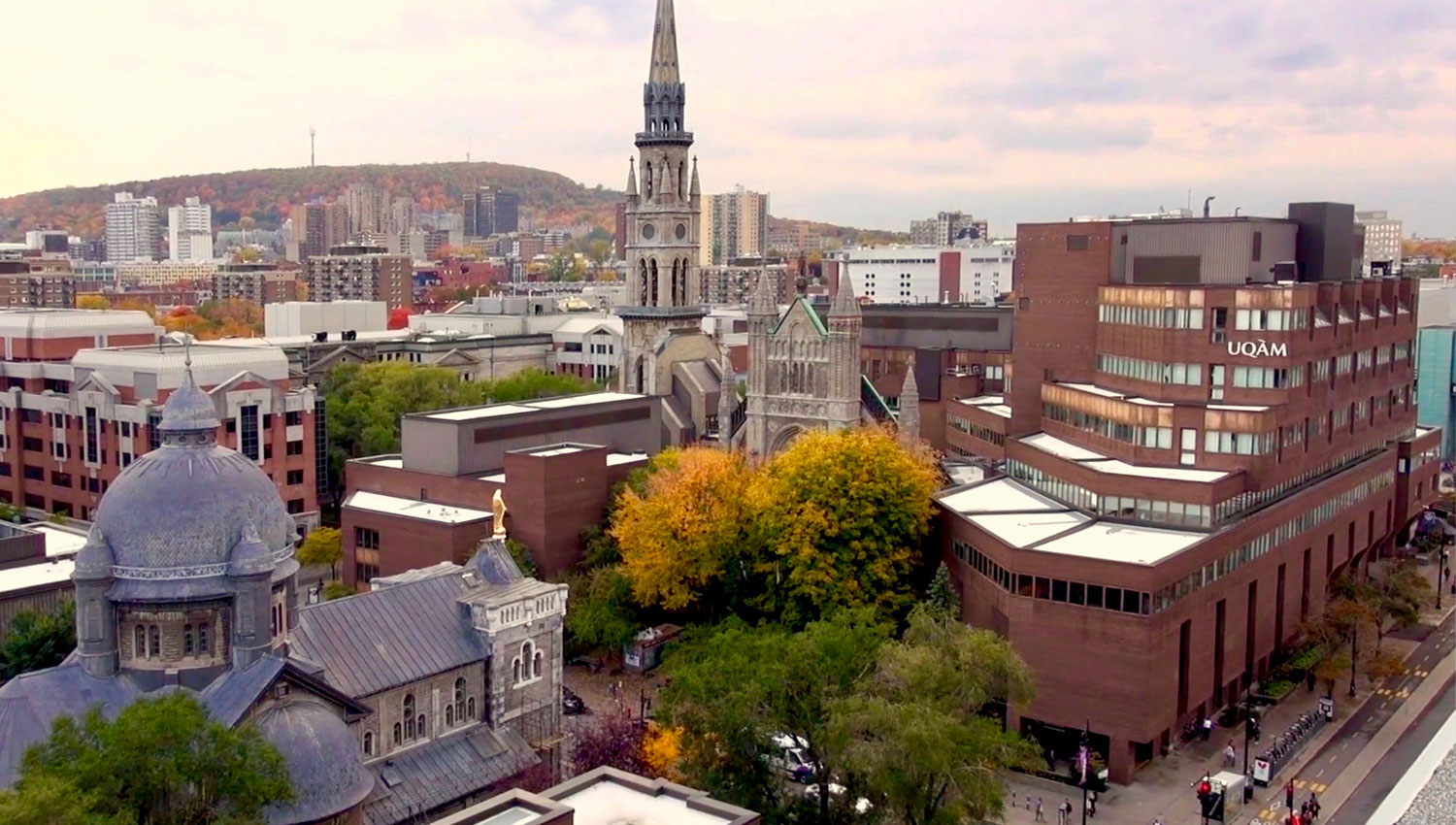


Trivia
- Since the yellow line was only added to the plan of the metro after construction had started, the plans for this station had to be modified to incorporate the yellow line terminus. Initially, the name Saint-Denis was considered for the yellow line station, similar to certain other cities in which different parts of transfer stations have different names.14

Architectural sketch of the western part of the green line platforms
(Source15)
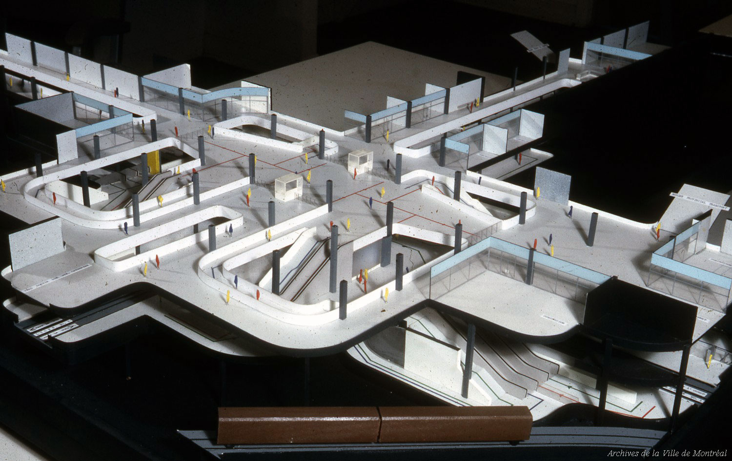
Architectural maquette of the station
(Source16)
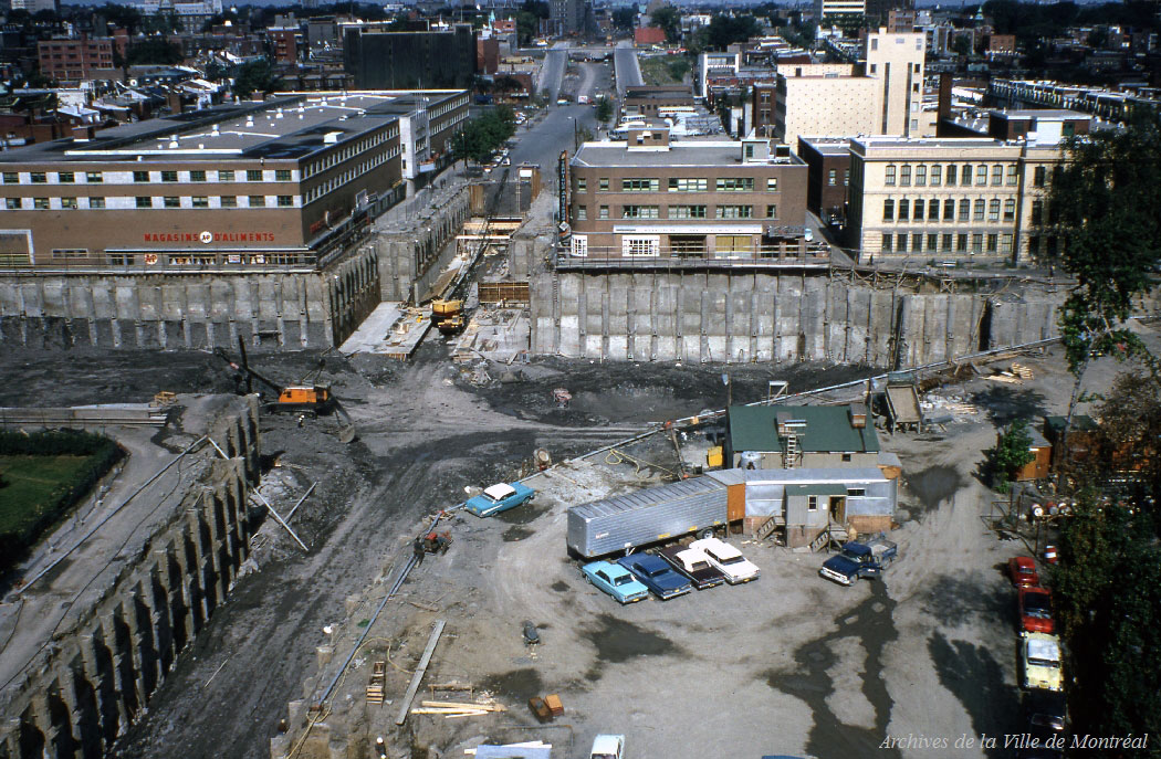
The station under construction, corner of Rue Berri and Rue De Montigny (now Boulevard De Maisonneuve)
(Source17)
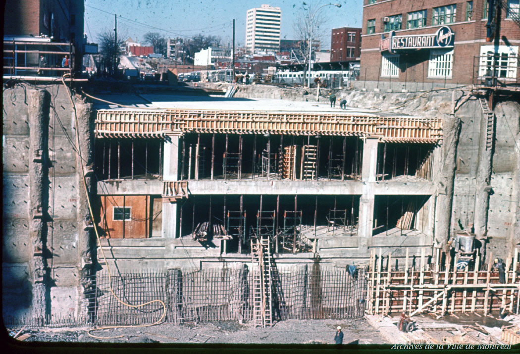
The station under construction, corner of Rue Berri and Rue De Montigny, showing the ticket hall level and orange line platforms
(Source18)

The yellow line platform under construction in January 1967, after the rest of the station was inaugurated
(Source19)
- This station hosted the imposing ceremonies for the opening of the initial network of the metro on October 14, 1966, in the presence of Montreal mayor Jean Drapeau; chief engineer Lucien L’Allier; Quebec Premier Daniel Johnson Sr.; Archbishop of Montreal Paul-Émile Léger; French Minister of State Louis Joxe; and Canadian Minister of Foreign Affairs Paul Martin Sr., among many other dignitaries.
- Each of the 19 other stations opened on that day held their own ceremony as the main one was beginning, with the guests then embarking on trains for Berri-de Montigny. After the first part of the main ceremony, Mayor Drapeau invited Minister Joxe to give the signal to begin metro service, and the trains at the other stations departed for Berri. But the organizers had failed to account for the arrival of more than 5,000 more guests all trying to crowd into the ticket hall at once, so the rest of the ceremony was drowned out in the commotion!2, 20
Inauguration day, October 14, 1966:

An invitation for inauguration day, October 14, 1966.
(Source21)
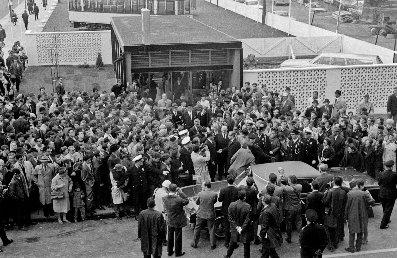
The former Sainte-Catherine entrance; dignitaries arriving, surrounded by inauguration day crowds
(Source22)
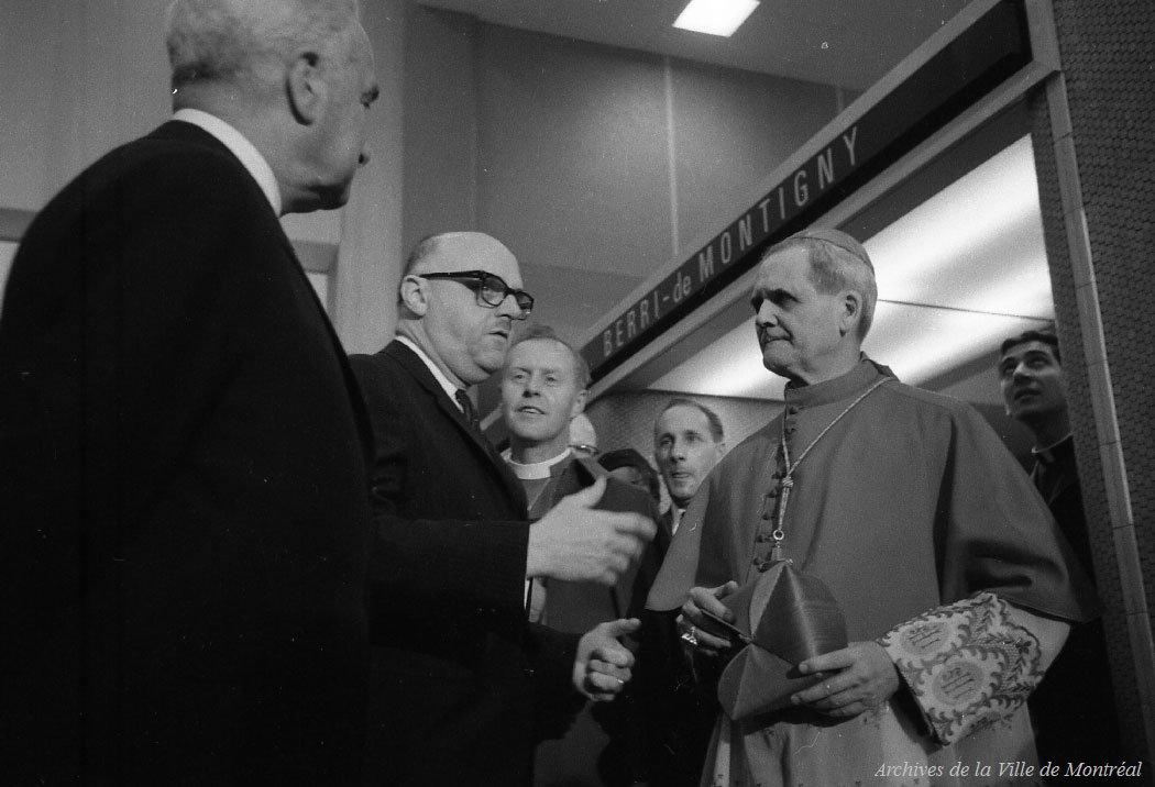
Mayor Jean Drapeau with Anglican Bishop Kenneth Maguire and Roman Catholic Archbishop Paul-Émile Léger on a platform
(Source23)
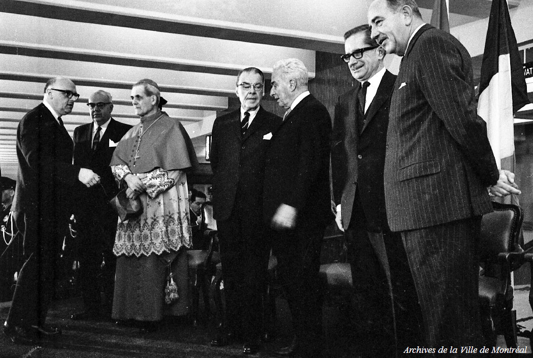
The platform party, from left to right: Mayor Jean Drapeau, chief engineer Lucien L’Allier, Archbishop of Montréal Cardinal Paul-Émile Léger, Canadian Foreign Affairs Minister Paul Martin Sr., French Minister of State Louis Joxe, Quebec Premier Daniel Johnson Sr., and Quebec Lieutenant Governor Hugues Lapointe
(Source24)
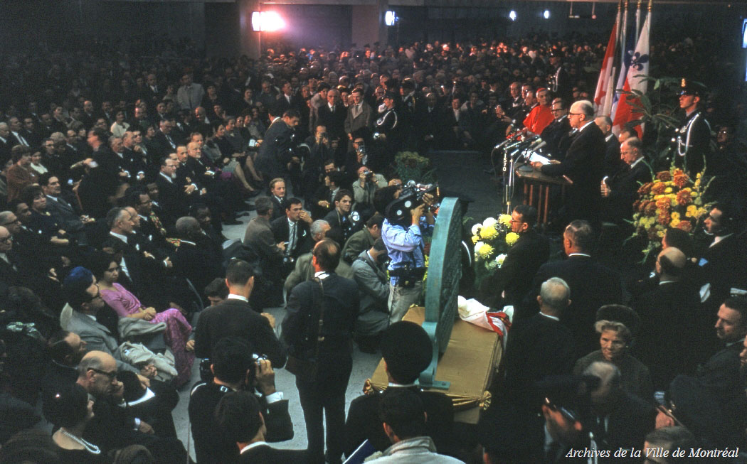
Mayor Jean Drapeau presides over the inauguration ceremony on the concourse of Berri-de Montigny station
(Source25)
- The never-completed program of works of art on historical subjects proposed by the metro’s first art director, Robert LaPalme, anticipated that, besides the stained glass by Pierre Gaboriau and Pierre Osterrath, this station would feature three murals by prominent Quebec artist Alfred Pellan dedicated to “the great explorers whose journeys originated from Montreal”; 26 another plan called for three stained-glass displays on this subject. 27 A mural in homage to Mother Émilie Gamelin was also planned26 (as opposed to the statue that would be added more than 30 years later). Yet another plan called for a “gallery” of famous Montrealers to be painted by Normand Hudon.28
- The Berri entrance to the station was only added after the station opened, in 1967. The entrance featured an interior passageway linking the station to the adjacent Église Saint-Jacques. This made it the only church in North America connected to a metro station. The tunnel was decorated with stained-glass works by José Osterrath (father of Pierre) and was blessed by Cardinal Léger. In addition to the official Roman Catholic church of Expo 67, church authorities also presented it as “the metro passengers’ church.”29, 30 The church was demolished in 1975-1979, except for the steeple and transept, which had themselves belonged to the former Saint-Jacques Cathedral which had burned down in 1933. UQAM’s Judith-Jasmin building was built in its place (integrating the steeple and transept), and is of course itself connected to the metro.
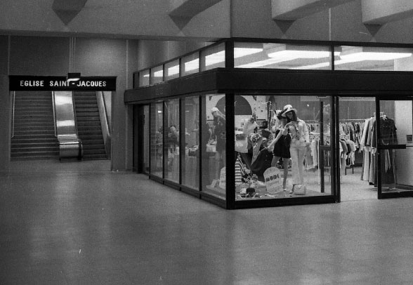
A sign indicating the passage to the Église Saint-Jacques, today leading to the Rue Berri exit
(Source31)
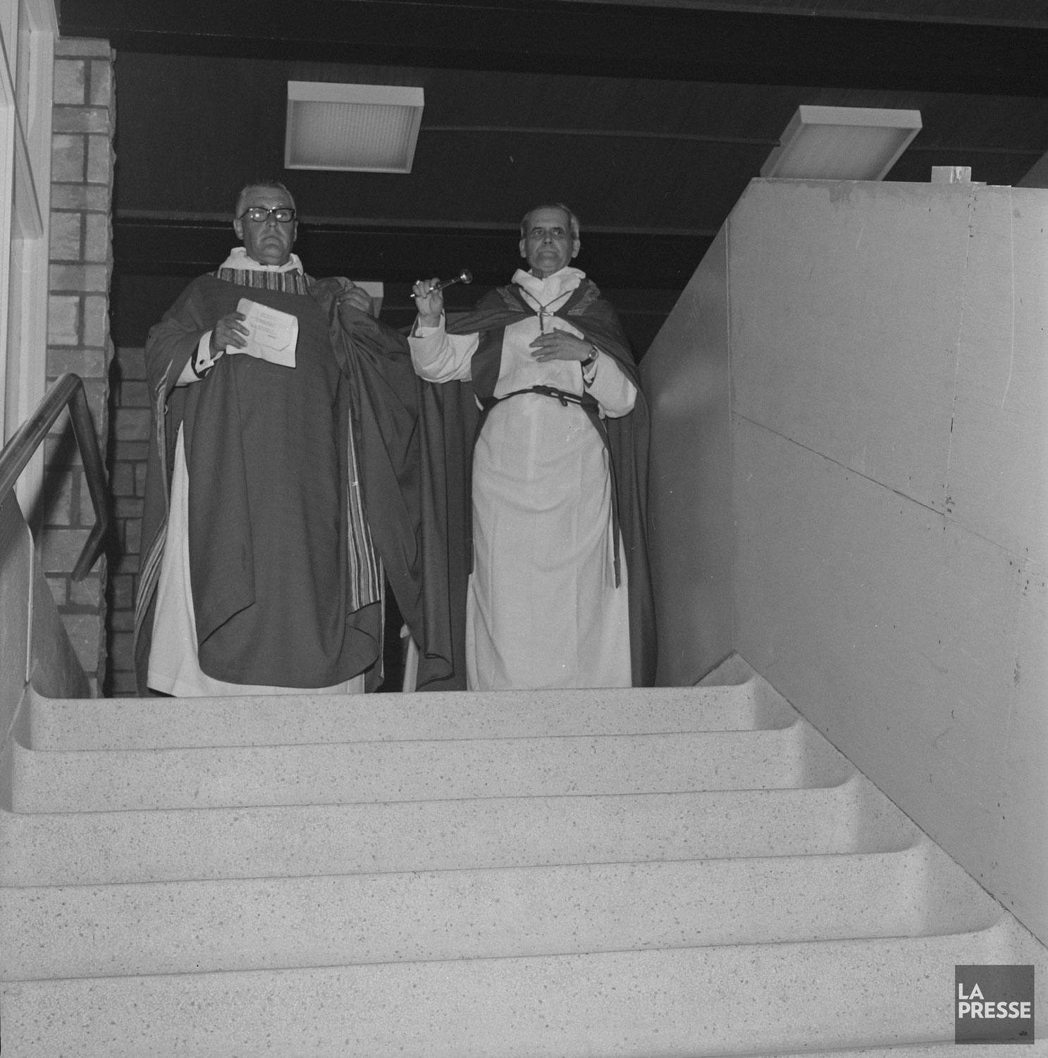
Cardinal Paul-Émile Léger participates in blessing the passage connecting Berri-de Montigny station with Église Saint-Jacques
(Source32)

Stained-glass decoration by José Osterrath, created for the passage between the station and Église Saint-Jacques
(Source29)
- This station had one of the very few metro station entrances ever to be permanently closed: the Palais du Commerce entrance at 1650 Rue Berri, integrated into the building of the same name. The Palais and its metro entrance were demolished in 1998, making way for the Grande Bibliothèque. The entrance was located at the north end of the station’s four-branched concourse, and the hallway leading to it has been closed since.

The now-closed Palais du Commerce exit at the northern end of the concourse level
(Source33)
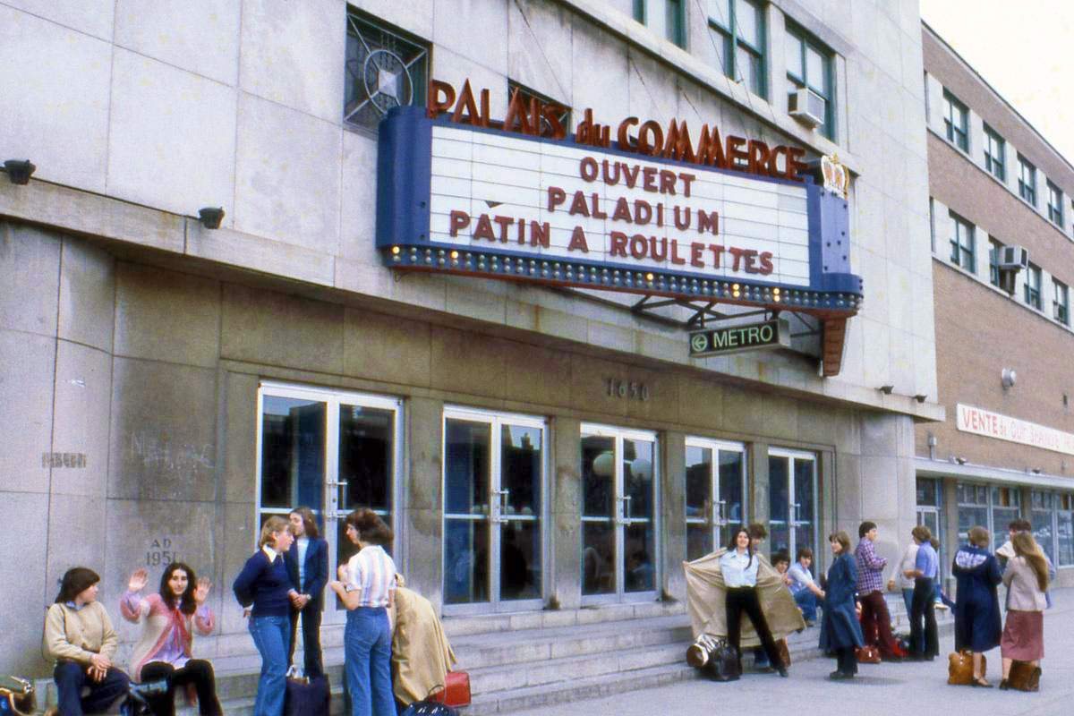
The façade of the former Palais du Commerce, with signage indicating the metro entrance integrated into its entranceway
(Source13)
- When the station was first opened, four of its five entrances were temporary headhouses. Of these, three have since been integrated into other buildings: the Gare d’Autocars entrance in 1970, the Saint-Hubert/Place Dupuis access in 1972, and the Saint-Denis access in UQAM’s Pavillon de la Musique in 1992. The Berri entrance, built in 1967, was incorporated into UQAM’s Pavillon Judith-Jasmin in 1979. The temporary headhouse on the Sainte-Catherine exit was replaced by a permanent free-standing headhouse in 1999. The fifth entrance when the station was inaugurated was the now-demolished Palais du Commerce entrance mentioned above, which was integrated into that building’s entranceway.

Map of the station’s entrances in 1969, with its five temporary headhouses
(Source34)
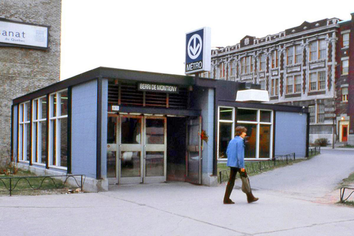

The temporary headhouse at the Saint-Denis exit
(Source13)

The temporary headhouse at the Berri exit, behind Église Saint-Jacques.
(Source35)
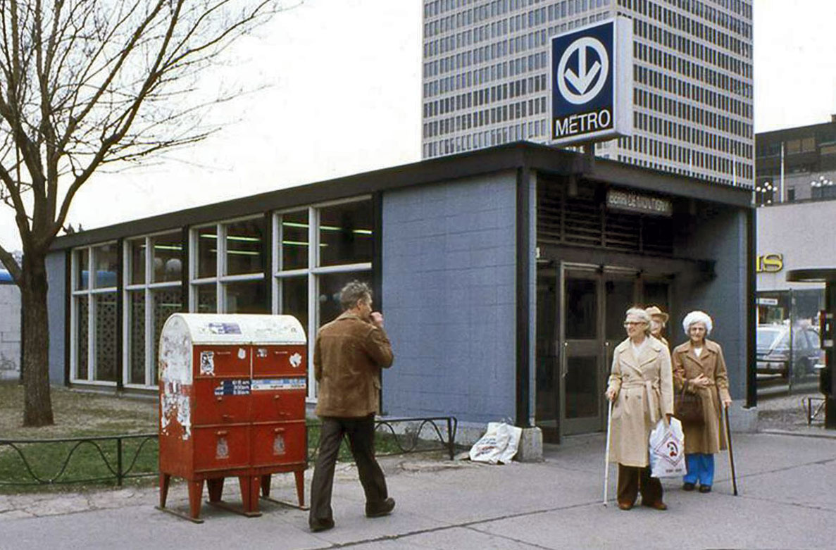
The temporary headhouse at the Sainte-Catherine exit
(Source13)

The permanent Sainte-Catherine headhouse under construction in 1998.
(Source36)
- The plaque at the centre of the “puck” was originally double-faced and displayed in an upright frame. After it was stolen by some university students as a prank, however, it was placed in its current, more secure position. The “puck” was inaugurated as a commemoration of the tenth anniversary of the metro on October 14, 1976.37 The other face of the plaque is displayed in the office of the STM’s CEO.
- The final orange and green line trains to go through this station each night are held for several minutes so that they all leave at 1:00 a.m. (1:30 on Saturday night), to ensure passengers can transfer.
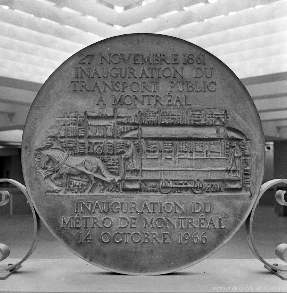
The commemorative plaque in the ticket hall, as originally displayed
(Source38)
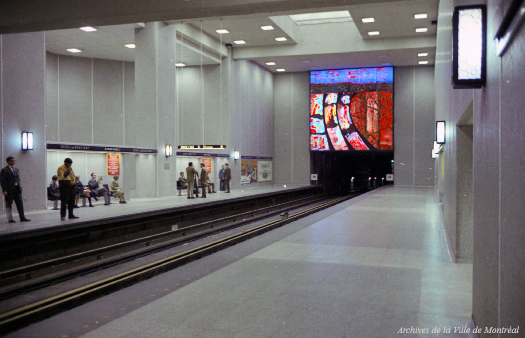
The eastern end of the green line main volume in 1970
(Source39)
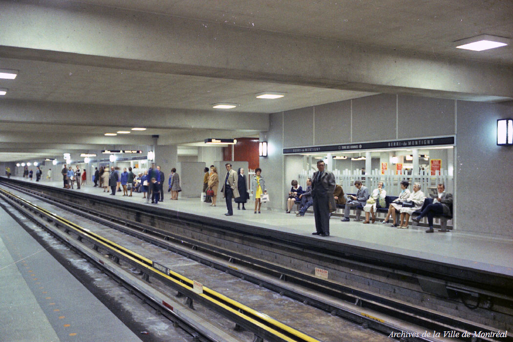
The orange line trainroom in 1970
(Source40)

View of the green line platforms from the corridor to the Saint-Denis exit, before the overlook was enclosed
(Source41)

The first design for the enclosures of the overlooks onto the platforms, seen in 2003
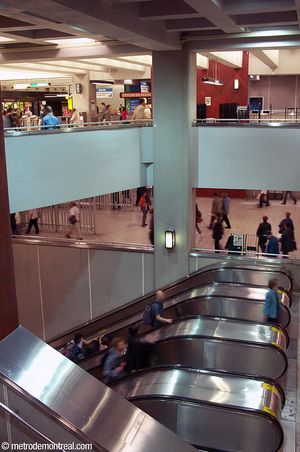
One of the main escalator wells in 2003, prior to the 2010-2021 renovations. Notice the grey ceramic tiles on the walls, the distinctive light fixtures, red ceramic tiles on the pillars, and the metal grilles dividing the orange line landings into lanes.

Decorations on the orange line platform during the early 2000s, prior to the 2010-2021 renovations
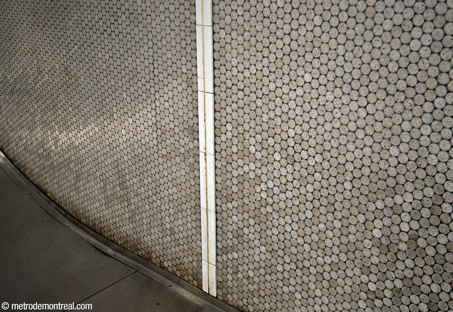
Closer view of the grey ceramic tiles used on the station walls prior to the 2010-2021 renovations. The last remaining section of these tiles is in the stairwell to the Gare d’Autocars exit.
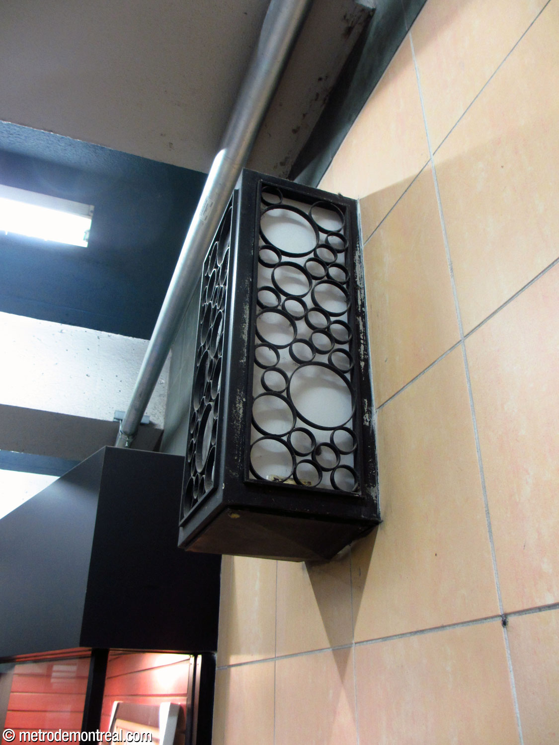
Distinctive light fixture used throughout the station prior to the 2010-2021 renovations

Plaque commemorating the 25th anniversary of the metro, previously located in the ticket hall. The red ceramic tiles, produced by Claude Vermette, decorated a false wall surrounding one of the station’s structural columns.

General Information
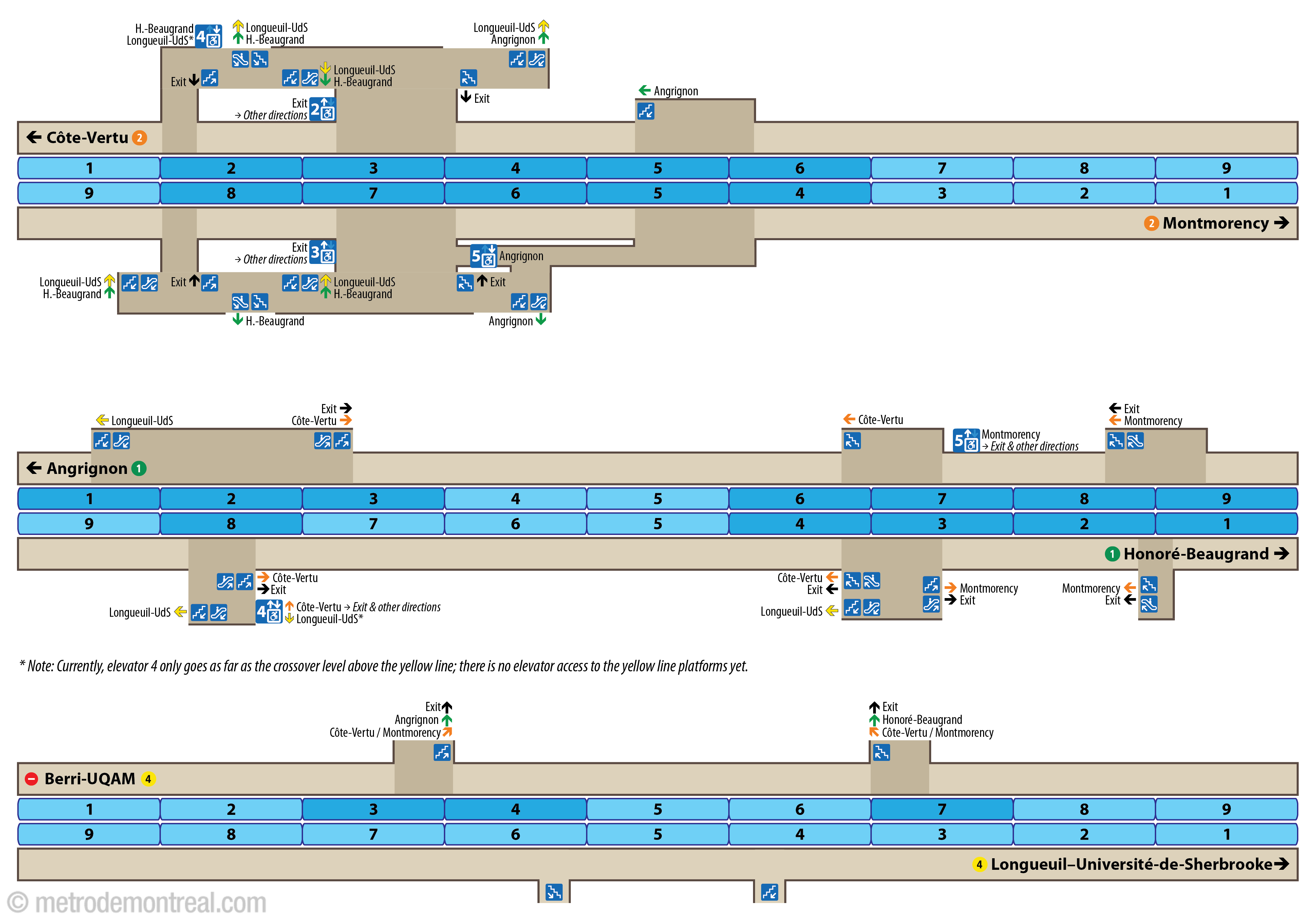
Platform diagram
Most convenient metro cars to use when travelling to this station
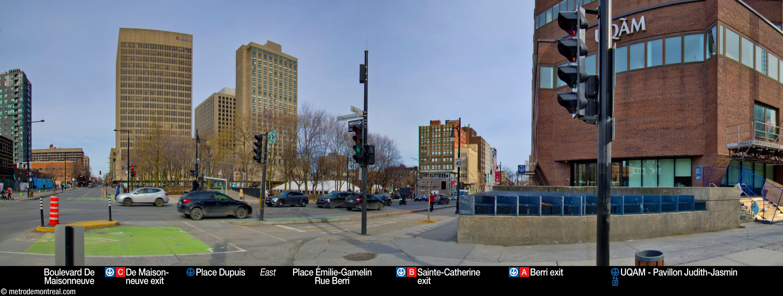
Station surroundings

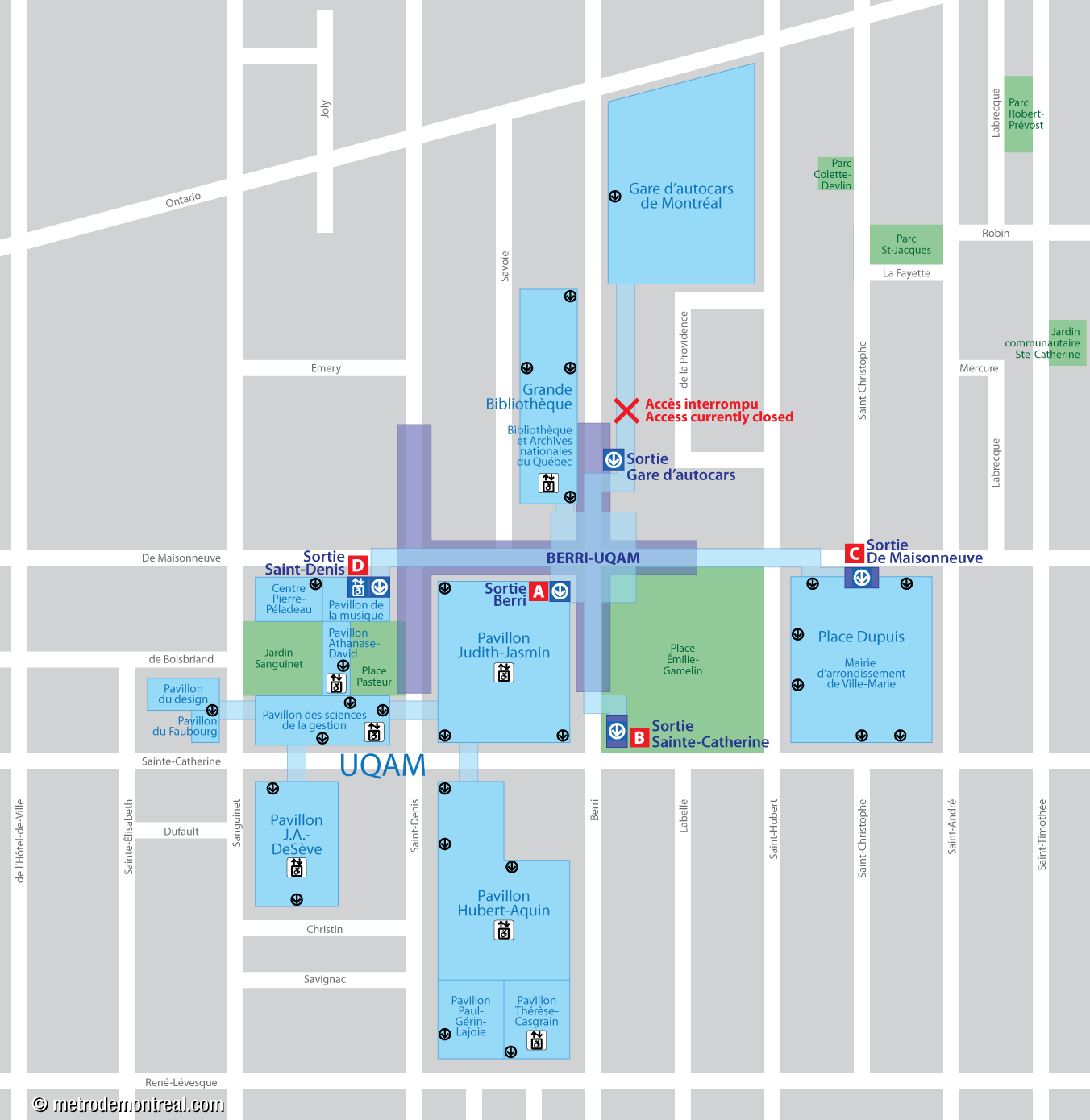
Station address
Borough of Ville-Marie
A Berri entrance: 1500 Rue Berri, at Boulevard De Maisonneuve
B Sainte-Catherine entrance: 505 Rue Sainte-Catherine Est, at Rue Berri
C De Maisonneuve entrance: 850 Boulevard De Maisonneuve Est, at Rue Saint-Christophe
D Saint-Denis entrance: 1470 Rue Saint-Denis, at Boulevard De Maisonneuve
• Gare d’autocars de Montréal entrance: 1621 Rue Berri, at Boulevard De Maisonneuve
Underground city connections
|
Nearby attractions
|
Official website
Service information, opening hours, frequency, bus routes

Most recent update: 2026-09-27
References
- Ouellet, Jean. (2001, February). “Gilles Marchand.” ARQ, la revue d’architecture. No. 114. P. 22. ↩
- Senosier Roberge, Véronique (producer). (2019, September 16). "Station Berri-UQAM" [TV series episode]. Le métro voyage dans le temps. MAtv Montréal. ↩ ↩
- Société d’histoire du Plateau-Mont-Royal. (2023). “Rue Berri.” Album virtuel des rues du Plateau-Mont-Royal. ↩
- Fiche descriptive : Rue Berri. Commission de toponymie du Québec. ↩
- “Fiche d’un espace public : Rue Berri.” (2004). Vieux-Montréal. Ville de Montréal. ↩
- Clairoux, Benoît. (2001). Le métro de Montréal: 35 ans déjà. Montreal: Hurtubise HMH. P. 110. ↩ ↩
- “De Montigny ou de Maisonneuve?” (1968, January 21.) La Patrie. Archives de la Ville de Montréal, CA M001 VM166-1-1-D5262, p. 74. ↩
- Ducas, Marie-Claude. (1987, June 25). “Deux stations de métro rebaptisées.” Le Devoir, p. 3. ↩
- “Deux stations de métro vont changer de nom.” (1987, December 9). La Presse, p. A5. ↩
- Lionais, E.H.C. Plan of St. James Ward. C. 1874. Source: Bibliothèque et Archives nationales du Québec, 0000337579. ↩
- Image source: Groov3, Wikimedia Commons. Used under the Creative Commons BY-SA 4.0 License. ↩
- Portrait of Jacques Testard, Sieur de Montigny. Details unknown. Source: Wikimedia Commons. ↩
- © STM archives. ↩ ↩ ↩ ↩
- Roy, Maurice. (1964, June 21). “Les stations du métro.” Le Petit Journal, p. A-48-9. ↩
- Source: Archives de la Ville de Montréal, VM94-M030-008. Used under the Creative Commons BY-NC-SA 2.5 CA License. ↩
- Source: Archives de la Ville de Montréal, VM94-MD01-003. Used under the Creative Commons BY-NC-SA 2.5 CA License. ↩
- Source: Archives de la Ville de Montréal, VM94-MD16-043. Used under the Creative Commons BY-NC-SA 2.5 CA License. ↩
- Source: Archives de la Ville de Montréal, VM097-Y-02-D005A-007-03. Used under the Creative Commons BY-NC-SA 2.5 CA License. ↩
- Photograph by Paul-Henri Talbot, La Presse, January 16, 1967. Fonds La Presse. Bibliothèque et Archives nationales du Québec, P833,S5,D1967-0018, no. 12. ↩
- Info-STM. (2006, 20 October). “Le 14 octobre 1966 (Deuxième partie).” Métro. P. 5. ↩
- Image source: Clairoux, Benoît. (2001). Le métro de Montréal, 35 ans déjà. Montreal: Éditions Hurtubise HMH. P. 37. Originally from Archives de la Ville de Montréal. ↩
- Image source: Szilasi, G. (1966, October 14). “Inauguration du métro de Montréal.” Fonds Ministère de la Culture et des Communications. Bibliothèque et Archives nationales du Québec, E6,S7,SS1,D662110-662112. Used under the Creative Commons BY-NC-ND 4.0 License. ↩
- Source: Archives de la Ville de Montréal, VM94-M207-085. Used under the Creative Commons BY-NC-SA 2.5 CA License. ↩
- Source: Archives de la Ville de Montréal, VM94-M207-001. Used under the Creative Commons BY-NC-SA 2.5 CA License. ↩
- Source: Archives de la Ville de Montréal, VM94-MD58-001. Used under the Creative Commons BY-NC-SA 2.5 CA License. ↩
- Gagnon, Lysiane. (1967, March 25.) "On va décorer notre métro." La Presse, supplement 1, pp. 4-9. Source: Bibliothèque et Archives nationales du Québec. ↩ ↩
- "Une fois décoré, le métro sera un livre d'images sur Montréal." (1968, February 25). Le Petit Journal, p. 7. Source: Bibliothèque et Archives nationales du Québec. ↩
- “Les ‘grands’ montréalais par Hudon pour une station de métro.” (1967, July 2.) Dimanche-Matin. Archives de la Ville de Montréal, CA M001 VM166-1-1-D5262, p. 60. ↩
- Drolet, J. (1967, July 19). “L’église de l’Expo est maintenant reliée à la station de métro.” Le Devoir. P. 3. ↩ ↩
- Masson, C. (1965, September 14). “La paroisse St-Jacques ressuscite.” L’Est Central. ↩
- Source: Archives de la Ville de Montréal, VM94-M266-023. Used under the Creative Commons BY-NC-SA 2.5 CA License. ↩
- Photograph by Pierre McCann, La Presse, July 23, 1967. Fonds La Presse. Bibliothèque et Archives nationales du Québec, P833,S5,D1967-0356, no. 2. ↩
- Image source: Rémillard, H. (1978). “Pancarte à l’entrée du Bureau d’immatriculation au métro Berri-de-Montigny devenu Berri-UQAM.” Fonds Ministère de la Culture et des Communications. Bibliothèque et Archives nationales du Québec, E6,S7,SS1,D780397-780397. Used under the Creative Commons BY-NC-ND 4.0 License. ↩
- Adapted from: Ville de Montréal, service d’habitation et de l’urbanisme. (1969). Land use map, 1:1200 scale. Plate 230-26. Montreal: author. Bibliothèque et Archives nationales du Québec, 0004552432. ↩
- Source: Archives de la Ville de Montréal, VM097-Y-02-D012A-185. Used under the Creative Commons BY-NC-SA 2.5 CA License. ↩
- Photograph by Armand Trottier, La Presse, April 21, 1998. Fonds La Presse. Bibliothèque et Archives nationales du Québec, P833,S5,D1998-0053, no. 9. ↩
- Commission de transport de la Communauté urbaine de Montréal. (1977). Rapport annuel/Annual Report 1976. Montreal: author. P. 26. ↩
- Source: Archives de la Ville de Montréal, VM94-M223-030. Used under the Creative Commons BY-NC-SA 2.5 CA License. ↩
- Source: Archives de la Ville de Montréal, VM94-M269-002. Used under the Creative Commons BY-NC-SA 2.5 CA License. ↩
- Source: Archives de la Ville de Montréal, VM94-M269-008. Used under the Creative Commons BY-NC-SA 2.5 CA License. ↩
- Source: Archives de la Ville de Montréal, VM94-MD57-007. Used under the Creative Commons BY-NC-SA 2.5 CA License. ↩
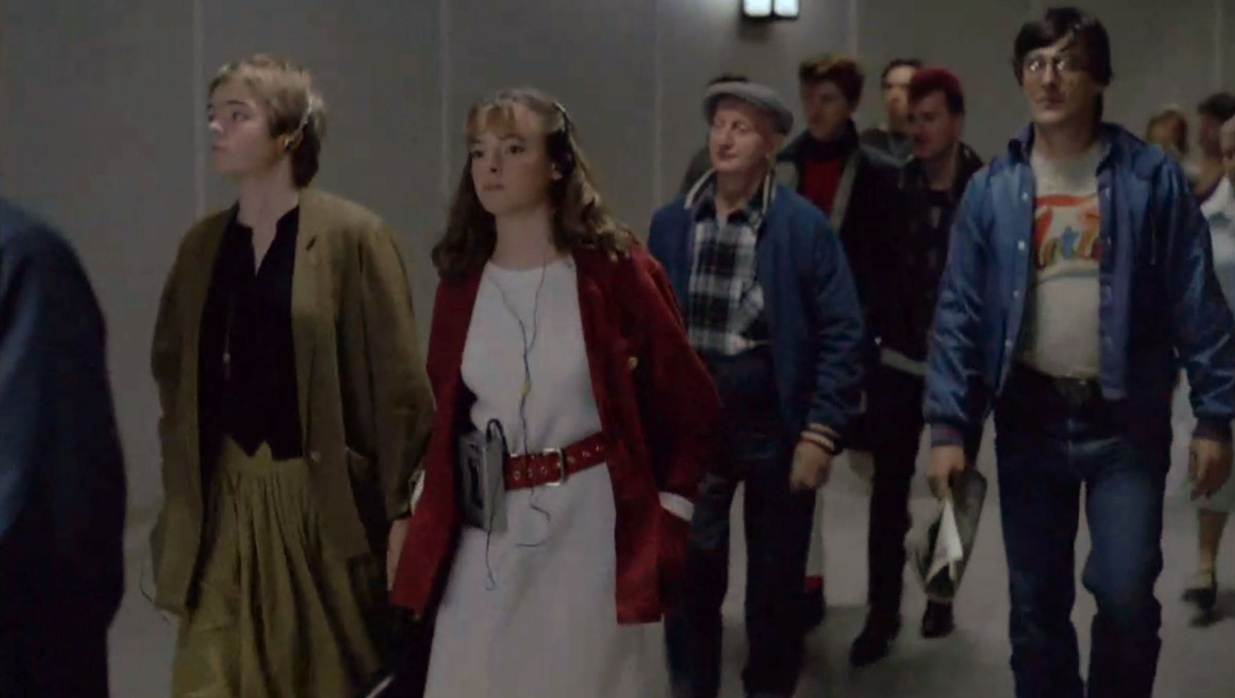
- Images © 1996 Malofilm Vidéo ↩

.png)