
 NAMUR
NAMUR
 NAMUR
NAMUR De la Savane
Architects
Henri P. Labelle and Atef Mourad1 (Labelle Marchand Geoffroy, Architectes)

Artist

Start of service
January 9, 1984

Art & Architecture
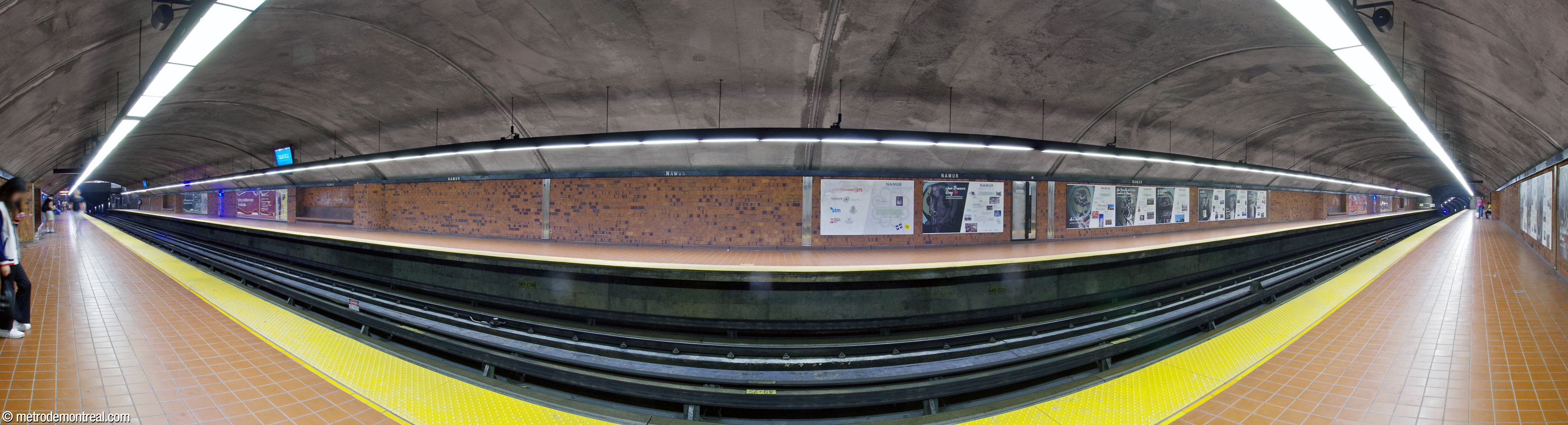
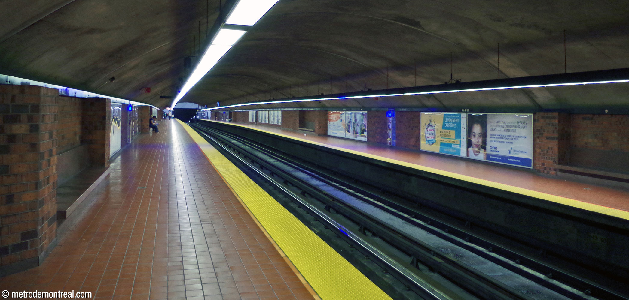
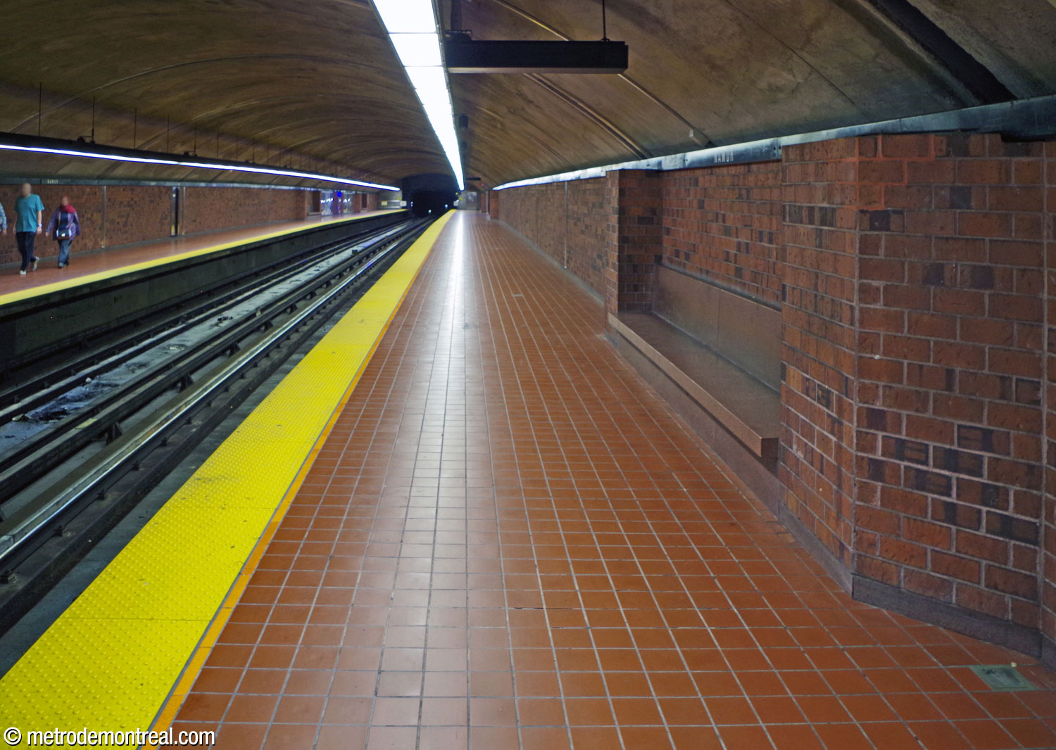
This station’s architecture is spacious but muted at the platform and entrance level, decorated with brown brick and terra cotta tiles. As with many stations of this era, the trainroom, dug in tunnel, projects out from a deep, cut-and-cover main volume at the north end of the platforms. Little is distinctive about the architecture of the platforms, other than that the walls angle inward around each bench to create an unusual recess.

The sober single headhouse features a rectangular archway with a single rounded upper corner, a form repeated in the main volume’s roof and spandrel wall. Unfortunately, the headhouse has not been improved by the 2015 addition of a rather top-heavy second storey with green-grey metal siding, housing technical equipment.
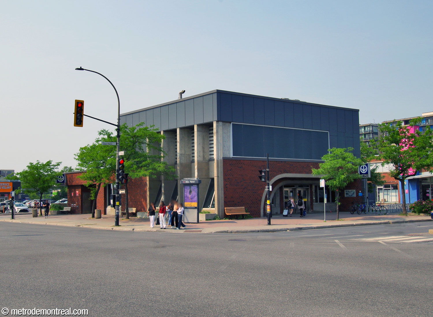
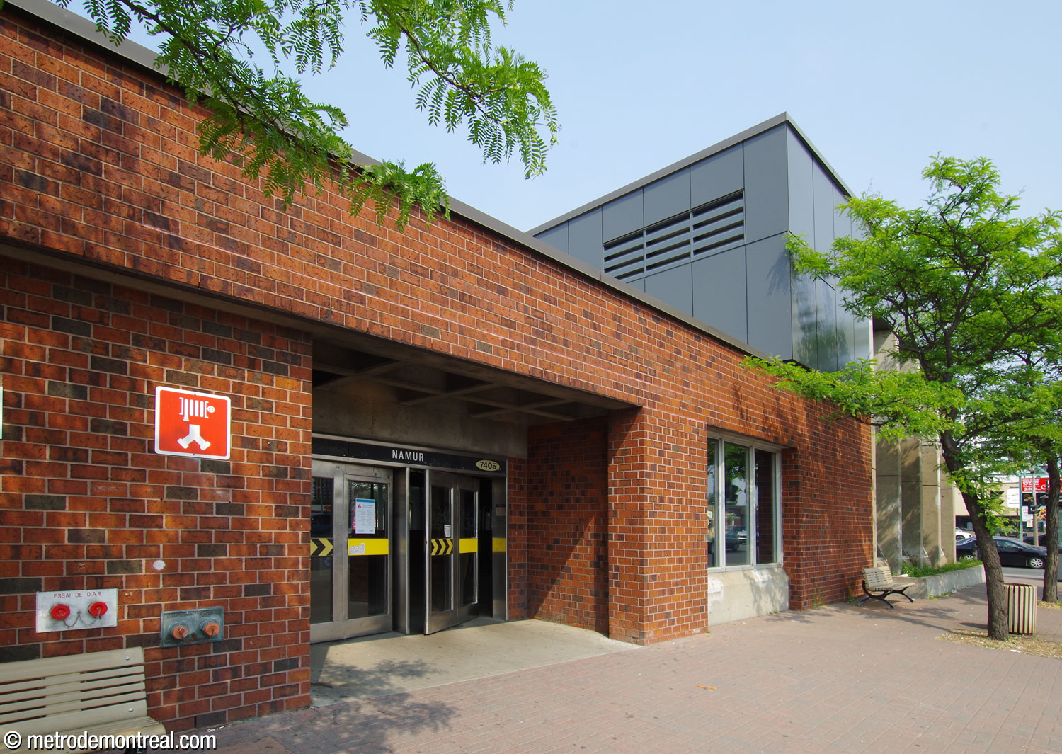

The interior features a square-coffered ceiling, the mouth of a light shaft in the northeast corner, and tilted windows over the stairwell. The stairs and escalators down to the ticket hall are interrupted by a landing.


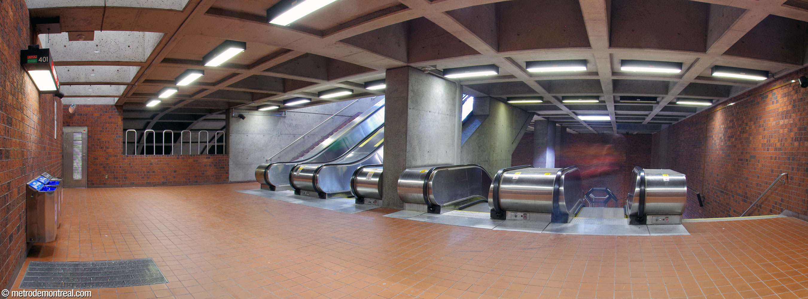
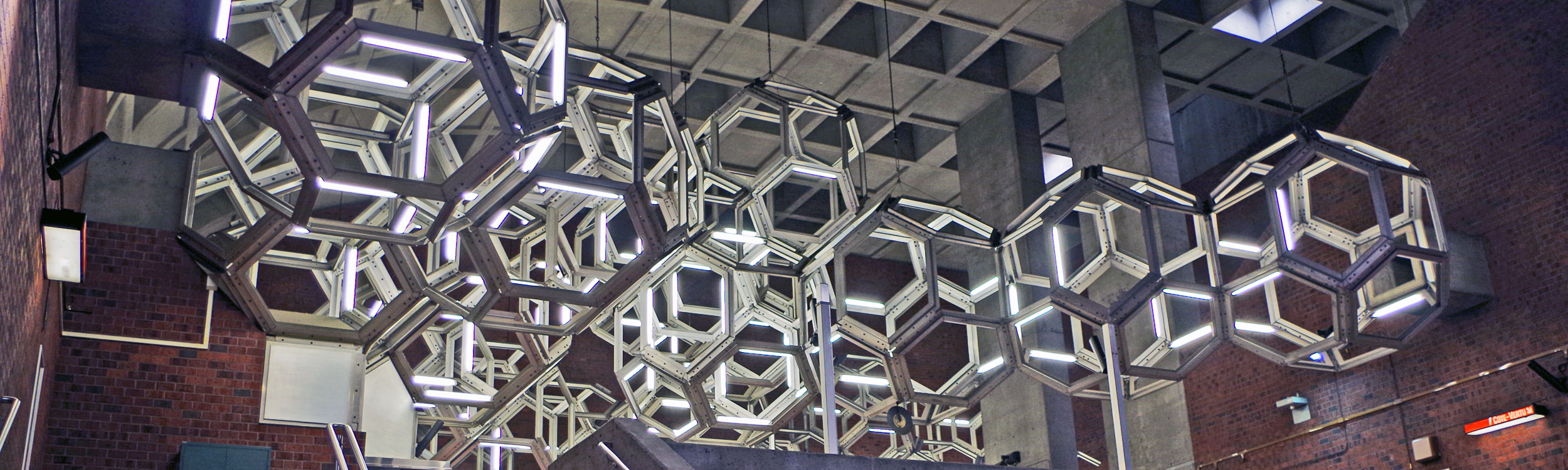
On the whole, the station would be rather uninteresting… were it not for the enormous spatial sculpture hanging in the main volume above the ticket hall.
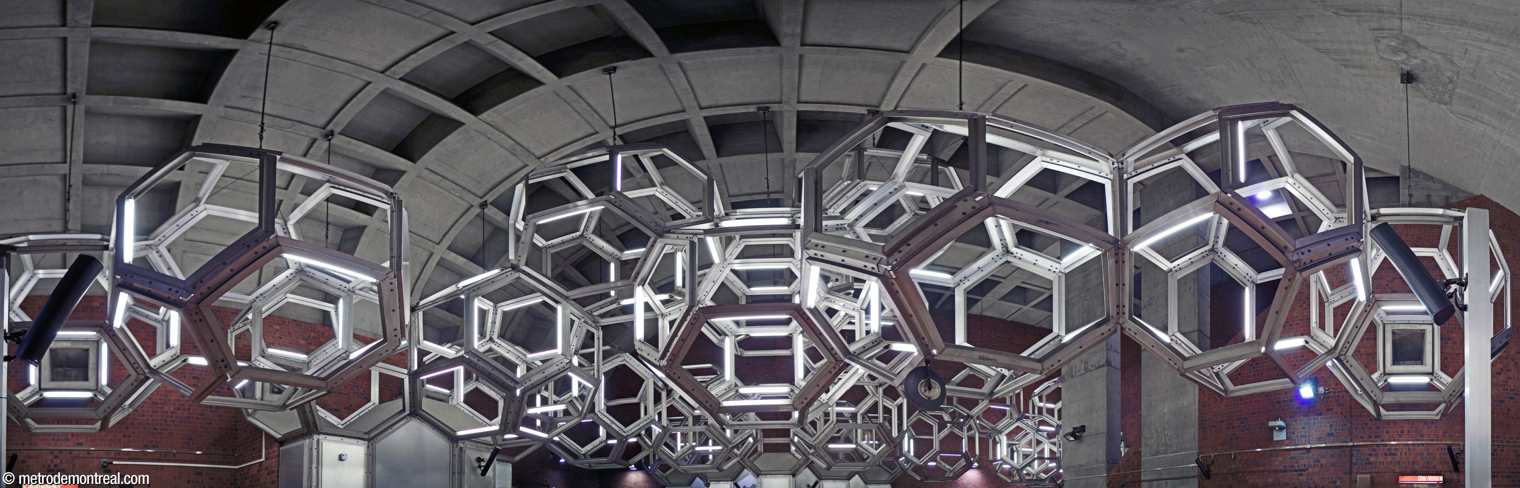
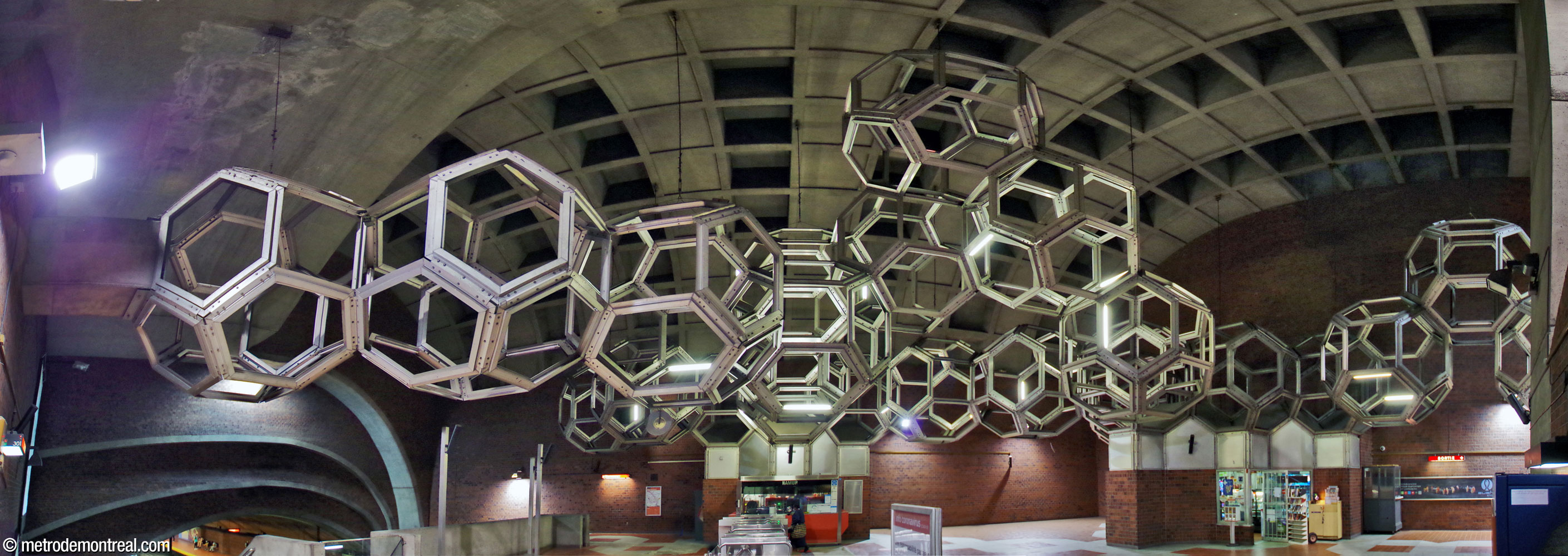
This dazzling illuminated structure, created by artist Pierre Granche and entitled Système, is one of the largest works of art in the network. Like an immense glowing cloud, it fills the whole volume, spreading out horizontally in all directions, lighting the whole area with the fluorescent tubes mounted on its beams.

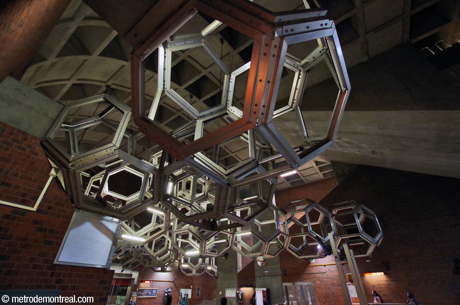
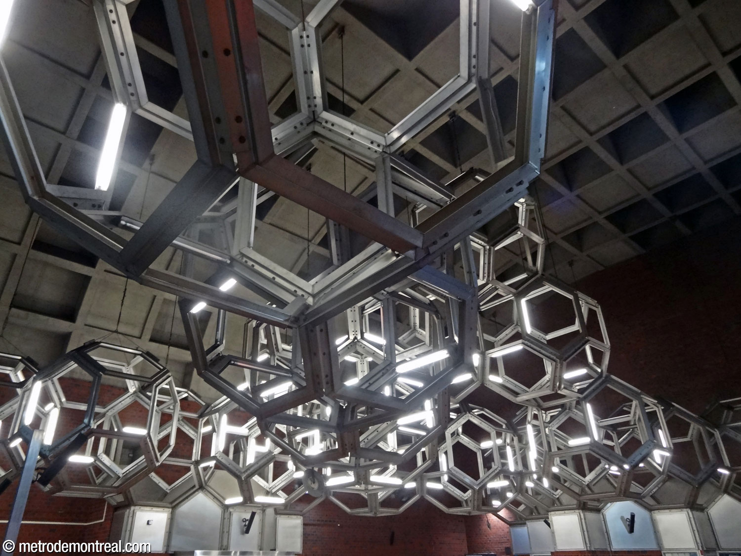
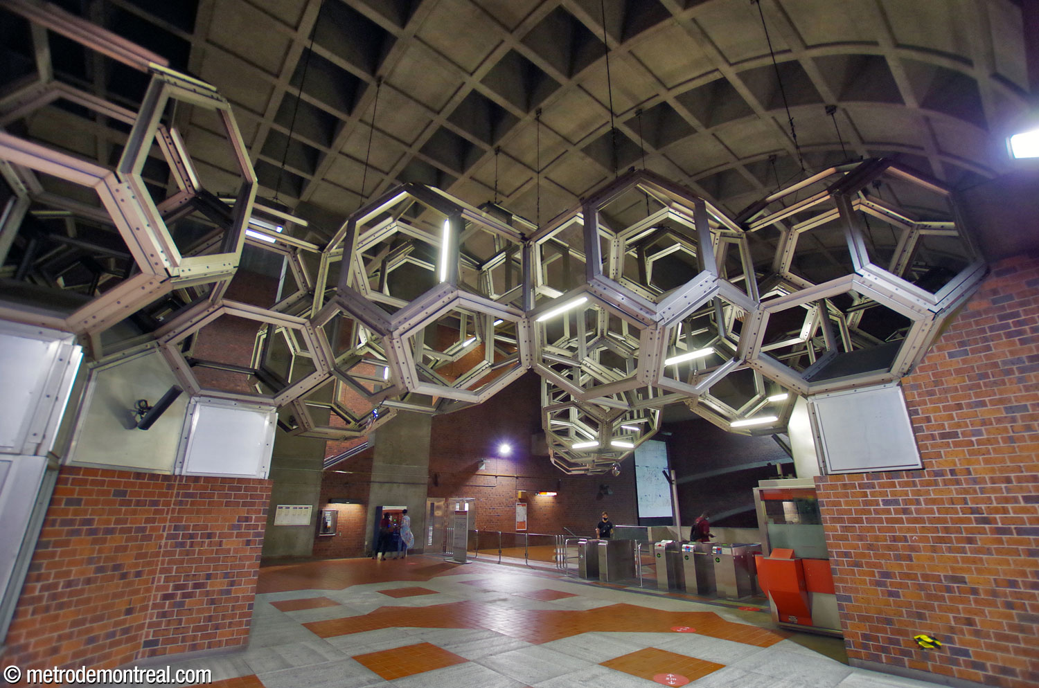

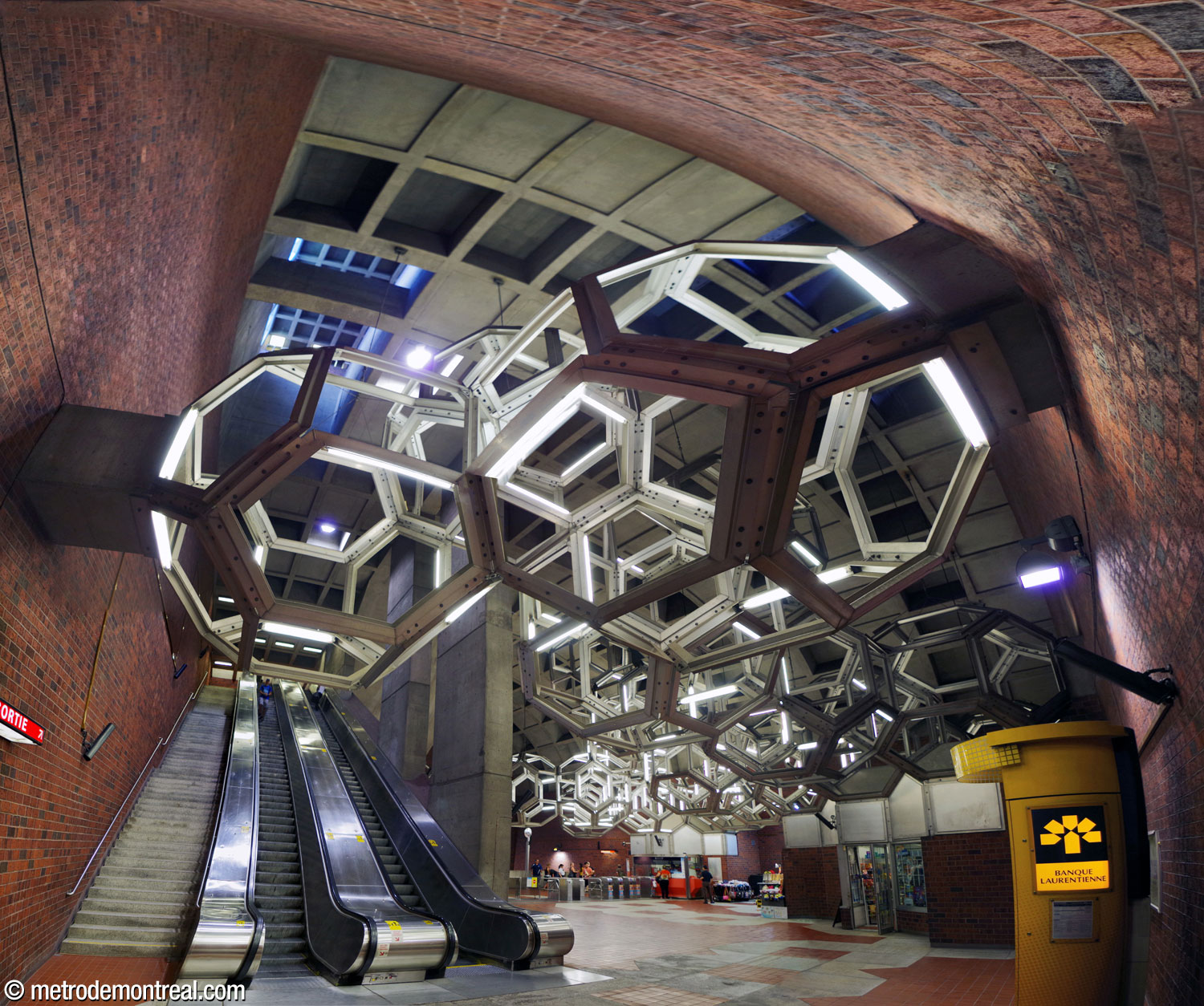
The array is suspended from the impressive coffered ceiling vault, anchored to the walls, and partially supported by the roofs of the ticket booth and concession. The stairs down from the entrance and the overlook on the landing offer magnificent views of the volume and the sculpture. Its shapes—tetratruncated rhombic dodecahedra, to be precise—are repeated in the designs of the tiled floor.
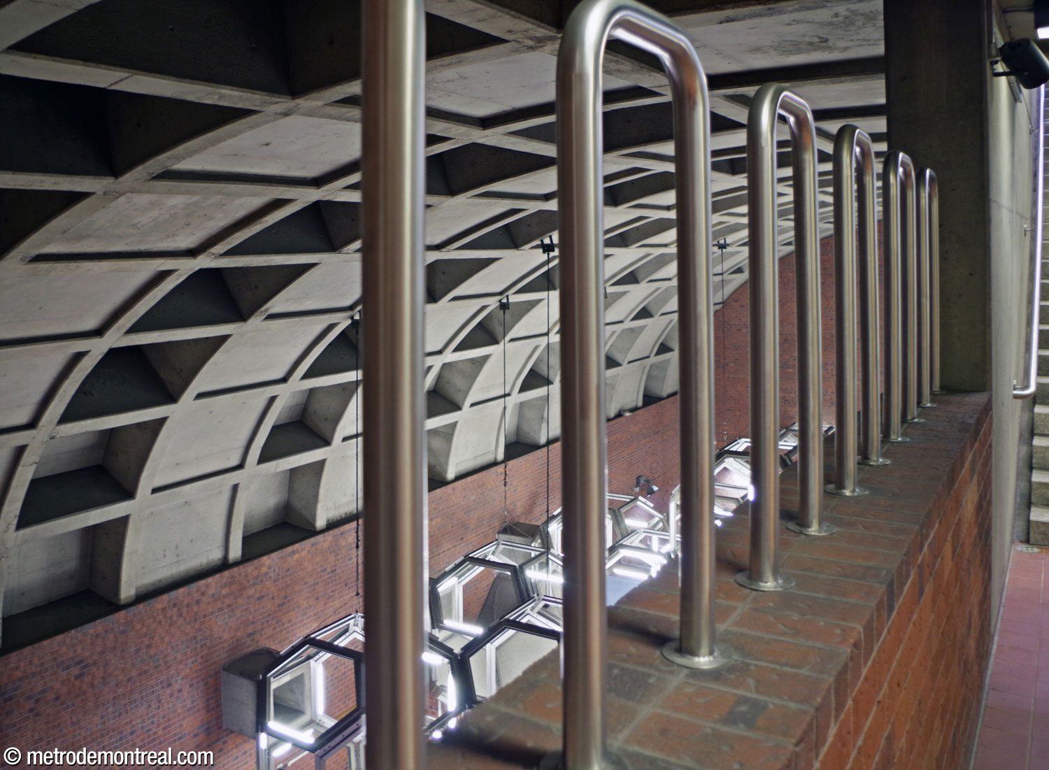


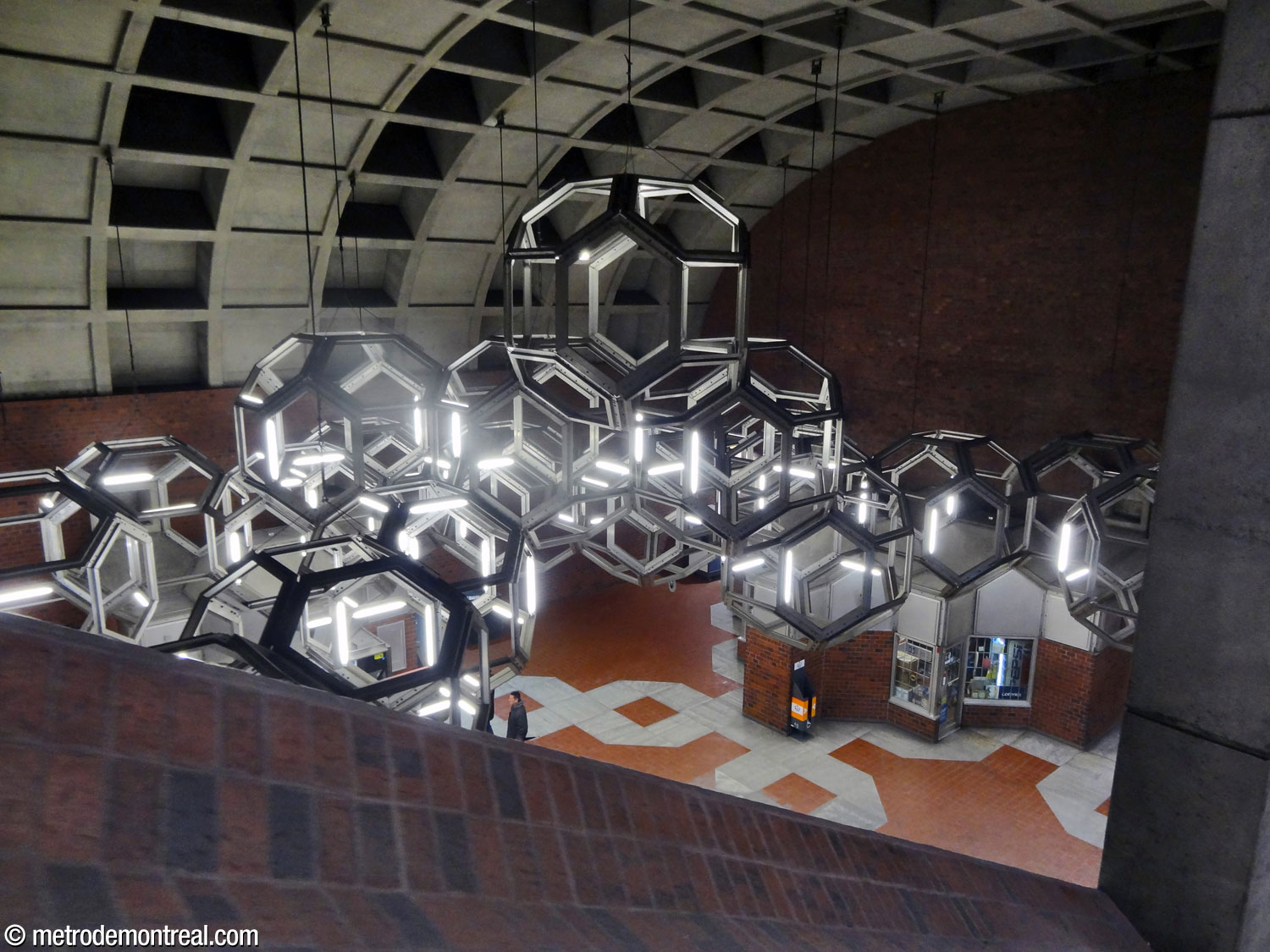

No visit to the metro would be complete without seeing this unforgettable work.

Accessibility
This station is not currently wheelchair-accessible. In the STM’s 2020-2029 capital expenditures program, this station was targeted for the installation of elevators by 2027. However, it no longer appears in the 2023-2032 program, the construction of new elevators has stalled due to budget cuts by the provincial government,2 and no construction work has yet been announced.
History & Trivia

Traffic
2,368,425 entrances in 2023
42nd busiest station

Platform Depth
24.1 m deep
7th deepest station

Interstation Distances
To De la Savane: 786.70 metres
To Plamondon: 988.47 metres
Origin of the Name
Rue de Namur. Namur is a city in Belgium at the confluence of the Sambre and Meuse rivers, the capital of the province of the same name and of the region of Wallonia. It is a sister-city of Quebec City.
This name has been used for various streets in the area over the years. Initially, what had been (and what is now) Rue de la Savane was renamed for Namur in November 1914 during the First World War,3 to commemorate the Siege of Namur in August of that year.4 Later, the name spread to include part of what is now Rue Jean-Talon;5 lastly, after Rue de la Savane resumed its name in 1947, Rue de Namur came to include the whole westernmost section of modern Rue Jean-Talon.6 This was connected to the existing Rue Jean-Talon and renamed accordingly, apparently in 1961. 7 A streetcar station was named Namur in 1921, and a CTM bus garage in 1954.8
When the station was planned at the corner of Rue Jean-Talon and Boulevard Décarie, neither cross street’s name was thought to be appropriate: there was already a Jean-Talon station, and multiple stations were located along Boulevard Décarie. Several different names were contemplated; ultimately, the former name of Rue Jean-Talon Ouest, still used by the bus garage, was chosen. To provide a basis for the station name, nearby Rue Arnoldi was renamed Rue de Namur in 1980.9
In June 2007 a delegation from the city of Namur, in Quebec for a conference of regional capitals in Victoriaville, visited the station and presented the STM with a plaque commemorating the station’s namesake. It is now installed in the headhouse. In 2017, another delegation from Belgium attended the installation of informative displays on the platform level regarding the city and province of Namur and their ties to Quebec (as well as two other towns called Namur, in Outaouais and in Wisconsin).
Names proposed during planning phase: Victoria,10 Jean-Talon Ouest, Paré, Savane, Arnoldi,11 Blue Bonnets.12

The city of Namur, Belgium, with the Sambre river and Saint-Aubin Cathedral (right)
(Source13)

Commemorative plaque in the headhouse, presented by the City of Namur in 2007
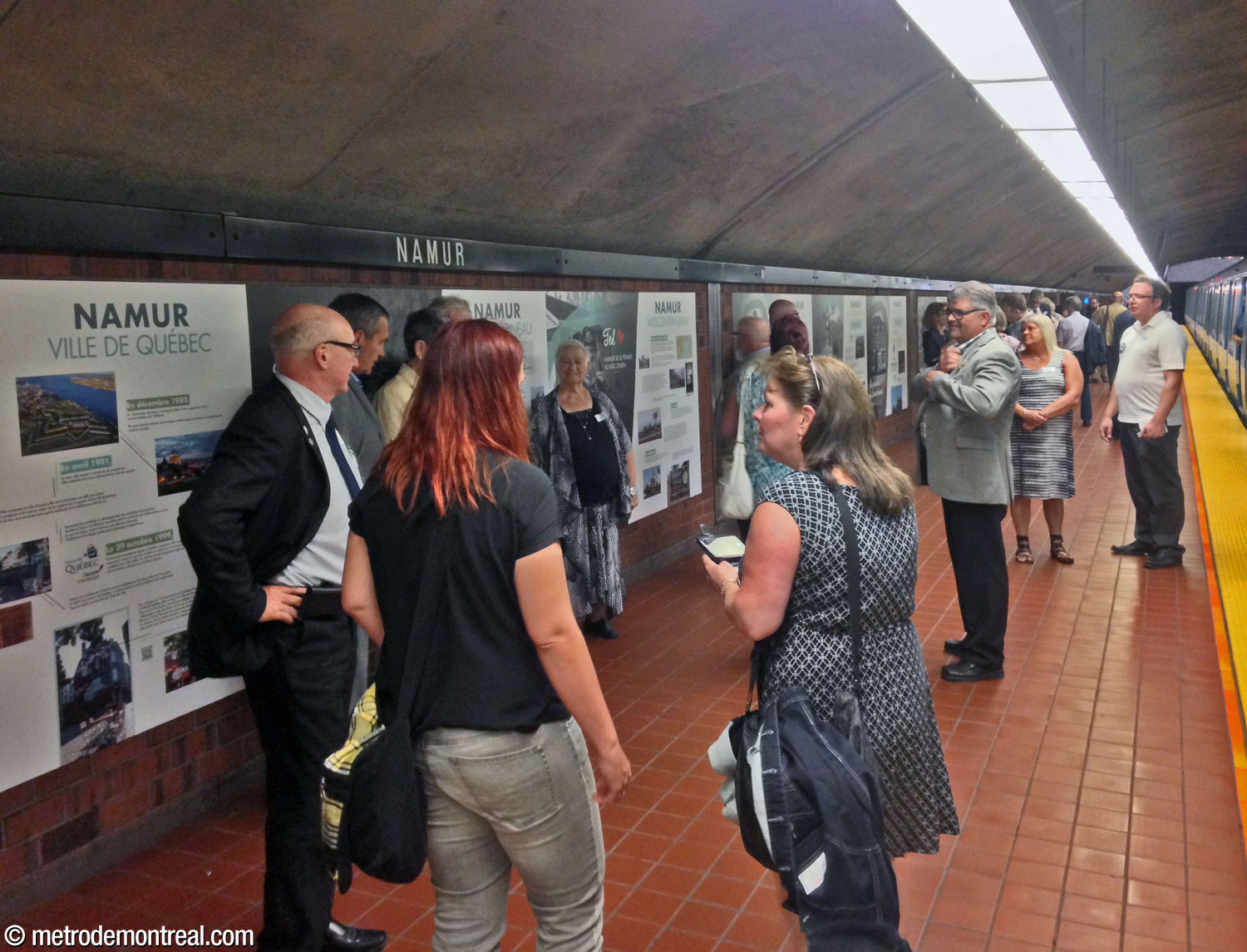
The delegation from Namur at the unveiling of informational displays on the station platforms in 2017

Informational displays about the City and Province of Namur and other places called Namur, installed on the station platforms in 2017
Trivia
- The location of this station was subject to a great deal of controversy. Its original location, starting in 1968, was at the corner of Rue Jean-Talon and Rue Victoria, in line with Plamondon and Côte-Sainte-Catherine stations. Another proposal in 1971 located it under Avenue Mountain Sights between Rue Arnoldi (now Rue de Namur) and Rue Jean-Talon; this proposal would have featured a 250-metre-long covered ground-level walkway along the CPR tracks to reach the area west of the Décarie Expressway. A position on Rue Jean-Talon halfway between Mountain Sights and Victoria, and even building the station west of the Décarie Expressway, were also considered.11
- The station reached its ultimate location under Boulevard Décarie in 1975, in order to serve forecast commercial and residential development on and around the Blue Bonnets racetrack. This decision was vigorously disputed and there were accusations of collusions between the MUC and the developer, Campeau Corporation. The controversy led to delays of some years before construction could start.14 Although various other developments have gone up nearby since, the Blue Bonnets site itself was never developed; the racetrack closed in 2009 and the site remains abandoned to this day.
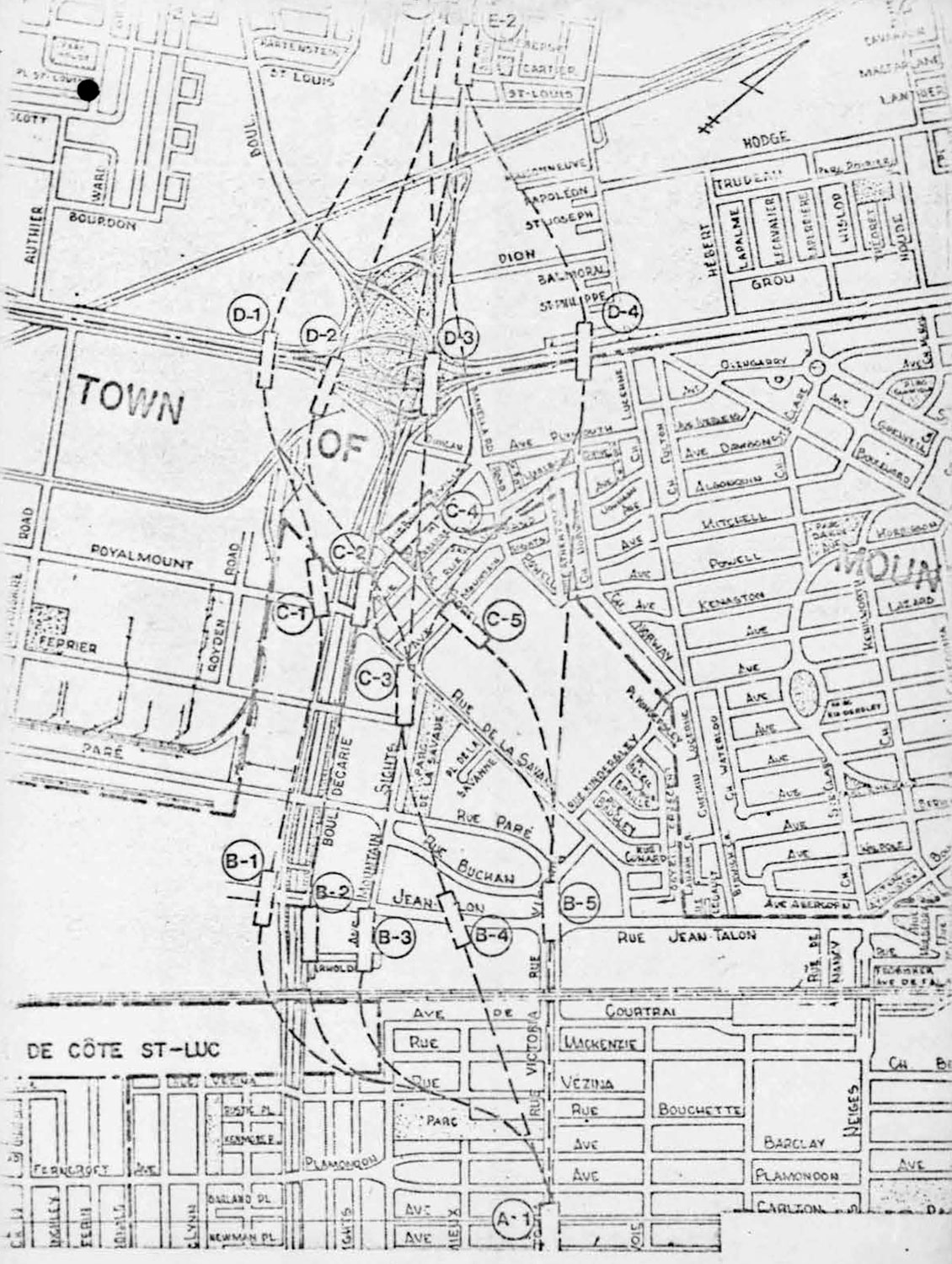
Overview map compiling the various planned locations of Namur station (B1 to B5)
(Source15)
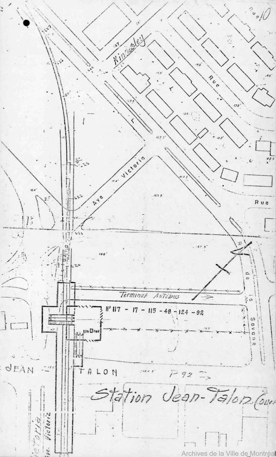
Sketch of the station in its original planned location at the corner of Rue Jean-Talon and Rue Victoria
(Source16)
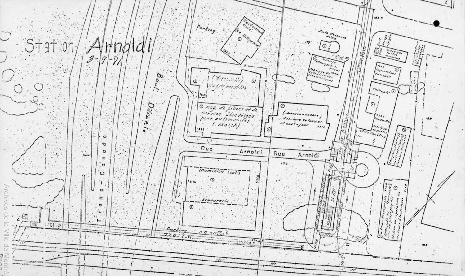
Sketch of the station in the contemplated location under Avenue Mountain Sights
(Source17)

Sketch of the station in the contemplated location partway between Avenue Mountain Sights and Rue Victoria
(Source18)
- This station was originally planned to accommodate four additional accesses to serve residential and commercial development projected for the area.1 Two of them were intended to be added to the existing north access, one on the south side of Rue Jean-Talon opposite the present headhouse, which would have connected to the station at the stairwell landing, and the other on the other side of Autoroute Décarie providing access to development at the Hippodrome site, which would have connected to the west side of the ticket hall.
- The other two were planned to connect to a new ticket hall at the south end of the station; they would have been located on either side of Autoroute Décarie at Rue de Namur. For this purpose, a large cavern was excavated to provide room for this second access. The cavern is visible from the south end of the platforms.
- Owing to the distance between the north access and planned south access, the platforms are slightly longer than the normal 152.4 metres. As a result, since the trains in both directions stand with their heads at the ends of their respective platforms, their standing positions are offset rather than directly side by side (see platform diagram below). This is compensated for by a barrier at the northern end of the Montmorency platform.

Architectural sketch of the headhouse, showing a planned wall and mast with a metro logo at the north end
(Source1)

Architectural sketch of the ticket hall. Note the semicircular joins between the columns (left) and the entrance to a tunnel leading to the anticipated access on the west side of Autoroute Décarie (right).
(Source1)

Diagram of originally planned accesses
(Source1)
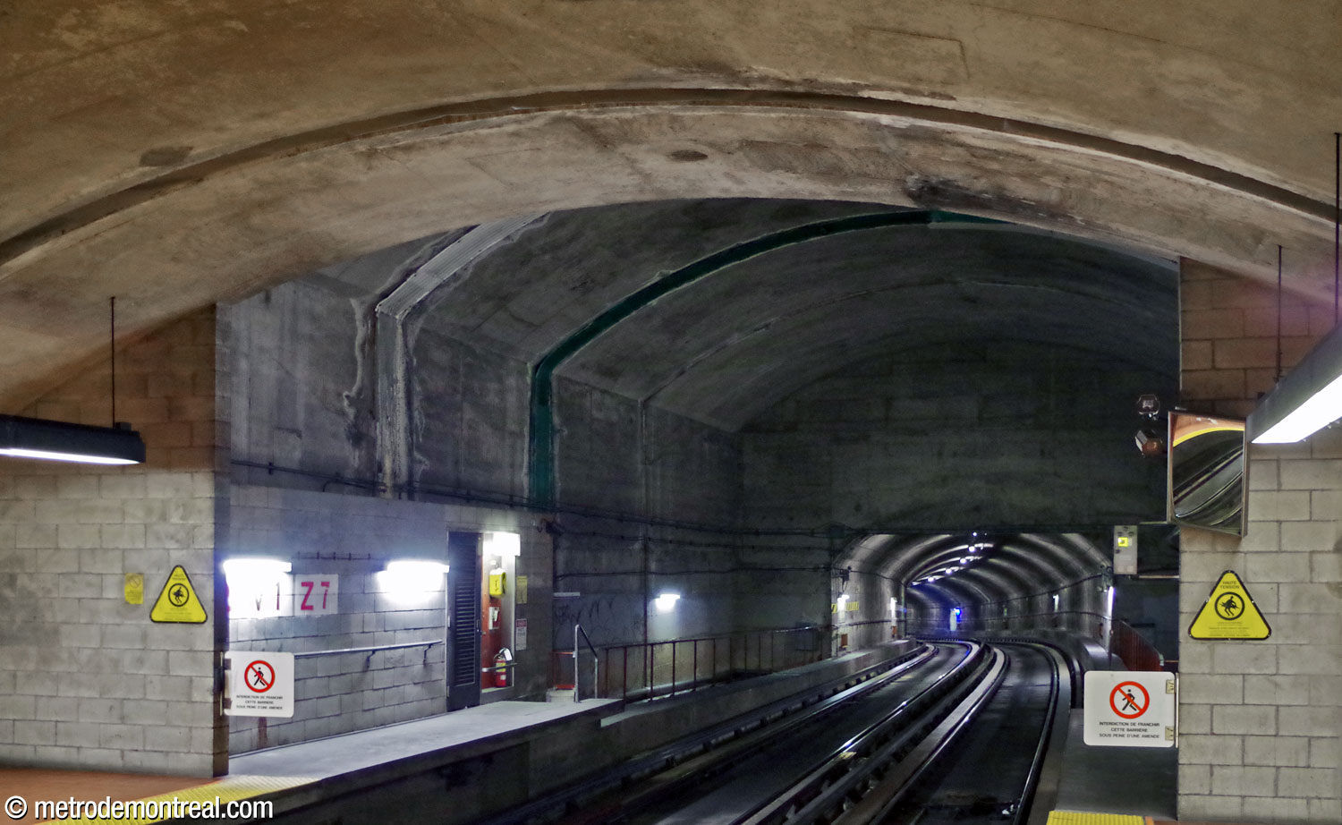
Vault at the south end of the station, providing for future construction of a second ticket hall
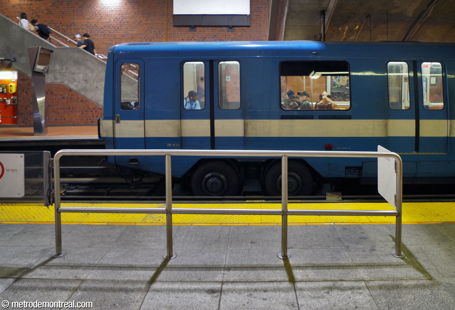
Barrier at the tail of the Montmorency platform across from a train standing at the Côte-Vertu platform, showing the offset between the two due to the increased platform length
- Pierre Granche’s spatial sculpture was originally planned to continue up the escalator well as far as the surface.1

Architectural maquette of the station, showing how the sculpture Système by Pierre Granche was originally planned to extend to just below street level
(Source19)

Mayor Jean Drapeau, accompanied by Quebec Premier René Lévesque, cuts a ribbon to inaugurate the station, January 9, 1984
(Source19)

Jockeys from Blue Bonnets Racetrack pose in the ticket hall with a banner during the station’s inauguration, January 9, 1984
(Source19)


The station’s headhouse before the 2015 addition
- Scenes from Louis Saia’s film Les Dangereux (2002) were filmed in this station, which was standing in for a fictional station in the Old Port.

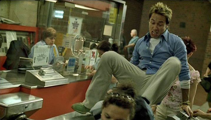
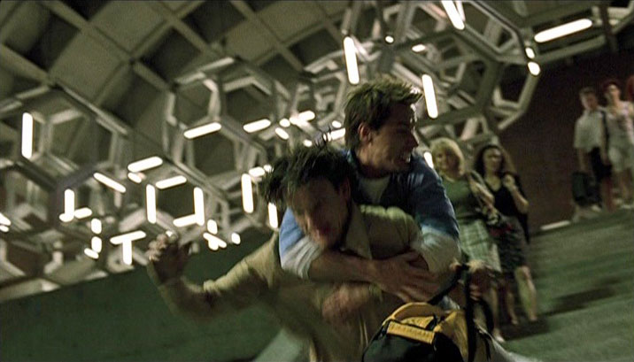
Stéphane Rousseau in Les Dangereux (2002)
(Source20)
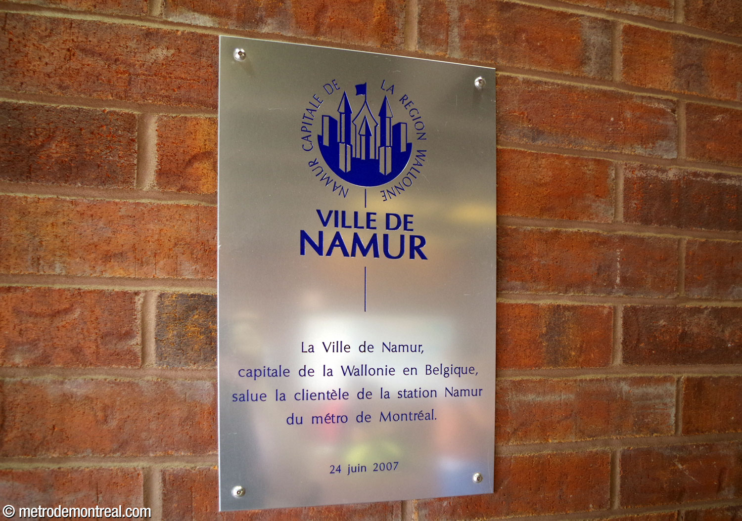
Text of the commemorative plaque located in the headhouse:
Namur, Capital of the Walloon Region
City of Namur
The City of Namur, capital of Wallonia in Belgium, sends greetings to the clients of Namur station of the Montreal metro.
June 24, 2007
General Information
Platform diagram
Most convenient metro cars to use when travelling to this station

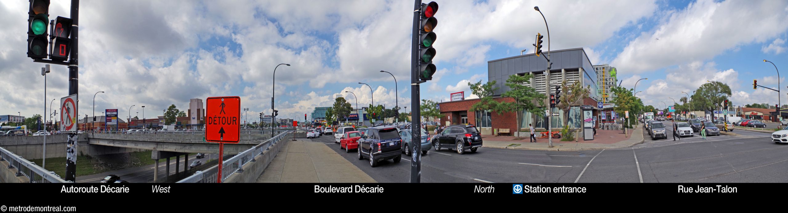
Station surroundings
Station address
Borough of Côte-des-Neiges–Notre-Dame-de-Grâce
7405 Boulevard Décarie, at Rue Jean-Talon
Nearby attractions |
Official website
Service information, opening hours, frequency, bus routes

Most recent update: 2026-09-18
References
- Labelle Marchand Geoffroy, architectes. Station Namur (presentation document for the Bureau de transport métropolitain). July 12, 1979. Archives de la Ville de Montréal, dossier CA M001 XCD001-D19, item 1D-06-01-27F. ↩ ↩ ↩ ↩ ↩ ↩
- Ouellette-Vézina, Henri. (2025, April 16). “Faute de financement: L’installation d’ascenseurs encore à l’arrêt dans le métro.” La Presse. ↩
- Fiche descriptive : Rue de la Savane. Commission de toponymie du Québec. ↩
- Fiche descriptive : Rue de Namur. Commission de toponymie du Québec. ↩
- Courval, E.P.J. (1931). Plan de la Cité de Montréal et de ses environs [map]. Montreal: City of Montreal. Bibliothèque et Archives nationales du Québec, G/3454/M65/1931b/C68 CAR. ↩
- Underwriters’ Survey Bureau. (1954/1955, April). Insurance plan of the city of Montreal. Vol. VII. Toronto: Author. Plan 700-2. Bibliothèque et Archives nationales du Québec, 555481 CON. ↩
- Underwriters’ Survey Bureau. (1954/1961, November). Insurance plan of the city of Montreal. Vol. VII. Toronto: Author. Plan 799-10. Bibliothèque et Archives nationales du Québec, 555481 CON. Rue de Namur still appears earlier that year: Service des travaux publics. (1961, June). Land use map, 1:2400. Plate 225-31. Montreal: Cité de Montréal. Bibliothèque et Archives nationales du Québec, G/3454/M65G4/s2,4/M65 CAR. ↩
- Ville de Montréal; STM; Namur Capitale. (2017). “Namur, Montréal” [informational poster displayed on the platforms at Namur station]. ↩
- Senosier Roberge, Véronique (producer). (2019, October 14). "Station Namur" [TV series episode]. Le métro voyage dans le temps. MAtv Montréal. ↩
- Descôteaux, Bernard. (1977, July 29.) “Québec lève son moratoire sur le métro.” Le Devoir, p. 1. ↩
- Communauté urbaine de Montréal. (1977, May 27). “La station Namur.” Archives de la Ville de Montréal, CA M001 VM166-1-1-D5319, pp. 21-38. ↩ ↩
- Duhamel, Alain. (1977, August 9.) “Une preuve de ‘collusion’ entre la CUM et Campeau.” Le Devoir, p. 3. ↩
- Jean-Pol Grandmont, Wikimedia Commons. Used under the Creative Commons Attribution 3.0 Unported License. ↩
- See Archives de la Ville de Montréal, CA M001 VM166-1-1-D5319, for a press file on Namur station with extensive newspaper reports on the controversy 1975-1977. ↩
- Image source: Communauté urbaine de Montréal (1977), p. 30. ↩
- Image source: Communauté urbaine de Montréal (1977), p. 22. ↩
- Image source: Communauté urbaine de Montréal (1977), p. 26. ↩
- Image source: Communauté urbaine de Montréal (1977), p. 31. ↩
- © STM archives. ↩ ↩ ↩
- Images © 2003 Christal Films ↩
.jpg)