
 CÔTE-SAINTE-CATHERINE
 CÔTE-SAINTE-CATHERINE
 Plamondon


Art & Architecture

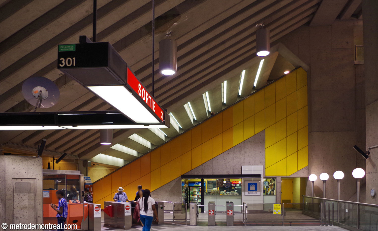
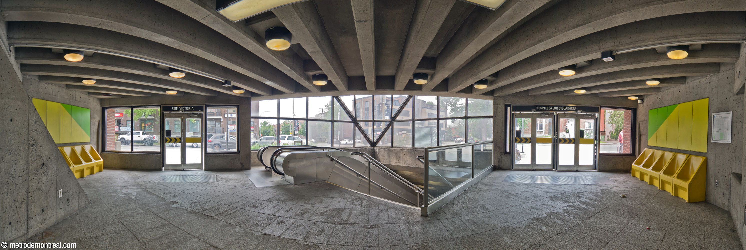
Like many stations along the 1980s extensions, Côte-Sainte-Catherine is an attractive, modern, and functional space. It is centered on a large volume, opening on all levels, through which passengers can see their entire path from the upper walkway to the trains, or from the platforms to the exit.
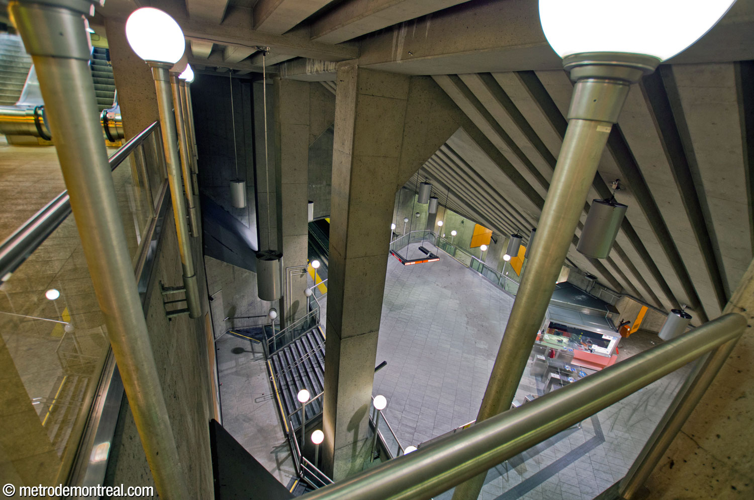

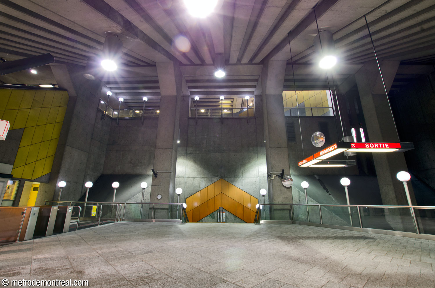
The main volume, which rises over the ticket hall, is triangular in section, following the slope of the line of the escalators at the northern end of the hall. A walkway runs along the upper ridge of the volume from the head of these escalators to the exit, with views down onto the ticket hall and platforms along its length.
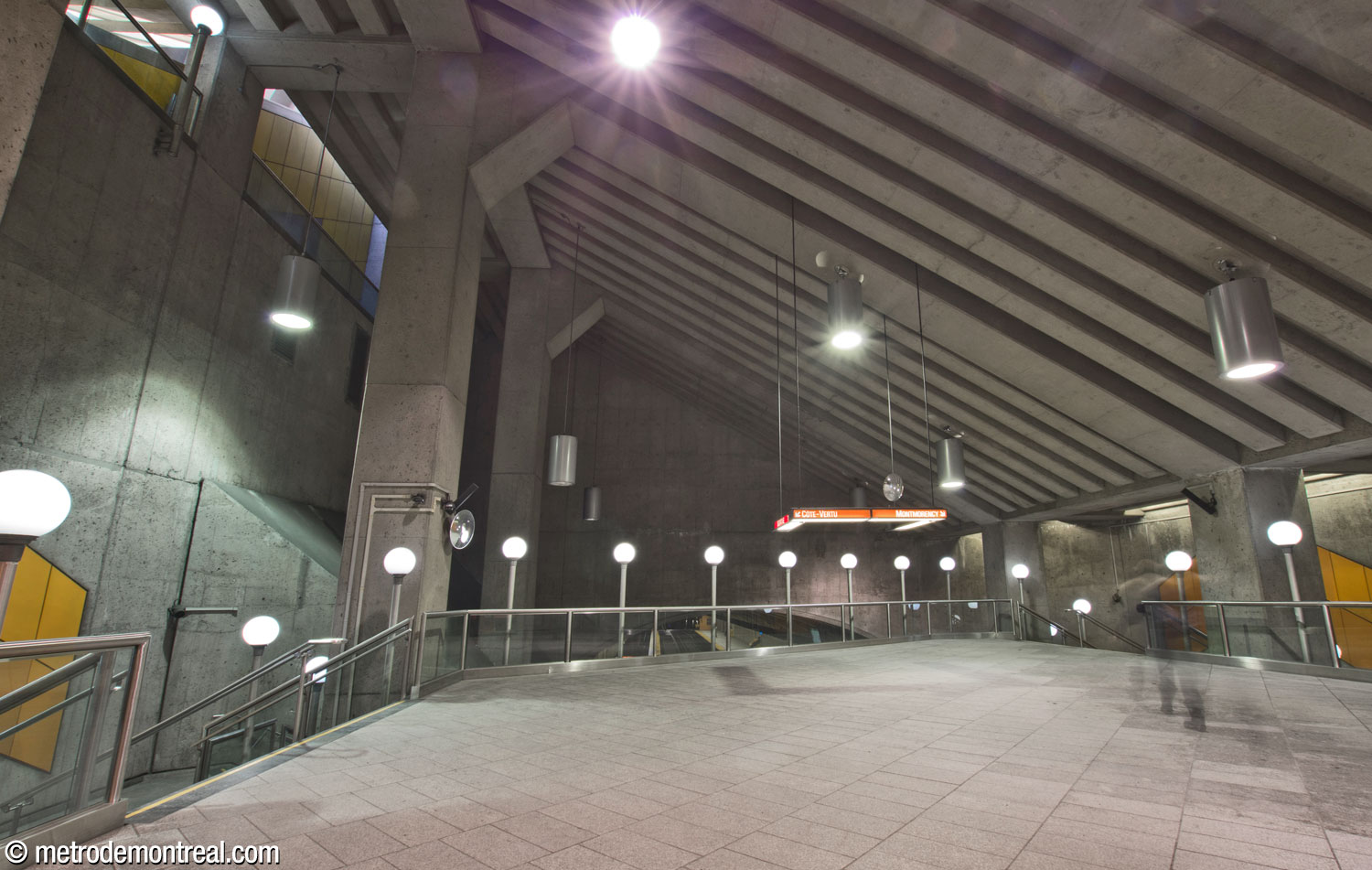
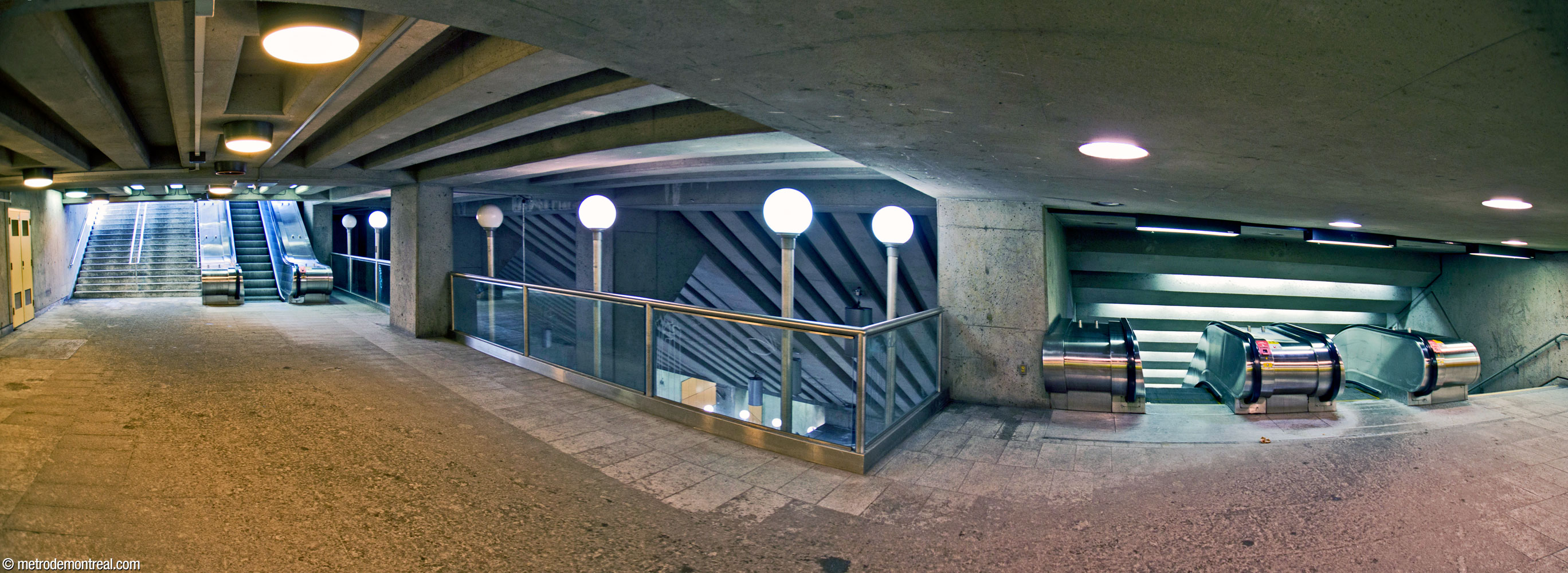
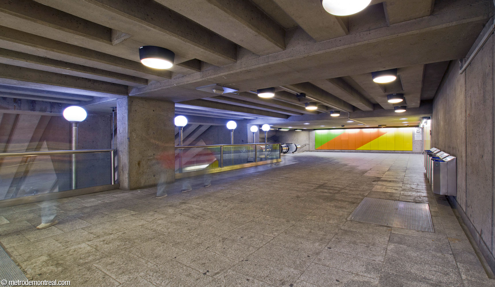
The floor plan of the mezzanine is also angular, with its southern edge crossing diagonally over the tracks, so that the platform stairs, at the southern corners of the mezzanine, are offset from one another. The stairs pass between and wrap around the pairs of pillars supporting the volume’s roof. The edges of the mezzanine, like that of the walkway above, are lined with glass parapets surmounted by attractive spherical light fixtures.
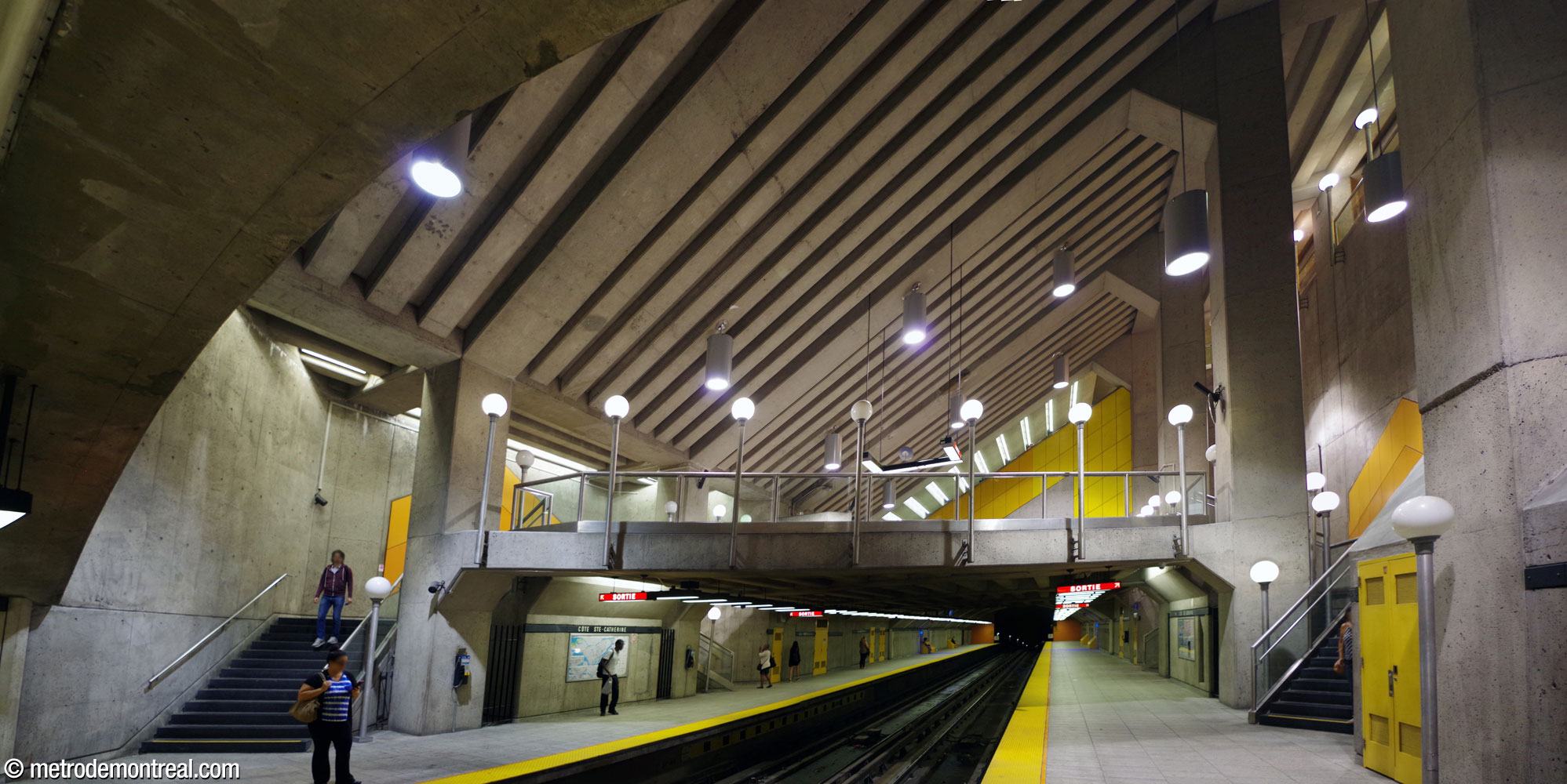
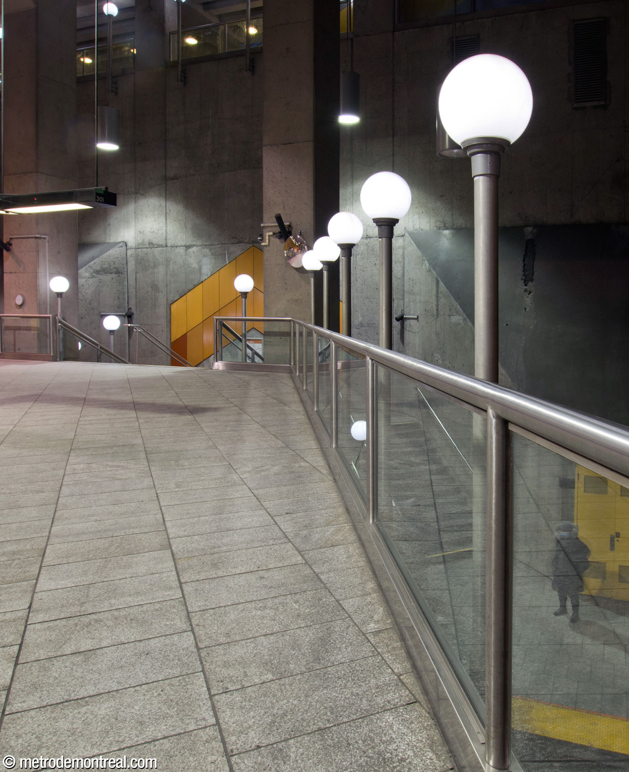
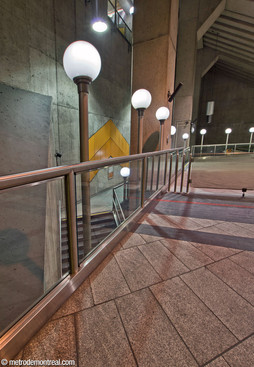
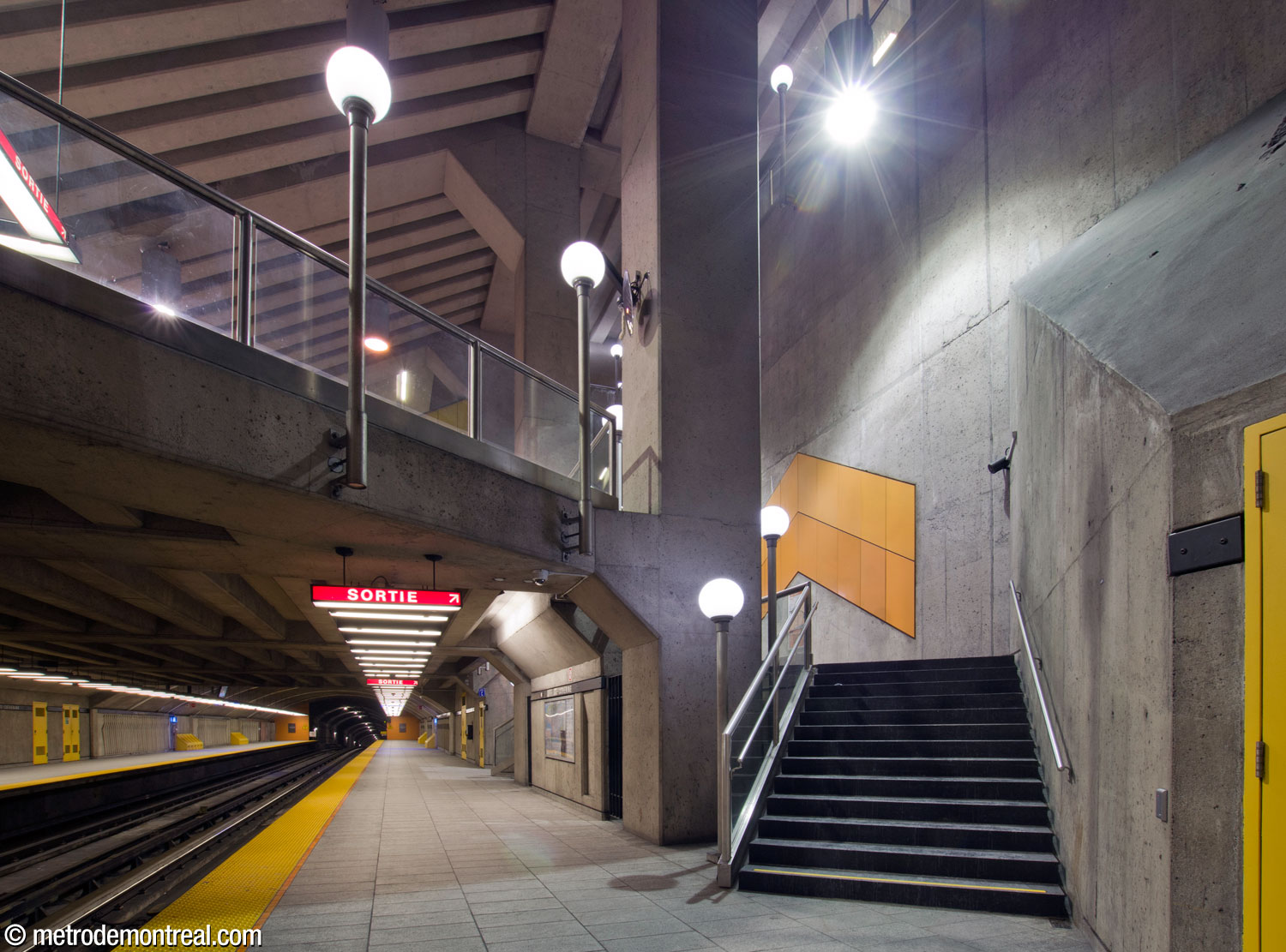

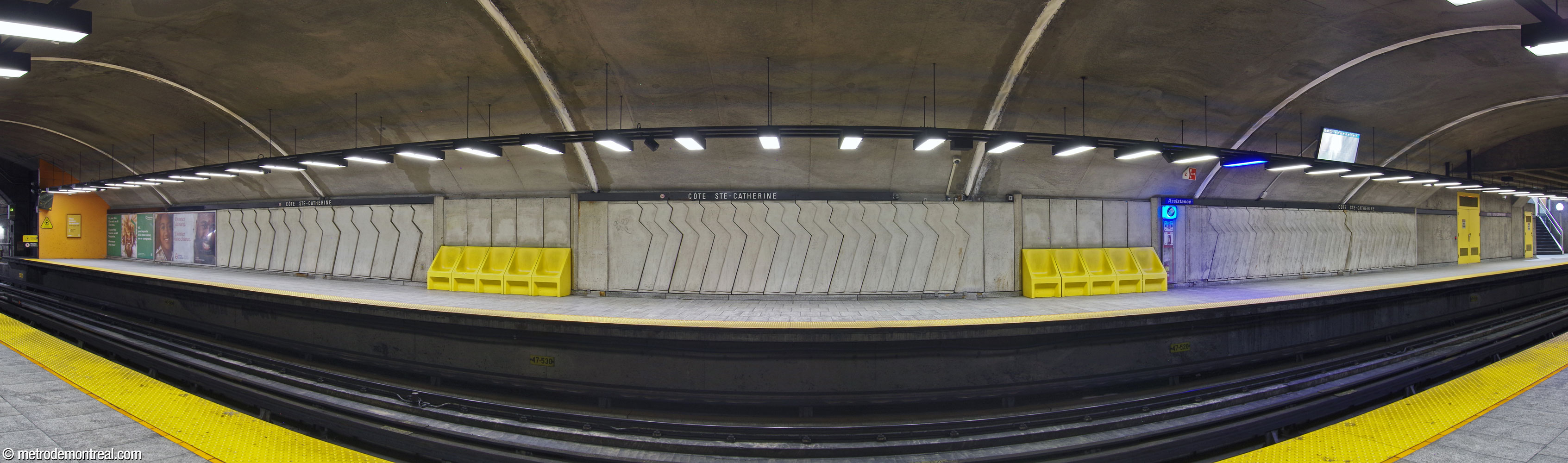
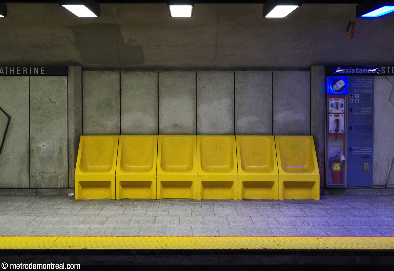
The platforms are built in tunnel out from the central volume. Their walls are clad in sandblasted concrete, with a dynamic pattern of slanting ridges pointing the way to the stairs up to the mezzanine. As one approaches the staircases, the angular ridges get closer together, symbolizing acceleration. Seating consists of rows of individual bucket seats in bright yellow.
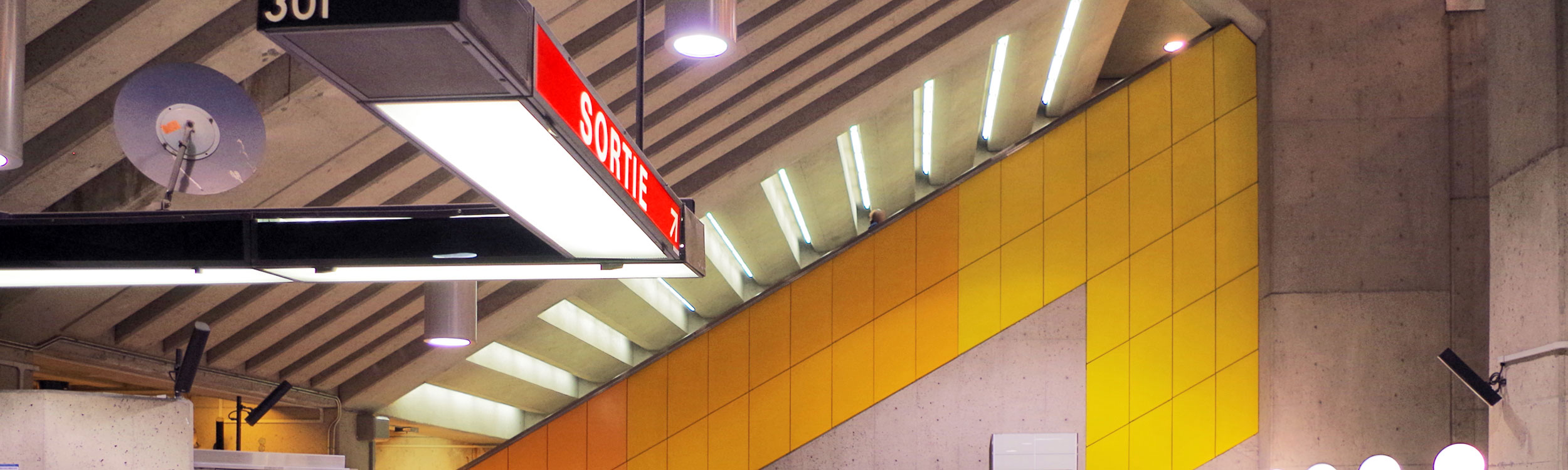
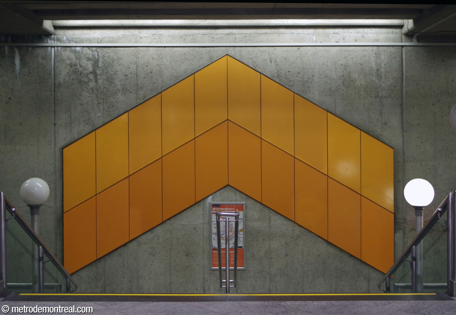
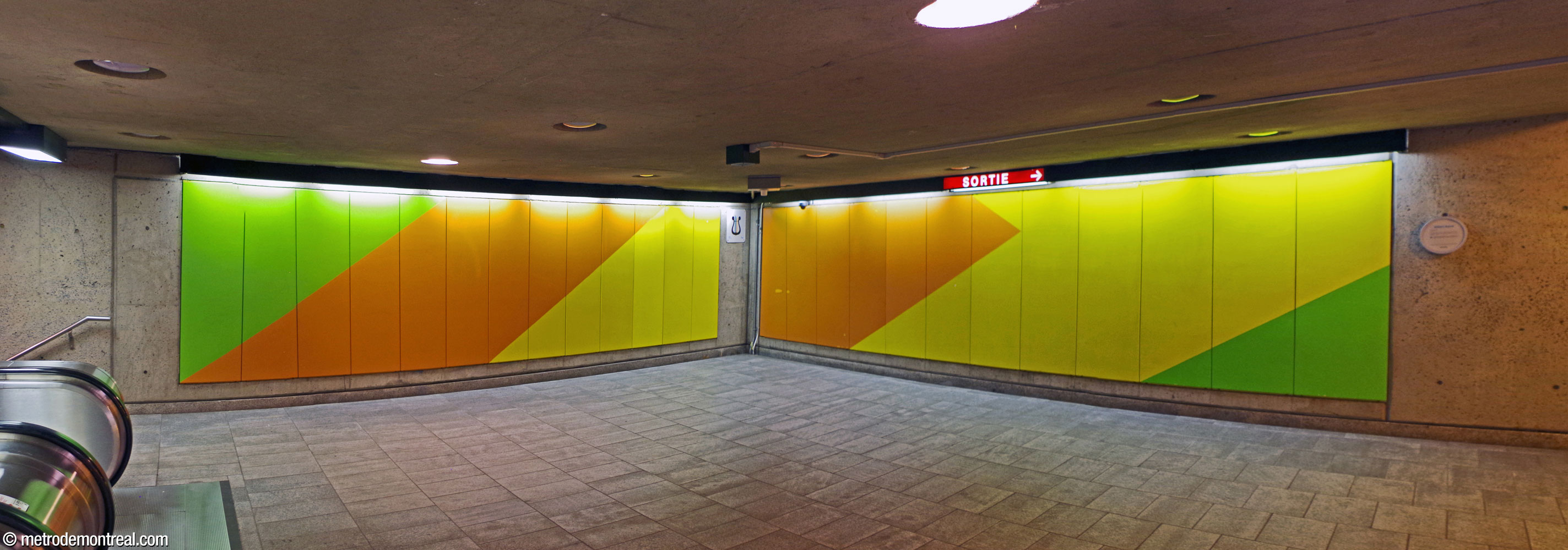
The station’s artwork, created by the architect, consists of several arrays of metal panels in bright yellow, orange, and green. In the ticket hall, rhombus-shaped panels form chevrons above the platform stairs and an arrow that runs up the main escalator; a similar arrow on the escalator to the headhouse, more discreet, is visible from the mezzanine below. On the walls of the walkway and in the headhouse, rectangular panels feature slanting fields of colour. The shapes of the panels and the designs, like the concrete panels on the platform walls, point the way to the exit.
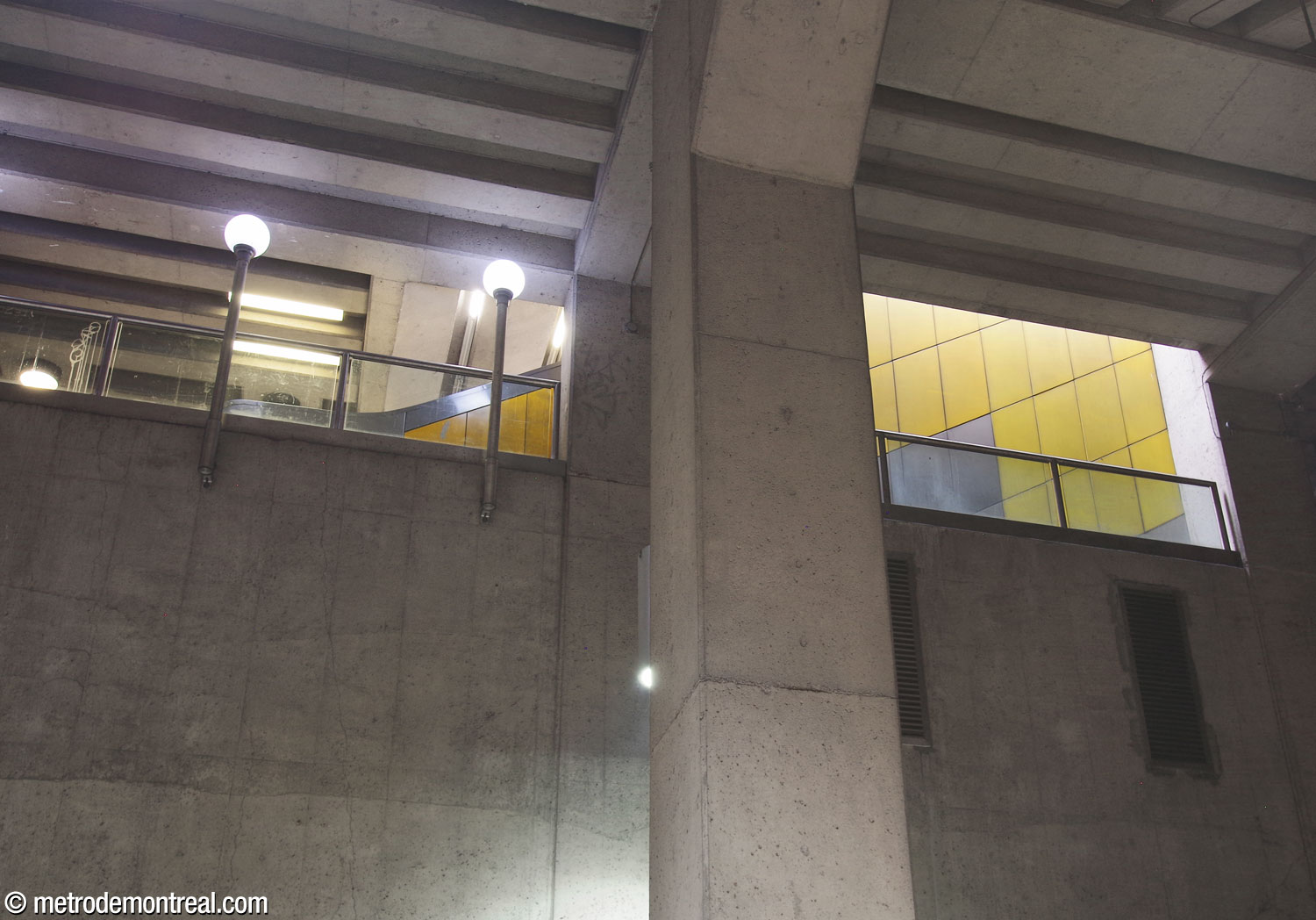
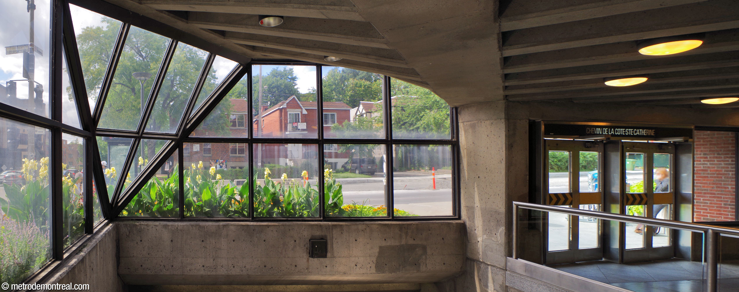
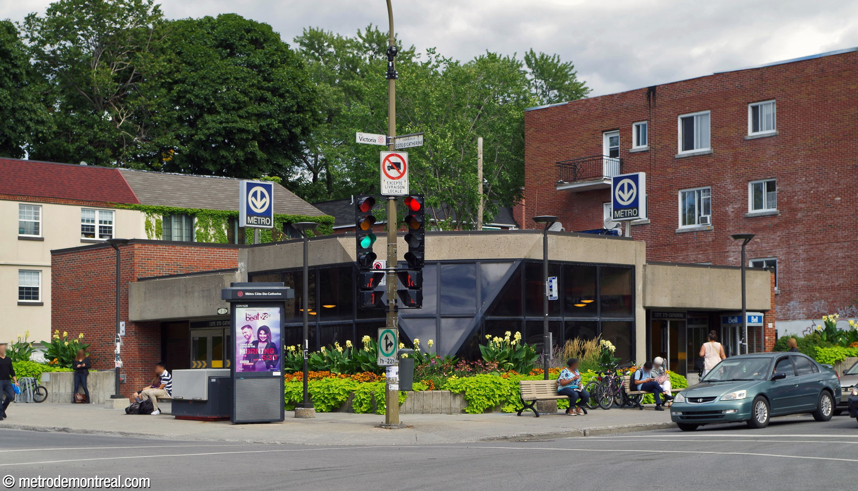
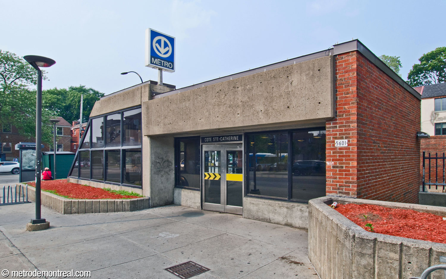
The single headhouse is an angular concrete structure with entrances at its northeast and southwest corners. Between them, a large expanse of window illuminates the stairwell leading down into the station. This windowed section is chamfered at the corner of the headhouse, forming a striking triangular surface facing the intersection.

Accessibility
This station is not currently wheelchair-accessible. No plans to install elevators have yet been announced.
History & Trivia

Traffic
1,923,544 entrances in 2023
50th busiest station

Platform Depth
17.7 m deep
21st deepest station

Interstation Distances
To Plamondon: 451.10 metres
To Snowdon: 693.00 metres
Origin of the Name
Chemin de la Côte-Sainte-Catherine. Côte Sainte-Catherine is one of the oldest European toponyms in the Montreal area. On November 9, 1694, François Dollier de Casson, seigneur of the island, conceded six plots of land under the name of Côte Sainte-Catherine. On June 12, 1709, Intendant Antoine-Denis Raudot gave the name Chemin de la Côte-Sainte-Catherine to a former Indigenous trail around the northeastern foot of the mountain, giving access to the area; as elsewhere, the name of the côte was given to its main road. Côte Sainte-Catherine became the village of Outremont in 1875.1
The western portion of the road, on which the metro station lies, is actually its most recent part, built by 1936;2 before that, the road went only as far as Chemin de la Côte-des-Neiges.
Catholicism recognizes several saints named Catherine. The most famous is St. Catherine of Alexandria, who was once the object of a very widespread devotion but is now considered of dubious historicity. According to legend, she was the daughter of a noble family of Alexandria who lived around AD 300. At age 18 she was learned enough to confound in argument Emperor Maxentius and a multitude of scholars he ordered to argue against her. After she converted the scholars, the emperor ordered her executed on a spiked wheel, but it flew into pieces when she touched it. He had her beheaded instead. Her feast day is November 25.
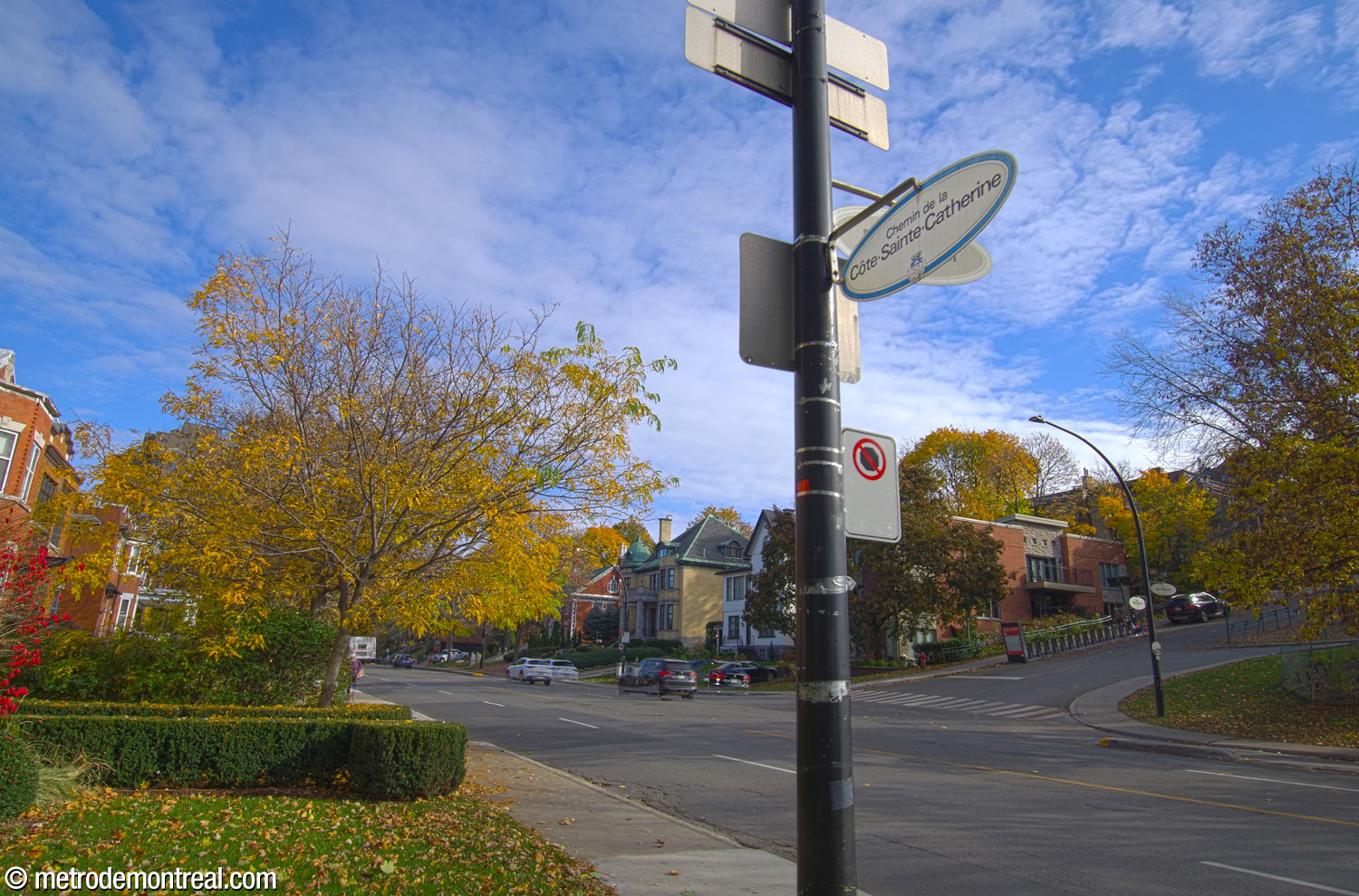
Chemin de la Côte-Sainte-Catherine, in Outremont
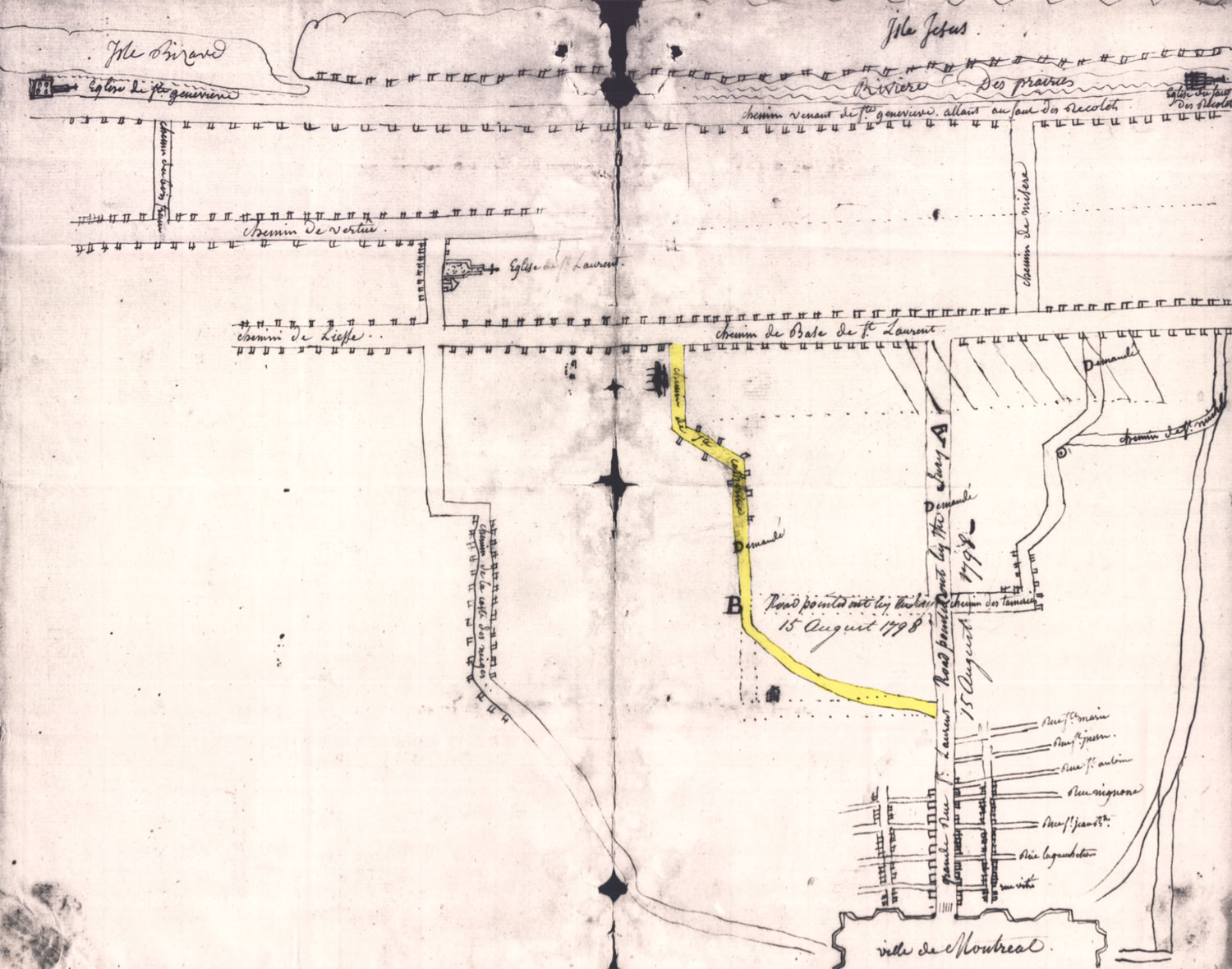
1798 map showing “Chemin de Ste Catherine”
(Source3)
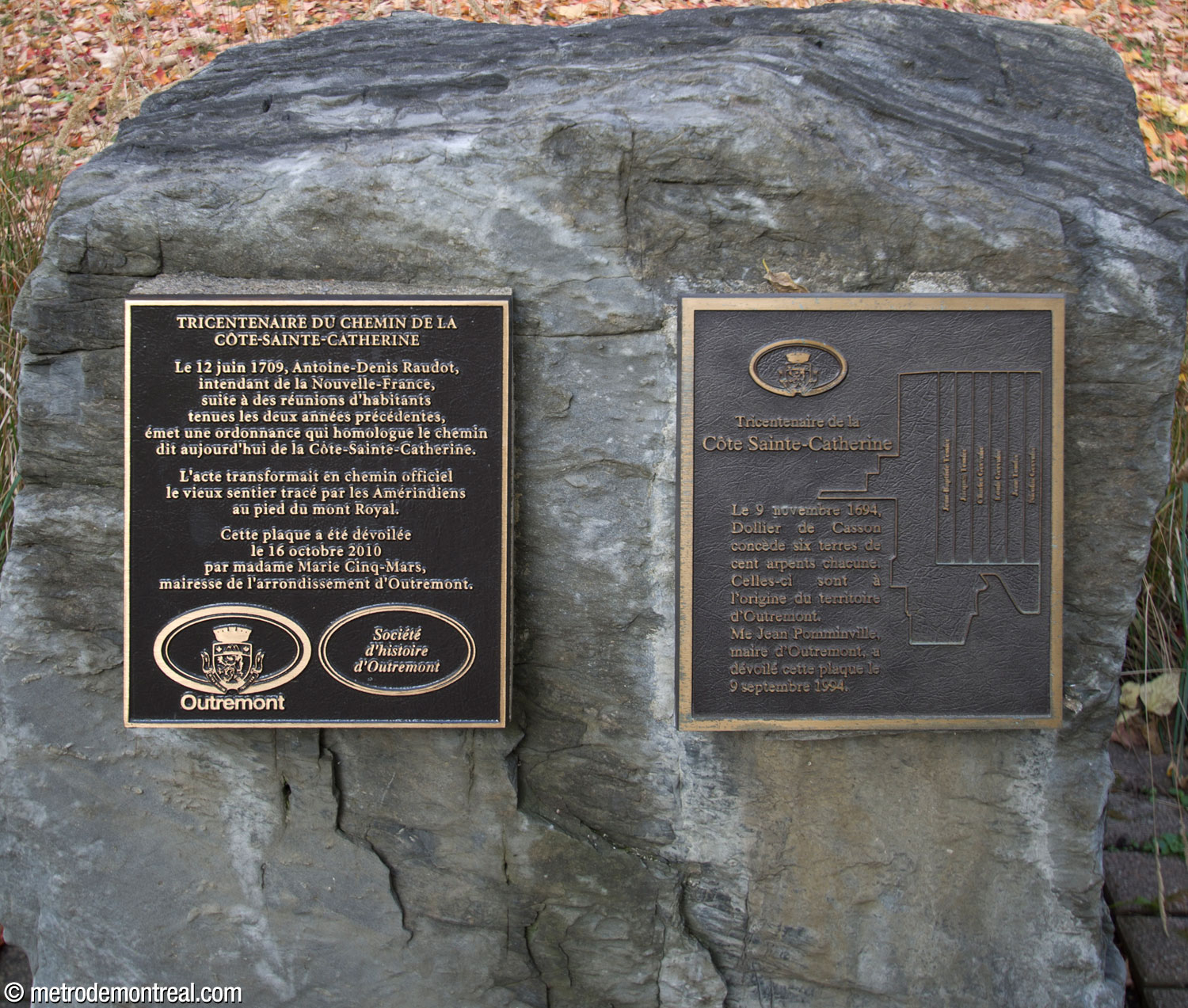
Plaques commemorating Côte Sainte-Catherine and its namesake road, in Outremont’s Parc François-Xavier-Garneau

Saint Catherine of Alexandria, by Caravaggio
(Source4)
Trivia
- This station served as the orange line’s terminus for six months, from its inauguration until that of Plamondon station.
- The station was designed to permit the addition of a secondary entrance north of Chemin de la Côte-Sainte-Catherine, connecting to the walkway overlooking the ticket hall.5
- The nameplates in the station have more than one rendering of the station’s name, a unique condition. Most say “CÔTE STE-CATHERINE,” but one says simply “STE-CATHERINE,” another (since removed) said “CÔTE-SAINTE-CATHERINE,” and the signs above the outside doors say “COTE STE-CATHERINE.” (For good measure, the sign inside the headhouse renders the street name as “CHEMIN DE LA COTE-STE-CATHERINE.”) According to the STM website and maps and the Commission de Toponymie du Québec,6 the official spelling is “Côte-Sainte-Catherine.”
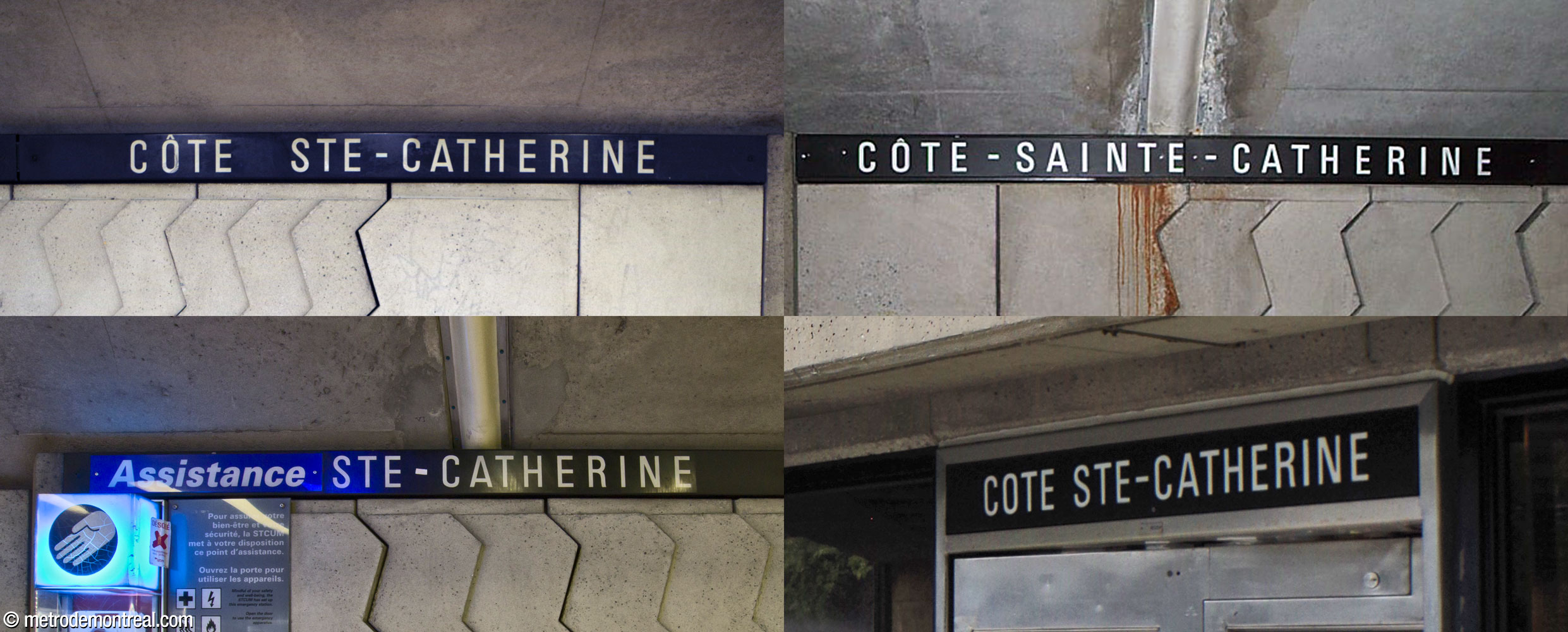
The different spellings on the station’s nameplates
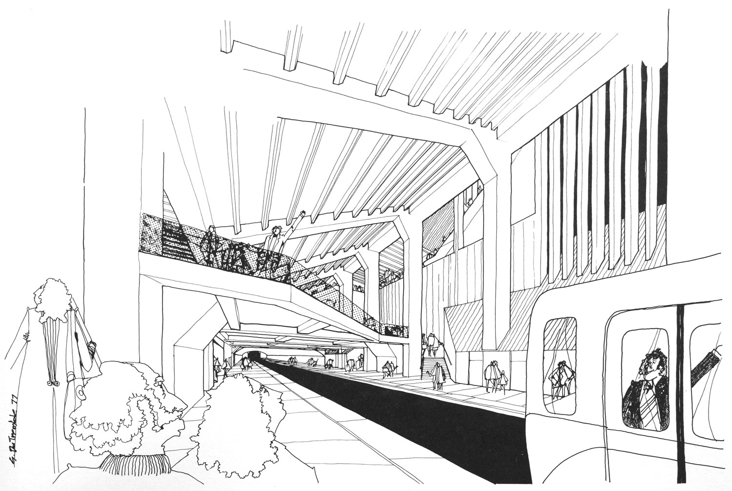
Architectural sketch of the main volume
(Source5)
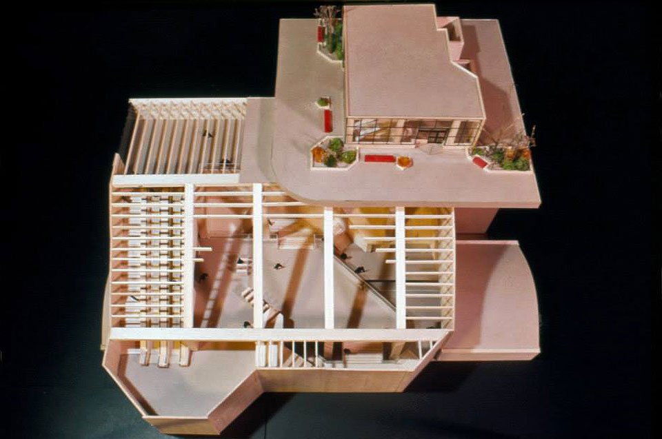
Maquette of the station
(Source7)
General Information
Platform diagram
Most convenient metro cars to use when travelling to this station

Station surroundings
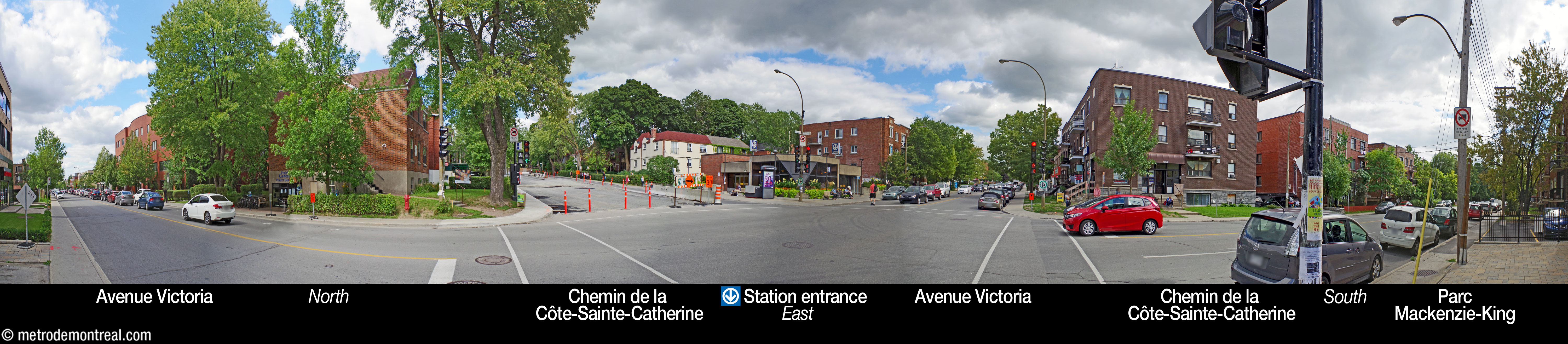
Station address
Borough of Côte-des-Neiges–Notre-Dame-de-Grâce
4780 Chemin de la Côte-Sainte-Catherine, at Avenue Victoria
Official website
Service information, opening hours, frequency, bus routes

Most recent update: 2026-08-15
References
- “Circuits virtuels.” (2021). Société d’histoire d’Outremont. ↩
- Lovell’s Montreal Directory for 1936-37. (1936). Montreal: John Lovell & Son. Bibliothèque et Archives nationales du Québec, 0005993752. See p. 567 (“A street directory of Montreal,” s.v. “St. Catherine Road”). ↩
- Image adapted from: Anonymous. Plan montrant l’ouverture de la rue Saint-Laurent et des prinicipales artères sur l’île de Montréal. August 15, 1798. Source: Archives de la Ville de Montréal, CA M001 VM066-3-P001. Used under the Creative Commons BY-NC-SA 2.5 CA License. ↩
- Michelangelo Merisi da Caravaggio. Saint Catherine of Alexandria. 1598-99. Oil on canvas. Museo Thyssen-Bornemisza, Madrid. Source: Wikimedia Commons. ↩
- Gilbert Sauvé. La station Côte Ste-Catherine (presentation document for the Bureau de transport métropolitain). January 1977. Archives de la Ville de Montréal, dossier CA M001 XCD001-D19, item 1D-06-01-05F. ↩ ↩
- Fiche descriptive : Station Côte-Sainte-Catherine. Commission de toponymie du Québec. ↩
- © STM archives. ↩
.jpg)